Kawambwa District
Kawambwa District is a district of Zambia, located in Luapula Province. The capital lies at Kawambwa, which lies at the intersection of three roads: D19, M13, and Kawambwa-Mbereshi. The Luapula River forms its boundary with the Democratic Republic of the Congo. As of the 2000 Zambian Census, the district had a population of 102,503 people.[1]
Kawambwa District | |
|---|---|
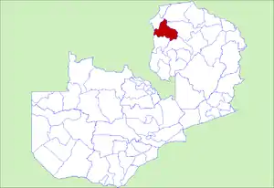 District location in Zambia | |
| Country | |
| Province | Luapula Province |
| Capital | Kawambwa |
| Population (2000) | |
| • Total | 102,503 |
| Time zone | UTC+2 (CAT) |
Climate change led to both floods and drought in Kawambwa District in 2008, thus hampering the activities of subsistence farmers.[2]
Lusenga Plain National Park, which was converted from a hunting area, is an 880 square kilometer park in the district's northern corner.[3]
References
- "Districts of Zambia". Statoids. Retrieved February 12, 2010.
- "Climate change in Zambia- the Kawambwa District". International Union for Conservation of Nature. Retrieved December 2, 2013.
- "Lusenga Plain National Park". The Best of Zambia. Archived from the original on December 4, 2013. Retrieved December 2, 2013.
| Central Province | |
|---|---|
| Copperbelt Province | |
| Eastern Province | |
| Luapula Province | |
| Lusaka Province | |
| Muchinga Province | |
| Northern Province | |
| North-Western Province | |
| Southern Province | |
| Western Province | |
This article is issued from Wikipedia. The text is licensed under Creative Commons - Attribution - Sharealike. Additional terms may apply for the media files.