Kingsburg, California
Kingsburg (formerly, Kings River Switch, Wheatville, Kingsbury, Drapersville, Farleyville, and Kingsburgh)[7] is a city in Fresno County, California. Kingsburg is located 5 miles (8 km) southeast of Selma at an elevation of 302 feet (92 m),[7] on the banks of the Kings River. The city is half an hour away from Fresno, and two hours away from the California Central Coast and Sierra Nevada Mountain Range. The population was 11,382 at the 2010 census.
Kingsburg, California | |
|---|---|
City | |
| City of Kingsburg | |
 Downtown Kingsburg | |
 Seal | |
| Motto(s): Past, Present and Future: Celebrating Kingsburg | |
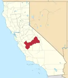
 Location of Kingsburg in Fresno County, California. | |
 Kingsburg, California Location in the United States | |
| Coordinates: 36°30′50″N 119°33′14″W | |
| Country | United States |
| State | California |
| County | Fresno |
| Incorporated | May 29, 1908[1] |
| Government | |
| • Mayor | Michelle Roman [2] |
| • Mayor Pro Tem | Laura North [2] |
| • State Senate | Anna Caballero (D)[3] |
| • State Assembly | Joaquin Arambula (D)[4] |
| • U. S. Congress | David Valadao (R)[5] |
| Area | |
| • Total | 3.71 sq mi (9.60 km2) |
| • Land | 3.71 sq mi (9.60 km2) |
| • Water | 0.00 sq mi (0.00 km2) 0% |
| Elevation | 302 ft (92 m) |
| Population (2010) | |
| • Total | 11,382 |
| • Estimate (2019)[8] | 12,108 |
| • Density | 3,266.25/sq mi (1,261.04/km2) |
| Time zone | UTC−08:00 (PST) |
| • Summer (DST) | UTC−07:00 (PDT) |
| ZIP Code | 93631 |
| Area code(s) | 559 |
| FIPS code | 06-38562 |
| Website | www |
History
Kingsburg was established as a railroad town, its site set by the Central Pacific Railroad when it completed the Valley Line in 1873. In the early 1870s, Swedish natives settled in a railroad town called "Kings River Switch". Kingsburg started out as a flag stop on the Central Pacific Railroad called Kings River Switch. In 1874 Kingsburg was called Wheatville and had a post office, later that year they changed the name to Kingsbury. During this time period, Josiah Draper and Andrew Farley each owned a quarter section, about 160 acres (65 ha), Draper on the east side of the railroad tracks and Farley on the west side of the tracks. So it was suggested that the east side be called Drapersville and the west side called Farleyville. Two years after that it became Kingsburgh and in January 1894 took on its present spelling, "Kingsburg", which was finally established as a town in 1908. By 1921, ninety-four percent of the population within a three-mile radius of Kingsburg was Swedish-American, giving the community the nickname of "Little Sweden". To keep up with the town's Swedish history most retail businesses are designed in Swedish architecture.
Agriculture
For much of the town's history, the fields around Kingsburg were mostly grape vineyards which produce mainly raisins and table grapes; in 2002 a large surplus of raisins and grapes drove the price for these commodities down to an all-time low. Subsequently, farmers were forced to replant the fields with stone fruit, or (particularly on the west side of town) sell their land to developers to help cope with the rising population. Kingsburg is the headquarters of Sun-Maid Growers of California, a producer of raisins and other dried fruits. Kingsburg is home to the world's largest box of raisins, built by students at California State University, Fresno.[9]
Swedish Festival
One of the unique landmarks in the community is the Kingsburg water tower, which is shaped like an antique Swedish coffee pot. The Swedish immigrant heritage of the community is principally preserved with festivals. The Kingsburg Swedish Festival, which is one of the biggest and best known festivals that bring people in from all over the country, is held annually during the third weekend in May. Activities include a Swedish pancake breakfast, a parade and the coronation of the Swedish Festival Queen. Many booths, rides and activities are set up all along the side of Downtown Kingsburg's Draper Street. This festival, which has traditionally been held on Friday, Saturday, and Sunday, was scheduled for only Saturday and Sunday in 2009 after the town's centennial due to the suffering economy, but in 2011, Thursday activities were added to the festival.[10][11]
Geography
Kingsburg is located at 36°30′50″N 119°33′14″W.[7] Kingsburg is located in the central portion of the Central Valley of California. The town is two hours away from The Sierra Nevada Mountain range and the coast. It is about 3–4 hours away from Los Angeles, San Francisco, and Sacramento. According to the United States Census Bureau, the city has a total area of 2.8 square miles (7.3 km2), all of it land.
Demographics
| Historical population | |||
|---|---|---|---|
| Census | Pop. | %± | |
| 1880 | 88 | — | |
| 1890 | 291 | 230.7% | |
| 1910 | 634 | — | |
| 1920 | 1,316 | 107.6% | |
| 1930 | 1,322 | 0.5% | |
| 1940 | 1,504 | 13.8% | |
| 1950 | 2,310 | 53.6% | |
| 1960 | 3,093 | 33.9% | |
| 1970 | 3,843 | 24.2% | |
| 1980 | 5,115 | 33.1% | |
| 1990 | 7,205 | 40.9% | |
| 2000 | 9,199 | 27.7% | |
| 2010 | 11,382 | 23.7% | |
| 2019 (est.) | 12,108 | [8] | 6.4% |
| U.S. Decennial Census[12] | |||
2010
The 2010 United States Census reported that Kingsburg had a population of 11,382. The population density was 4,024.3 people per square mile (1,553.8/km2).[13] The racial makeup of Kingsburg was 8,576 (75.3%) White, 62 (0.5%) African American, 146 (1.3%) Native American, 383 (3.4%) Asian, 21 (0.2%) Pacific Islander, 1,706 (15.0%) from other races, and 488 (4.3%) from two or more races. Hispanic or Latino of any race were 4,883 persons (42.9%).
The census reported that 11,300 people (99.3% of the population) lived in households, no one lived in non-institutionalized group quarters and 82 (0.7%) were institutionalized.
There were 3,822 households, 1,671 (43.7%) had children under the age of 18 living in them, 2,287 (59.8%) were opposite-sex married couples living together, 474 (12.4%) had a female householder with no husband present, 176 (4.6%) had a male householder with no wife present. There were 186 (4.9%) unmarried opposite-sex partnerships, and 19 (0.5%) same-sex married couples or partnerships. 770 households (20.1%) were one person and 398 (10.4%) had someone living alone who was 65 or older. The average household size was 2.96. There were 2,937 families (76.8% of households); the average family size was 3.41.
The age distribution was 3,368 people (29.6%) under the age of 18, 1,043 people (9.2%) aged 18 to 24, 2,899 people (25.5%) aged 25 to 44, 2,618 people (23.0%) aged 45 to 64, and 1,454 people (12.8%) who were 65 or older. The median age was 33.7 years. For every 100 females, there were 92.9 males. For every 100 females age 18 and over, there were 89.1 males.
There were 4,069 housing units at an average density of 1,438.7 per square mile (555.5/km2),of which 3,822 were occupied, 2,536 (66.4%) by the owners and 1,286 (33.6%) by renters. The homeowner vacancy rate was 2.8%; the rental vacancy rate was 6.5%. 7,518 people (66.1% of the population) lived in owner-occupied housing units and 3,782 people (33.2%) lived in rental housing units.
2000
At the 2000 census there were 9,199 people in 3,226 households, including 2,458 families, in the city. The population density was 3,933.4 people per square mile (1,517.8/km2). There were 3,358 housing units at an average density of 1,435.8 per square mile (554.1/km2). The racial makeup of the city was 71.93% White, 0.45% Black or African American, 0.67% Native American, 2.74% Asian, 0.14% Pacific Islander, 9.61% from other races, and 4.46% from two or more races. 34.42% of the population were Hispanic or Latino of any race. 21.7% were of German, 28.6% Swedish, 9.7% English and 5.4% Irish ancestry according to Census 2000.[14] Of the 3,226 households 40.0% had children under the age of 18 living with them, 60.4% were married couples living together, 11.3% had a female householder with no husband present, and 23.8% were non-families. 21.3% of households were one person and 10.8% were one person aged 65 or older. The average household size was 2.82 and the average family size was 3.29.
The age distribution was 30.0% under the age of 18, 8.3% from 18 to 24, 29.0% from 25 to 44, 19.5% from 45 to 64, and 13.2% 65 or older. The median age was 34 years. For every 100 females, there were 91.6 males. For every 100 females age 18 and over, there were 87.6 males.
The median household income was $40,490 and the median family income was $44,737. Males had a median income of $35,452 versus $23,409 for females. The per capita income for the city was $16,137. About 10.4% of families and 11.5% of the population were below the poverty line, including 16.6% of those under age 18 and 6.8% of those age 65 or over.
The town's population increased to 12,567 during the 2011 year.
Media
The local weekly newspaper is The Kingsburg Recorder.[16] Residents are served by the daily Fresno Bee and by Fresno-based television and radio stations. KUFW ("Radio Campesina"), a Regional Mexican station, is licensed to Kingsburg.
School system
Kingsburg Elementary schools operate on a charter school system. Kingsburg's elementary school system is unique in that all students in Kindergarten through 8th grades will all go to the same schools together. The school year starts during the later weeks of August. Washington Elementary serves as a Kindergarten only school. First grade is at Roosevelt Elementary. Second and Third grades are at Lincoln Elementary. Fourth, Fifth, and Sixth grades are at Ronald Reagan Elementary. Seventh and Eighth grades are at Rafer Johnson Junior High School. Kingsburg High School serves as the community high school, and its district is separate from that of the elementary school system. The elementary school district also operates Central Valley Home School which serves as a supplement to traditional Home Schooling.
Career Colleges
Kingsburg School of Dental Assisting is a Dental Assistant career school located in Kingsburg, California, United States. [17]
Notable people
- Rafer Johnson, Olympic gold-medal decathlete
- Monte Clark, Monte Dale Clark was born in Kingsburg and was an American football player who served as head coach for two National Football League teams: the San Francisco 49ers and the Detroit Lions
- Jimmy Johnson, cornerback for the San Francisco 49ers
- Slim Pickens and Easy Pickens, Western film actors, born in Kingsburg
- Larry Hillblom, co-founder of DHL Worldwide Express
- Tyler Bray, former quarterback for the University of Tennessee and current Chicago Bears third-string quarterback
- Kody Swanson, 2014, 2015 & 2017 United States Auto Club Silver Crown Series Champion
References
- "California Cities by Incorporation Date". California Association of Local Agency Formation Commissions. Archived from the original (Word) on November 3, 2014. Retrieved April 6, 2013.
- "City Council". City of Kingsburg. Retrieved July 11, 2017.
- "Senators". State of California. Retrieved April 6, 2013.
- "Members Assembly". State of California. Retrieved April 6, 2013.
- "California's 21st Congressional District - Representatives & District Map". Civic Impulse, LLC. Retrieved April 6, 2013.
- "2019 U.S. Gazetteer Files". United States Census Bureau. Retrieved July 1, 2020.
- "Kingsburg". Geographic Names Information System. United States Geological Survey.
- "Population and Housing Unit Estimates". United States Census Bureau. May 24, 2020. Retrieved May 27, 2020.
- "World's Largest Box of Raisins". Archived from the original on 2004-04-10. Retrieved 2004-05-05.
- Kingsburg, CA Page(Nordic Way)
- Kingsburg's Swedish Village and Historical Park (California Travel & Tourism Commission)
- "Census of Population and Housing". Census.gov. Retrieved June 4, 2015.
- "2010 Census Interactive Population Search: CA - Kingsburg city". U.S. Census Bureau. Archived from the original on July 15, 2014. Retrieved July 12, 2014.
- "U.S. Census website". United States Census Bureau. Retrieved 2008-01-31.
- Woeste, Victoria (1998). The Farmer's Benevolent Trust. USA: The University of North Carolina Press. p. 57. ISBN 0807824216.
- Kingsburg Recorder
- "Kingsburg School Of Dental Assisting Official Site". kingsburgdentalassisting.com. 28 August 2020.
External links
- Official website

- Kingsburg Recorder Newspaper
- Kingsburg High School Multi-class Reunion site
- Kingsburg Joint Union High School District
- Valkommem to Kingsburg "The Swedish Village"
| Authority control |
|---|