Kitty Hawk, North Carolina
Kitty Hawk is a town in Dare County, North Carolina, and is a part of what is known as North Carolina's Outer Banks.[6] The population was 3,272 at the 2010 Census.[7] It was established in the early 18th century as Chickahawk.
Kitty Hawk, North Carolina | |
|---|---|
 Kitty Hawk Airfield in June 1998 | |
 Seal | |
| Motto(s): "First in Flight" | |
 Location in Dare County and the state of North Carolina. | |
| Coordinates: 36°4′37″N 75°42′17″W | |
| Country | United States |
| State | North Carolina |
| County | Dare |
| Area | |
| • Total | 8.28 sq mi (21.44 km2) |
| • Land | 8.11 sq mi (21.01 km2) |
| • Water | 0.17 sq mi (0.43 km2) |
| Elevation | 7 ft (2 m) |
| Population (2010) | |
| • Total | 3,272 |
| • Estimate (2019)[2] | 3,571 |
| • Density | 440.16/sq mi (169.95/km2) |
| Time zone | UTC-5 (Eastern (EST)) |
| • Summer (DST) | UTC-4 (EDT) |
| ZIP code | 27949 |
| Area code(s) | 252 |
| FIPS code | 37-36060[3] |
| GNIS feature ID | 1021059[4] |
| Website | townofkittyhawk.org |
| Historical population | |||
|---|---|---|---|
| Census | Pop. | %± | |
| 1990 | 1,937 | — | |
| 2000 | 2,991 | 54.4% | |
| 2010 | 3,272 | 9.4% | |
| 2019 (est.) | 3,571 | [2] | 9.1% |
| sources:[5] | |||
History
Kitty Hawk became world-famous after the Wright brothers made the first controlled powered airplane flights at Kill Devil Hills, four miles (6 km) south of the town, on December 17, 1903. After the four flights in their Wright Flyer, the brothers walked back to Kitty Hawk, where they sent a telegram from the Weather Bureau office to their father informing him of their success.[8] Kitty Hawk is usually credited as the site of the powered flights because it was the nearest named settlement at the time of the flight; the modern town of Kill Devil Hills did not exist until 50 years after the flights. The Wrights chose the area because its frequent winds and soft sandy surfaces were suitable for their glider experiments, which they conducted over a three-year period prior to making the powered flights.
The aircraft carrier USS Kitty Hawk (CV-63), the B-2 Spirit stealth bomber AV-19 with an aircraft number of 93–1086, P-40D Kittyhawk fighter aircraft, the aircraft transport ship USS Kitty Hawk (AKV-1), and the Apollo 14 command module have been named for the town, which incorporated in 1981.[6]
The Kitty Hawk Life-Saving Station was listed on the National Register of Historic Places in 1984.[9]
Geography
Kitty Hawk is located at 36.1°N 75.7°W at an elevation of 7 feet (2 m) above sea level.
According to the United States Census Bureau, the town has a complete area of 8.23 square miles (21.3 km2). 8.18 square miles (21.2 km2) of it is land and 0.0476 square miles (0.123 km2) of it (0.579%) is water.[10]
Kitty Hawk is served by U.S. Route 158 and Highway 12, which parallel each other in the city. US 158 can be used to go west, while the barrier islands extend north and south.
Demographics
As of the census[3] of 2000, there were 2,991 people, 1,265 households, and 866 families residing in the town. The population density was 365.8 people per square mile (141.2/km2). There were 2,618 housing units at an average density of 320.1 per square mile (123.6/km2). The racial makeup of the town was 98.13% White, 0.64% African American, 0.23% Native American, 0.27% Asian, 0.03% Pacific Islander, 0.20% from other races, and 0.50% from two or more races. 0.94% of the population were Hispanic or Latino of any race.
There were 1,265 households, out of which 27.9% had children under the age of 18 years living with them, 58.7% were married couples living together, 7.3% had a female householder with no husband present, and 31.5% were non-families. 23.8% of all tribes were made up of individuals, and 8.0% had someone living alone who was 65 years of age or older. The average household size was 2.35 and the average family size was 2.79.
In the town, the population was spread out, with 21.5% under the age of 18, 5.7% from 18 to 24, 31.6% from 25 to 44, 28.3% from 45 to 64, and 13.0% who were 65 years of age or older. The median age was 41 years. For every 100 girls, there were 103.7 boys. For every 100 girls age 18 and over, there were 97.6 boys.
The median income for a household in the town was $42,813, and the median income for a family was $48,676. Males had a median income of $31,250 versus $25,744 for females. The per capita income for the town was $22,960. About 4.3% of families and 6.5% of the population were below the poverty line, including 7.9% of people under age 18 and 4.6% of people age 65 or over.
Politics
Federally, Kitty Hawk is part of North Carolina's 3rd congressional district, represented by Republican Walt Jones, first elected in 1994, until his death on February 10, 2019.[11]
Sister city
- Coulaines in Pays de la Loire, France, which is about 1.7 miles (2.7 km) north of Le Mans (signed in 2005)
Climate
According to the Trewartha climate classification system, Kitty Hawk, North Carolina has a humid subtropical climate with hot and humid summers, cool winters and year-around precipitation (Cfak). Cfak climates are characterized by all months having an average mean temperature > 32.0 °F (> 0.0 °C), at least eight months with an average mean temperature ≥ 50.0 °F (≥ 10.0 °C), at least one month with an average mean temperature ≥ 71.6 °F (≥ 22.0 °C) and no significant precipitation difference between seasons. During the summer months in Kitty Hawk, a cooling afternoon sea breeze is present on most days, but episodes of extreme heat and humidity can occur with heat index values ≥ 100 °F (≥ 38 °C). Kitty Hawk is prone to hurricane strikes, particularly during the Atlantic hurricane season which extends from June 1 through November 30, sharply peaking from late August through September. During the winter months, episodes of cold and wind can occur with wind chill values < 10 °F (< -12 °C). The plant hardiness zone in Kitty Hawk is 8b with an average annual extreme minimum air temperature of 16.6 °F (-8.9 °C).[12] The average seasonal (Dec–Mar) snowfall total is < 2 inches (< 5 cm), and the average annual peak in nor'easter activity is in February.
| Climate data for Kitty Hawk, NC (1981-2010 Averages) | |||||||||||||
|---|---|---|---|---|---|---|---|---|---|---|---|---|---|
| Month | Jan | Feb | Mar | Apr | May | Jun | Jul | Aug | Sep | Oct | Nov | Dec | Year |
| Average high °F (°C) | 50.2 (10.1) |
51.9 (11.1) |
57.3 (14.1) |
65.5 (18.6) |
73.0 (22.8) |
80.4 (26.9) |
84.3 (29.1) |
83.0 (28.3) |
78.3 (25.7) |
70.3 (21.3) |
62.3 (16.8) |
54.0 (12.2) |
67.6 (19.8) |
| Daily mean °F (°C) | 43.8 (6.6) |
45.4 (7.4) |
50.3 (10.2) |
58.5 (14.7) |
66.5 (19.2) |
74.9 (23.8) |
79.2 (26.2) |
78.4 (25.8) |
73.8 (23.2) |
64.9 (18.3) |
56.3 (13.5) |
47.6 (8.7) |
61.7 (16.5) |
| Average low °F (°C) | 37.4 (3.0) |
38.8 (3.8) |
43.4 (6.3) |
51.5 (10.8) |
60.1 (15.6) |
69.4 (20.8) |
74.1 (23.4) |
73.8 (23.2) |
69.2 (20.7) |
59.5 (15.3) |
50.3 (10.2) |
41.2 (5.1) |
55.8 (13.2) |
| Average precipitation inches (mm) | 4.23 (107) |
3.50 (89) |
3.86 (98) |
3.41 (87) |
3.73 (95) |
4.29 (109) |
4.97 (126) |
5.94 (151) |
5.26 (134) |
3.79 (96) |
3.68 (93) |
3.71 (94) |
50.37 (1,279) |
| Average relative humidity (%) | 69.9 | 69.5 | 67.4 | 67.6 | 70.2 | 73.9 | 75.3 | 74.7 | 73.5 | 71.1 | 72.0 | 71.7 | 71.4 |
| Average dew point °F (°C) | 34.6 (1.4) |
36.0 (2.2) |
39.9 (4.4) |
47.8 (8.8) |
56.5 (13.6) |
66.0 (18.9) |
70.7 (21.5) |
69.7 (20.9) |
64.8 (18.2) |
55.3 (12.9) |
47.4 (8.6) |
38.9 (3.8) |
52.4 (11.3) |
| Source: PRISM[13] | |||||||||||||
| Climate data for Duck, NC Ocean Water Temperature (8 N Kitty Hawk) | |||||||||||||
|---|---|---|---|---|---|---|---|---|---|---|---|---|---|
| Month | Jan | Feb | Mar | Apr | May | Jun | Jul | Aug | Sep | Oct | Nov | Dec | Year |
| Daily mean °F (°C) | 45 (7) |
44 (7) |
46 (8) |
59 (15) |
67 (19) |
74 (23) |
71 (22) |
74 (23) |
75 (24) |
69 (21) |
59 (15) |
52 (11) |
61 (16) |
| Source: NOAA[14] | |||||||||||||
Ecology
According to the A. W. Kuchler U.S. potential natural vegetation types, Kitty Hawk, North Carolina would have a dominant vegetation type of Live oak/Sea Oats Uniola paniculata (90) with a dominant vegetation form of Coastal Prairie (20).[15]
References
- "2019 U.S. Gazetteer Files". United States Census Bureau. Retrieved July 27, 2020.
- "Population and Housing Unit Estimates". United States Census Bureau. May 24, 2020. Retrieved May 27, 2020.
- "U.S. Census website". United States Census Bureau. Retrieved 2008-01-31.
- "US Board on Geographic Names". United States Geological Survey. 2007-10-25. Retrieved 2008-01-31.
- "Census of Population and Housing". U.S. Census Bureau. Retrieved April 5, 2013.
- "Kitty Hawk". Outer Banks Visitors Bureau. Retrieved April 5, 2013.
- Staff, Website Services & Coordination. "US Census Bureau 2010 Census Interactive Population Map". www.census.gov. Archived from the original on 2016-06-30. Retrieved 2015-12-17.
- "Telegram from Orville Wright in Kitty Hawk, North Carolina, to His Father Announcing Four Successful Flights, 1903 December 17". World Digital Library. 1903-12-17. Retrieved 2013-07-21.
- "National Register Information System". National Register of Historic Places. National Park Service. July 9, 2010.
- Census 2000 Gazetteer Files: Places Archived 2006-10-24 at the Wayback Machine. Retrieved on 2009-05-18.
- Seelye, Katherine (February 13, 2019). "Walter B. Jones, 76, Dies; Republican Turned Against Iraq War". New York Times. Retrieved April 9, 2019.
- "USDA Interactive Plant Hardiness Map". United States Department of Agriculture. Retrieved August 6, 2019.
- "PRISM Climate Group, Oregon State University". Retrieved August 6, 2019.
- "Water Temperature Table of All Coastal Regions". Retrieved August 6, 2019.
- "U.S. Potential Natural Vegetation, Original Kuchler Types, v2.0 (Spatially Adjusted to Correct Geometric Distortions)". Retrieved August 6, 2019.
External links
| Wikivoyage has a travel guide for Kitty Hawk. |
| Wikimedia Commons has media related to Kitty Hawk, North Carolina. |
| Preceded by Southern Shores |
Beaches of The Outer Banks | Succeeded by Kill Devil Hills |
Municipalities and communities of Dare County, North Carolina, United States | ||
|---|---|---|
| Towns | 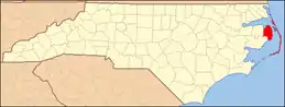 Dare County map | |
| CDPs | ||
| Unincorporated communities | ||
| Ghost town | ||
| ||
| Authority control |
|---|