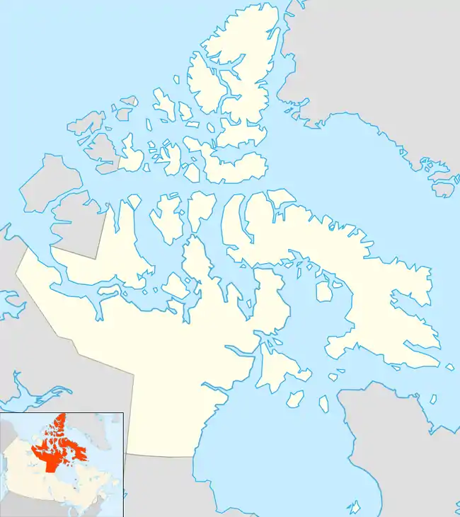
Kugluktuk
Kugluktuk (Inuinnaqtun: Qurluktuk, "the place of moving water"; Inuktitut syllabics: ᖁᕐᓗᖅᑐᖅ [quʁluqtuq], formerly Coppermine until 1 January 1996) is a hamlet located at the mouth of the Coppermine River in the Kitikmeot Region of Nunavut, Canada, on Coronation Gulf, southwest of Victoria Island. It is the westernmost community in Nunavut, near the border with the Northwest Territories.
Kugluktuk
Qurluqtuq ᖁᕐᓗᖅᑐᖅ | |
|---|---|
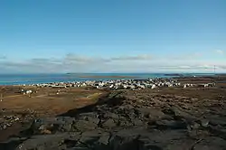 Hill top view of Kugluktuk | |
 Kugluktuk  Kugluktuk | |
| Coordinates: 67°49′32″N 115°05′42″W | |
| Country | Canada |
| Territory | Nunavut |
| Region | Kitikmeot |
| Electoral district | Kugluktuk |
| Government | |
| • Mayor | David Audlatak Nivingalok |
| • MLA | Calvin Pedersen[3] |
| Area | |
| • Land | 549.65 km2 (212.22 sq mi) |
| • Population centre | 0.34 km2 (0.13 sq mi) |
| Elevation | 23 m (75 ft) |
| Population | |
| • Total | 1,491 |
| • Density | 2.6/km2 (7/sq mi) |
| • Population centre | 1,057 |
| • Population centre density | 3,148.6/km2 (8,155/sq mi) |
| Time zone | UTC−07:00 (MST) |
| • Summer (DST) | UTC−06:00 (MDT) |
| Canadian Postal code | X0B 0E0 |
| Area code(s) | 867 |
The traditional language of the area is Inuinnaqtun and is written using the Latin alphabet, rather than the syllabics of the Inuktitut writing system. Like Cambridge Bay, Bathurst Inlet, and Umingmaktok, syllabics are rarely seen and are used mainly by the Government of Nunavut.
Location
The community has the usual services: a post office, Northern Store, co-op store, and Hunters & Trappers Association. The two schools in the area are Kugluktuk High School and Jimmy Hikok Ilihakvik. In June 2004, a fuel line broke in the centre of Kugluktuk, spilling 2,000 L (439.9 imp gal; 528.3 US gal) of diesel fuel.
Demographics
At the 2016 census, the population was 1,491, an increase of 2.8% from the 2011 census.[4] The Population centre showed a population of 1,057, in an area of 0.34 km2 (0.13 sq mi), an increase of 1% from 2011.[5]
In 1982, a division plebiscite was held. While approximately 80% of the population in what is now Nunavut voted in favour of division, Coppermine was one of only two communities to vote against division. Cambridge Bay was the other.[7]
Broadband communications
The community has been served by the Qiniq network since 2005. Qiniq is a fixed wireless service to homes and businesses, connecting to the outside world via a satellite backbone. The Qiniq network is designed and operated by SSI Micro. In 2017, the network was upgraded to 4G LTE technology, and 2G-GSM for mobile voice.
Geography
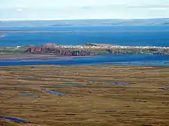
Kugluktuk is located on the shore of the Arctic Ocean. The surrounding landscape is dominated by the rocky and often barren Canadian Shield. The region has a subarctic climate, but barely so, with July having an average of 10.9 °C (51.6 °F). It has very cold and extremely dry winters, light snowfall. Though trees do exist in the region, they are dwarfed and extremely sparse.
Flora
Plant growth in the region during summer months includes small shrubs, grass, moss, lichens, blueberries, blackberries, cranberries, various flowers, and dwarf willow and birch trees.
Climate
Kugluktuk features a subarctic climate (Köppen climate classification: Dfc); like most of mainland Nunavut; with wet summers and dry winters. It is in the transitional zone to a cold tundra climate (ET), but falls outside of it, since its warmest month of July surpasses the 10 °C (50 °F) isotherm, averaging 10.9 °C (51.6 °F).
The highest temperature ever recorded in Kugluktuk was 34.9 °C (94.8 °F) on 15 July 1989.[8] The coldest temperature ever recorded was −50.0 °C (−58 °F) on 2 February 1968.[9]
| Climate data for Kugluktuk Airport, 1981–2010 normals, extremes 1930–present[lower-alpha 1] | |||||||||||||
|---|---|---|---|---|---|---|---|---|---|---|---|---|---|
| Month | Jan | Feb | Mar | Apr | May | Jun | Jul | Aug | Sep | Oct | Nov | Dec | Year |
| Record high °C (°F) | 0.8 (33.4) |
1.1 (34.0) |
0.0 (32.0) |
9.8 (49.6) |
23.3 (73.9) |
32.5 (90.5) |
34.9 (94.8) |
30.3 (86.5) |
26.1 (79.0) |
13.9 (57.0) |
4.4 (39.9) |
−0.5 (31.1) |
34.9 (94.8) |
| Average high °C (°F) | −23.2 (−9.8) |
−23.4 (−10.1) |
−20.7 (−5.3) |
−11.4 (11.5) |
−1.3 (29.7) |
9.9 (49.8) |
15.6 (60.1) |
13.1 (55.6) |
6.5 (43.7) |
−3.5 (25.7) |
−14.8 (5.4) |
−20.3 (−4.5) |
−6.1 (21.0) |
| Daily mean °C (°F) | −27.3 (−17.1) |
−27.7 (−17.9) |
−25.3 (−13.5) |
−16.3 (2.7) |
−5.3 (22.5) |
5.5 (41.9) |
10.9 (51.6) |
9.0 (48.2) |
3.3 (37.9) |
−6.6 (20.1) |
−18.7 (−1.7) |
−24.5 (−12.1) |
−10.3 (13.5) |
| Average low °C (°F) | −31.4 (−24.5) |
−32.0 (−25.6) |
−29.8 (−21.6) |
−21.2 (−6.2) |
−9.2 (15.4) |
1.0 (33.8) |
6.1 (43.0) |
4.8 (40.6) |
0.1 (32.2) |
−9.8 (14.4) |
−22.6 (−8.7) |
−28.6 (−19.5) |
−14.4 (6.1) |
| Record low °C (°F) | −47.8 (−54.0) |
−50.0 (−58.0) |
−48.9 (−56.0) |
−43.9 (−47.0) |
−30.2 (−22.4) |
−15.0 (5.0) |
−0.8 (30.6) |
−4.4 (24.1) |
−20.0 (−4.0) |
−35.4 (−31.7) |
−41.1 (−42.0) |
−45.0 (−49.0) |
−50.0 (−58.0) |
| Average precipitation mm (inches) | 10.4 (0.41) |
8.4 (0.33) |
9.9 (0.39) |
10.0 (0.39) |
14.6 (0.57) |
16.6 (0.65) |
44.5 (1.75) |
45.1 (1.78) |
37.8 (1.49) |
26.5 (1.04) |
13.0 (0.51) |
10.4 (0.41) |
247.2 (9.73) |
| Average rainfall mm (inches) | 0.1 (0.00) |
0.0 (0.0) |
0.0 (0.0) |
0.1 (0.00) |
4.3 (0.17) |
14.6 (0.57) |
44.4 (1.75) |
44.9 (1.77) |
31.4 (1.24) |
4.7 (0.19) |
0.0 (0.0) |
0.0 (0.0) |
144.5 (5.69) |
| Average snowfall cm (inches) | 19.6 (7.7) |
16.3 (6.4) |
19.4 (7.6) |
18.2 (7.2) |
16.2 (6.4) |
2.1 (0.8) |
0.0 (0.0) |
0.2 (0.1) |
7.7 (3.0) |
35.0 (13.8) |
25.5 (10.0) |
21.9 (8.6) |
182.1 (71.7) |
| Average precipitation days (≥ 0.2 mm) | 8.9 | 8.7 | 10.0 | 8.2 | 7.5 | 7.6 | 11.5 | 13.3 | 12.8 | 14.3 | 11.1 | 9.7 | 123.4 |
| Average rainy days (≥ 0.2 mm) | 0.0 | 0.0 | 0.0 | 0.2 | 1.9 | 6.8 | 11.5 | 13.1 | 10.5 | 2.3 | 0.0 | 0.0 | 46.4 |
| Average snowy days (≥ 0.2 cm) | 10.5 | 10.1 | 11.6 | 9.5 | 7.2 | 1.3 | 0.1 | 0.2 | 3.7 | 14.5 | 13.4 | 11.6 | 93.6 |
| Average relative humidity (%) (at 1500 LST) | 76.7 | 75.1 | 77.5 | 82.3 | 83.1 | 70.2 | 64.8 | 69.8 | 75.5 | 84.7 | 80.9 | 77.8 | 76.5 |
| Mean monthly sunshine hours | 17.8 | 77.3 | 160.3 | 233.3 | 246.7 | 375.0 | 341.6 | 207.7 | 91.1 | 51.2 | 19.6 | 0.2 | 1,821.7 |
| Percent possible sunshine | 17.7 | 35.5 | 44.4 | 49.6 | 38.7 | 52.1 | 48.5 | 38.5 | 22.8 | 17.6 | 12.7 | 0.7 | 31.6 |
| Source: Environment Canada[8][10][11][12][13][14][15][16][17][18][19][20][21][9][22][23][24][25] | |||||||||||||
Gallery
 Kugluktuk NU
 A lifeguard is stationed at the beach on hot days
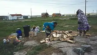
.jpg.webp) Wildflowers in Kugluktuk
Wildflowers in Kugluktuk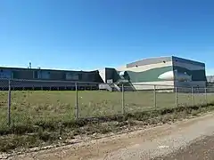 Grades 6 to 12 with a student population of about 150
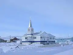 The Roman Catholic Church at Kugluktuk
See also
Notes
- Climate data was recorded at Coppermine from October 1930 to November 1977 and at Kugluktuk Airport from December 1977 to present.
References
- Nunavummiut elect new municipal leaders
- Election Results 2013 General Election Archived 13 November 2013 at the Wayback Machine at Elections Nunavut
- Kugluktuk By-Election
- "2016 Community Profiles Kugluktuk". Retrieved 5 March 2017.
- "2016 Community Profiles Kugluktuk [Population centre]". Retrieved 5 March 2017.
- Elevation at airport. Canada Flight Supplement. Effective 0901Z 16 July 2020 to 0901Z 10 September 2020.
- The 1982 Plebiscite on Division of the Northwest Territories: Regional Government and Federal Policy
- "Kugluktuk A *". Canadian Climate Normals 1981–2010. Environment Canada. Climate ID: 2300902. Retrieved 30 April 2014.
- "February 1968". Canadian Climate Data. Environment Canada. Climate ID: 2300900. Retrieved 25 June 2016.
- "June 1934". Canadian Climate Data. Environment Canada. Climate ID: 2300900. Retrieved 25 June 2016.
- "December 1934". Canadian Climate Data. Environment Canada. Climate ID: 2300900. Retrieved 25 June 2016.
- "May 1941". Canadian Climate Data. Environment Canada. Climate ID: 2300900. Retrieved 25 June 2016.
- "February 1943". Canadian Climate Data. Environment Canada. Climate ID: 2300900. Retrieved 25 June 2016.
- "October 1943". Canadian Climate Data. Environment Canada. Climate ID: 2300900. Retrieved 25 June 2016.
- "January 1947". Canadian Climate Data. Environment Canada. Climate ID: 2300900. Retrieved 25 June 2016.
- "November 1948". Canadian Climate Data. Environment Canada. Climate ID: 2300900. Retrieved 25 June 2016.
- "March 1949". Canadian Climate Data. Environment Canada. Climate ID: 2300900. Retrieved 25 June 2016.
- "May 1952". Canadian Climate Data. Environment Canada. Climate ID: 2300900. Retrieved 25 June 2016.
- "March 1955". Canadian Climate Data. Environment Canada. Climate ID: 2300900. Retrieved 25 June 2016.
- "September 1957". Canadian Climate Data. Environment Canada. Climate ID: 2300900. Retrieved 25 June 2016.
- "April 1958". Canadian Climate Data. Environment Canada. Climate ID: 2300900. Retrieved 25 June 2016.
- "September 1970". Canadian Climate Data. Environment Canada. Climate ID: 2300900. Retrieved 25 June 2016.
- "November 1970". Canadian Climate Data. Environment Canada. Climate ID: 2300900. Retrieved 25 June 2016.
- "June 2013". Canadian Climate Data. Environment Canada. Climate ID: 2300902. Retrieved 25 June 2016.
- "August 2013". Canadian Climate Data. Environment Canada. Climate ID: 2300902. Retrieved 25 June 2016.
Further reading
| Wikimedia Commons has media related to Kugluktuk. |
- Dredge, L. A. Where the river meets the sea geology and landforms of the lower Coppermine River Valley and Kugluktuk, Nunavut. [Ottawa]: Geological Survey of Canada, 2001. ISBN 0-660-18550-4
- Pedersen, Lena, and Donna Stephania. Crime Prevention in Kugluktuk. Ottawa: Caledon Institute of Social Policy, 1999. ISBN 1-894159-61-6
