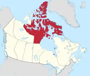
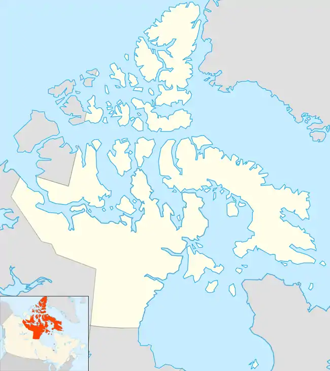
List of communities in Nunavut
This is a list of communities in Nunavut, Canada. Note that many of these communities have alternate names or spellings in Inuktitut or Inuinnaqtun, while others are primarily known by their Inuktitut or Inuinnaqtun names. As of the 2016 census the population of Nunavut was 35,944, an increase of 12.66% from the 2011 census.[1]
Communities
The following are communities recognised by the Government of Nunavut.
| Community[2] | Inuktitut/Inuinnaqtun[3] | Inuktitut syllabics | Translation[2] | Region | Population | Location | ||
|---|---|---|---|---|---|---|---|---|
| 2016[4] | 2011 | % change | ||||||
| Arctic Bay | Ikpiarjuk[5] | ᐃᒃᐱᐊᕐᔪᒃ | the pocket[5] | Qikiqtaaluk Region | 868 | 823 | +5.5 | 73°02′11″N 085°09′09″W |
| Arviat | ᐊᕐᕕᐊᑦ | bowhead whale[6] | Kivalliq Region | 2,657 | 2,318 | +14.6 | 61°06′29″N 094°03′25″W | |
| Baker Lake | Qamani’tuaq[7] | ᖃᒪᓂᑦᑐᐊᖅ | big lake joined by a river at both ends | Kivalliq Region | 2,069 | 1,872 | +10.5 | 64°19′05″N 096°01′03″W |
| Bathurst Inlet | Qingaut | ᕿᙵᐅᓐ | the nose | Kitikmeot Region | 0 | 0 | n/a | 66°50′00″N 108°02′00″W |
| Cambridge Bay | Iqaluktuuttiaq[8] | ᐃᖃᓗᒃᑑᑦᑎᐊᖅ | a good place with many fish[8] | Kitikmeot Region | 1,766 | 1,608 | +9.8 | 69°07′02″N 105°03′11″W |
| Chesterfield Inlet | Igluligaarjuk[9] | ᐃᒡᓗᓕᒑᕐᔪᒃ | place with a few igloos (houses)[9] | Kivalliq Region | 437 | 313 | +39.6 | 63°20′27″N 090°42′22″W |
| Clyde River | Kangiqtugaapik[10] | ᑲᖏᖅᑐᒑᐱᒃ | nice little inlet[10] | Qikiqtaaluk Region | 1,053 | 934 | 12.7 | 70°28′26″N 068°35′10″W |
| Coral Harbour | Salliq[11] | ᓴᓪᓖᑦ | a large, flat island in front of the mainland[11] | Kivalliq Region | 891 | 834 | +6.8 | 64°08′13″N 083°09′51″W |
| Gjoa Haven | Uqsuqtuuq[12] | ᐅᖅᓱᖅᑑᖅ | place of plenty of fat (blubber)[12] | Kitikmeot Region | 1,324 | 1,279 | +3.5 | 68°37′33″N 095°52′30″W |
| Grise Fiord | Aujuittuq[13] | ᐊᐅᔪᐃᑦᑐᖅ | place that never thaws[13] | Qikiqtaaluk Region | 129 | 130 | −0.8 | 76°25′03″N 082°53′38″W |
| Igloolik | Iglulik | ᐃᒡᓗᓕᒃ | place of iglus[14]a | Qikiqtaaluk Region | 1,682 | 1,454 | +15.7 | 69°22′34″N 081°47′58″W |
| Iqaluit (capital) |
ᐃᖃᓗᐃᑦ | place of many fish[15] | Qikiqtaaluk Region | 7,740 | 6,699 | +15.5 | 63°44′55″N 068°31′11″W | |
| Kimmirut | ᑭᒻᒥᕈᑦ | looks like a heel[16] | Qikiqtaaluk Region | 389 | 455 | −14.5 | 62°50′48″N 069°52′07″W | |
| Kinngait | ᑭᙵᐃᑦ | high mountain[17] | Qikiqtaaluk Region | 1,441 | 1,363 | +5.7 | 64°13′54″N 076°32′25″W | |
| Kugaaruk | Arviligjuaq[18] | ᑰᒑᕐᔪᒃ or ᐊᕐᕕᓕᒡᔪᐊᖅ | place of many bowhead whales (Arviligjuaq), little stream (Kugaaruk)[18] |
Kitikmeot Region | 933 | 771 | +21.0 | 68°31′59″N 089°49′36″W |
| Kugluktuk | Qurluqtuq | ᖁᕐᓗᖅᑐᖅ | Place of moving water[19] | Kitikmeot Region | 1,491 | 1,450 | +2.8 | 67°49′32″N 115°05′42″W |
| Nanisivikc | ᓇᓂᓯᕕᒃ | the place where people find things | Qikiqtaaluk Region | 0 | 0 | n/a | 73°02′05″N 084°32′13″W | |
| Naujaat | ᓇᐅᔮᑦ | nesting place for seagulls[20] | Kivalliq Region | 1,082 | 945 | +14.5 | 66°31′19″N 086°14′06″W | |
| Pangnirtung | Pangniqtuuq | ᐸᖕᓂᖅᑑᖅ | place of the bull caribou[21] | Qikiqtaaluk Region | 1,481 | 1,425 | +3.9 | 66°08′52″N 065°41′58″W |
| Pond Inlet | Mittimatalik[22] | ᒥᑦᑎᒪᑕᓕᒃ | place where Mittiima is buried[22] | Qikiqtaaluk Region | 1,617 | 1,549 | +4.4 | 72°41′57″N 077°57′33″W |
| Qikiqtarjuaq | ᕿᑭᖅᑕᕐᔪᐊᖅ | big island[23] | Qikiqtaaluk Region | 598 | 520 | +15.0 | 67°33′29″N 064°01′29″W | |
| Rankin Inlet | Kangiqtiniq[24] | ᑲᖏᕿᓂᖅ or ᑲᖏᖅᖠᓂᖅ | deep bay/inlet[24] | Kivalliq Region | 2,842 | 2,577 | +10.3 | 62°48′35″N 092°05′58″W |
| Resolute | Qausuittuq[25] | ᖃᐅᓱᐃᑦᑐᖅ | place with no dawn[25] | Qikiqtaaluk Region | 198 | 214 | −7.5 | 74°41′51″N 094°49′56″W |
| Sanikiluaq | ᓴᓂᑭᓗᐊᖅ | named for a man known as a fast runner[26] | Qikiqtaaluk Region | 882 | 812 | +8.6 | 56°32′34″N 079°13′30″W | |
| Sanirajak | ᓴᓂᕋᔭᒃ | one that is along the coast[27] | Qikiqtaaluk Region | 848 | 736 | +15.2 | 68°46′38″N 081°13′27″W | |
| Taloyoak | Talurjuaq | ᑕᓗᕐᔪᐊᕐᒃ | large stone caribou blind[28] | Kitikmeot Region | 1,029 | 899 | +14.5 | 69°32′13″N 093°31′36″W |
| Umingmaktokc | Umingmaktuuq | ᐅᒥᖕᒪᒃᑑᖅ | he or she caught a muskox | Kitikmeot Region | 0 | 5 | n/a | 67°41′56″N 107°55′27″W |
| Whale Cove | Tikirarjuaq[29] | ᑎᑭᕋᕐᔪᐊᖅ | long point[29] | Kivalliq Region | 435 | 407 | +6.9 | 62°10′22″N 092°34′46″W |
Former communities
- Amadjuak, on Baffin Island
- Brooman Point Village, on Bathurst Island
- Craig Harbour, on Ellesmere Island
- Dundas Harbour, on Devon Island
- Iglunga, on an island off Baffin Island
- Killiniq (Port Burwell), on Killiniq Island
- Native Point, on the peninsula of the same name
- Nuwata, on Baffin Island
- Padlei, on the mainland
- Port Leopold, on Somerset Island
- Tavani, on the mainland
Hudson's Bay Company trading posts
- Amadjuak
- Apex
- Arctic Bay
- Baker Lake
- Bathurst Inlet
- Bay Chimo (Umingmaktok)
- Belcher Islands
- Blacklead Island
- Cambridge Bay
- Cape Dorset
- Charlton Island Depot
- Chesterfield Inlet
- Clyde River
- Coats Island
- Dundas Harbour
- Eskimo Point (Arviat)
- Fort Hearne
- Fort Ross
- Frobisher Bay (Iqaluit)
- Gjoa Haven
- Igloolik
- Kent Peninsula
- King William Island
- Kugaryuak
- Lake Harbour (Kimmirut)
- Mansel Island
- Nueltin House
- Padley (Padlei)
- Pangnirtung
- Pangnirtung Fox Farm
- Perry River
- Ponds Inlet
- Port Leopold
- Port Burwell (Killiniq)
- Repulse Bay
- Southampton Island
- Tavane (Tavani)
- Tree River
- Wager Inlet (Wager Bay)
Notes
- ^a iglu meaning house and refers to the sod houses that were originally in the area.[30]
- ^b Part of the Hope Bay greenstone belt and are operated by Newmont Mining Corporation
- ^c Neither Nanisivik or Umingmaktok are listed as an official community by the Government of Nunavut but are listed as settlements by Statistics Canada
References
- 2011 census
- "Community Information - Government of Nunavut". www.gov.nu.ca. Retrieved 7 October 2017.
- Bathurst Inlet, Cambridge Bay and Kugluktuk are Inuinnaqtun speaking communities
- "Population and dwelling counts, for Canada, provinces and territories, and census subdivisions (municipalities), 2016 and 2011 censuses – 100% data (Nunavut)". Statistics Canada. 20 February 2019. Retrieved 7 October 2019.
- Arctic Bay at the Government of Nunavut
- Arviat at the Government of Nunavut
- "Baker Lake". Baker Lake. Retrieved 29 June 2017.
- Cambridge Bay at the Government of Nunavut
- Chesterfield Inlet at the Government of Nunavut
- Clyde River at the Government of Nunavut
- Coral Harbour at the Government of Nunavut
- Gjoa Have at the Government of Nunavut
- Grise Fiord at the Government of Nunavut
- Igloolik Archived 2015-04-15 at the Wayback Machine at the Qikiqtani Inuit Association
- "About Iqaluit: History & Milestones - City of Iqaluit". www.city.iqaluit.nu.ca. Retrieved 29 June 2017.
- Kimmirut at Inns North
- "History of Cape Dorset". capedorset.ca. Archived from the original on 14 June 2007. Retrieved 29 June 2017.
- Kugaaruk at Nunavut Tourism
- Kugluktuk at Nunavut Tourism
- Naujaat at the Government of Nunavut
- Pangnirtung at Inns North
- Pond Inlet at the Government of Nunavut
- Qikiqtarjuaq at the Government of Nunavut
- Rankin Inlet at the Government of Nunavut
- Resolute at Nunavut Tourism
- Sanikiluaq at the Qikiqtani Inuit Association
- "Hall Beach" (PDF). gov.nu.ca. Retrieved 29 June 2017.
- Taloyoak at the Government of Nunavut
- Whale Cove at the Government of Nunavut
- Igloolik at CBC News
External links
- Communities of Nunavut Poster (Canada-Nunavut Geoscience Office) (free for download with a map)
- Nunavut communities at Nunavut Tourism
- Interactive map at Nunavut Tourism
| Provinces |
|
|---|---|
| Territories | |
| |
This article is issued from Wikipedia. The text is licensed under Creative Commons - Attribution - Sharealike. Additional terms may apply for the media files.