L'Argentière-la-Bessée
L'Argentière-la-Bessée is a commune of the Hautes-Alpes department in the Alps in southeastern France.
L'Argentière-la-Bessée | |
|---|---|
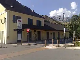 The L'Argentière-les Écrins railway station | |
 Coat of arms | |
Location of L'Argentière-la-Bessée 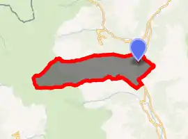
| |
 L'Argentière-la-Bessée  L'Argentière-la-Bessée | |
| Coordinates: 44°47′43″N 6°33′36″E | |
| Country | France |
| Region | Provence-Alpes-Côte d'Azur |
| Department | Hautes-Alpes |
| Arrondissement | Briançon |
| Canton | L'Argentière-la-Bessée |
| Intercommunality | Pays des Écrins |
| Government | |
| • Mayor (2020–2026) | Patrick Vigne |
| Area 1 | 64.55 km2 (24.92 sq mi) |
| Population | 2,279 |
| • Density | 35/km2 (91/sq mi) |
| Time zone | UTC+01:00 (CET) |
| • Summer (DST) | UTC+02:00 (CEST) |
| INSEE/Postal code | 05006 /05120 |
| Elevation | 945–3,243 m (3,100–10,640 ft) (avg. 976 m or 3,202 ft) |
| 1 French Land Register data, which excludes lakes, ponds, glaciers > 1 km2 (0.386 sq mi or 247 acres) and river estuaries. | |
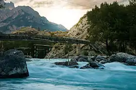
The town lies on the River Durance, which is used for kayaking, white-water rafting and other water sports. The Argentiere Canoe Slalom Course is in the Durance River south of the town. The town is located on the edge of the Écrins National Park. There is an SNCF station in the town with trains running to Briançon and Paris. The village has an old silver mine (which is where the name of L'Argentière derived from), which is now opened to tourists.
Population
| Year | Pop. | ±% |
|---|---|---|
| 2006 | 2,302 | — |
| 2007 | 2,304 | +0.1% |
| 2008 | 2,330 | +1.1% |
| 2009 | 2,328 | −0.1% |
| 2010 | 2,326 | −0.1% |
| 2011 | 2,322 | −0.2% |
| 2012 | 2,318 | −0.2% |
| 2013 | 2,311 | −0.3% |
| 2014 | 2,317 | +0.3% |
| 2015 | 2,307 | −0.4% |
| 2016 | 2,293 | −0.6% |
See also
Argentiere Canoe Slalom Course
References
- "Populations légales 2017". INSEE. Retrieved 6 January 2020.
External links
| Wikimedia Commons has media related to L'Argentière-la-Bessée. |
| Authority control |
|---|
This article is issued from Wikipedia. The text is licensed under Creative Commons - Attribution - Sharealike. Additional terms may apply for the media files.