Orpierre
Orpierre is a commune in the Hautes-Alpes department in southeastern France. The village has multiple venues for sport climbing nearby; one is directly to the north of the village.
Orpierre | |
|---|---|
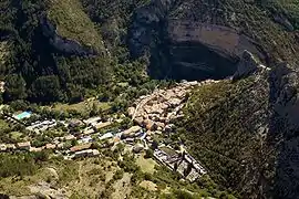 An aerial view of the village in Orpierre. The RN75 road leads in from the left, from Eyguians. | |
 Coat of arms | |
Location of Orpierre 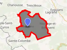
| |
 Orpierre  Orpierre | |
| Coordinates: 44°18′50″N 5°41′30″E | |
| Country | France |
| Region | Provence-Alpes-Côte d'Azur |
| Department | Hautes-Alpes |
| Arrondissement | Gap |
| Canton | Serres |
| Intercommunality | Baronnies |
| Government | |
| • Mayor (2008–2014) | Julie Ravel |
| Area 1 | 27.57 km2 (10.64 sq mi) |
| Population (2017-01-01)[1] | 352 |
| • Density | 13/km2 (33/sq mi) |
| Time zone | UTC+01:00 (CET) |
| • Summer (DST) | UTC+02:00 (CEST) |
| INSEE/Postal code | 05097 /05700 |
| Elevation | 619–1,323 m (2,031–4,341 ft) (avg. 698 m or 2,290 ft) |
| 1 French Land Register data, which excludes lakes, ponds, glaciers > 1 km2 (0.386 sq mi or 247 acres) and river estuaries. | |
Population
| Year | Pop. | ±% |
|---|---|---|
| 1962 | 231 | — |
| 1968 | 258 | +11.7% |
| 1975 | 257 | −0.4% |
| 1982 | 275 | +7.0% |
| 1990 | 335 | +21.8% |
| 1999 | 256 | −23.6% |
| 2008 | 324 | +26.6% |
References
- "Populations légales 2017". INSEE. Retrieved 6 January 2020.
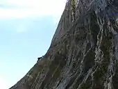 Climber high on a route near the village |
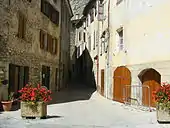 Street scene, Orpierre |
| Wikimedia Commons has media related to Orpierre. |
| Authority control |
|
|---|
This article is issued from Wikipedia. The text is licensed under Creative Commons - Attribution - Sharealike. Additional terms may apply for the media files.