Le Dévoluy
Le Dévoluy is a commune in the Hautes-Alpes department in Provence-Alpes-Côte d'Azur region in southeastern France. It is the result of the merger, on 1 January 2013, of the four communes of Agnières-en-Dévoluy, La Cluse, Saint-Disdier, and Saint-Étienne-en-Dévoluy.
Le Dévoluy | |
|---|---|
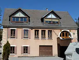 The town hall of Le Dévoluy | |
Location of Le Dévoluy 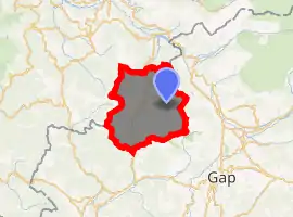
| |
 Le Dévoluy  Le Dévoluy | |
| Coordinates: 44°41′36″N 5°56′31″E | |
| Country | France |
| Region | Provence-Alpes-Côte d'Azur |
| Department | Hautes-Alpes |
| Arrondissement | Gap |
| Canton | Veynes |
| Intercommunality | Buëch Dévoluy |
| Government | |
| • Mayor (2020–2026) | Marie-Paule Rogou |
| Area 1 | 186.37 km2 (71.96 sq mi) |
| Population (2017-01-01)[1] | 966 |
| • Density | 5.2/km2 (13/sq mi) |
| Time zone | UTC+01:00 (CET) |
| • Summer (DST) | UTC+02:00 (CEST) |
| INSEE/Postal code | 05139 /05250 |
| Elevation | 1,134–2,652 m (3,720–8,701 ft) (avg. 1,263 m or 4,144 ft) |
| 1 French Land Register data, which excludes lakes, ponds, glaciers > 1 km2 (0.386 sq mi or 247 acres) and river estuaries. | |
SuperDévoluy, a ski resort, is part of the commune.
Population
| Year | Pop. | ±% |
|---|---|---|
| 2012 | 1,013 | — |
| 2013 | 1,011 | −0.2% |
| 2014 | 1,006 | −0.5% |
| 2017 | 966 | −4.0% |
Geography
Location
Saint-Étienne-en-Dévoluy is located 28 km (17 mi) northeast of the railroad hub of Veynes.
At 18,637 hectares, it is the second-largest commune in the area, right behind Névache.
Terrain and Geology
The town covers the entirety of the Dévoluy range.
Dévoluy is known for its numerous underground cavities, the chourums , and its suitability for speleology.
The European larch, or common larch (Larix decidua) is particularly present in the commune.
References
- "Populations légales 2017". INSEE. Retrieved 6 January 2020.
| Wikimedia Commons has media related to Dévoluy (Hautes-Alpes). |
This article is issued from Wikipedia. The text is licensed under Creative Commons - Attribution - Sharealike. Additional terms may apply for the media files.