Lacave, Lot
Lacave is a commune of France, situated in the North-West of the Lot department, within the Occitanie region.
Lacave | |
|---|---|
 The chateau in Lacave | |
Location of Lacave 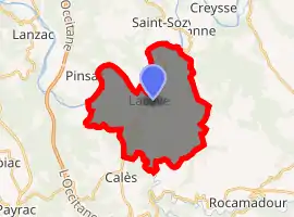
| |
 Lacave  Lacave | |
| Coordinates: 44°50′43″N 1°33′32″E | |
| Country | France |
| Region | Occitanie |
| Department | Lot |
| Arrondissement | Gourdon |
| Canton | Souillac |
| Intercommunality | Causses et Vallée de la Dordogne |
| Government | |
| • Mayor (2008–2014) | André Lestrade |
| Area 1 | 21.19 km2 (8.18 sq mi) |
| Population (2017-01-01)[1] | 262 |
| • Density | 12/km2 (32/sq mi) |
| Time zone | UTC+01:00 (CET) |
| • Summer (DST) | UTC+02:00 (CEST) |
| INSEE/Postal code | 46144 /46200 |
| Elevation | 80–349 m (262–1,145 ft) (avg. 100 m or 330 ft) |
| 1 French Land Register data, which excludes lakes, ponds, glaciers > 1 km2 (0.386 sq mi or 247 acres) and river estuaries. | |
Geography
Situated in the foothills of the "Causse de Gramat" at the confluence of the Dordogne and the Ouysse, 12 km from Souillac and 8 km from Rocamadour.
History
Inhabited since the time of the Solutrean and Magdalenian cultures of the Paleolithic era.
Administration
| Period | Name | Party |
|---|---|---|
| March 2001 - 2014 | André Lestrade | General Council |
Population
At the start of the 20th century, Lacave had 519 inhabitants "with just 27 concentrated in the main town".[2]
|
| |||||||||||||||||||||||||||||||||||||||||||||
| Source: Armand Viré[3] and INSEE[4] | ||||||||||||||||||||||||||||||||||||||||||||||
See also
References
- "Populations légales 2017". INSEE. Retrieved 6 January 2020.
- Le Lot chapter Souillac et Lacave p.223 - Armand Viré - Réédition de l'ouvrage de 1907 - ISBN 2-7455-0049-X
- Lacave à travers les âges - Armand Viré - ISBN 2-9508492-0-2
- Population en historique depuis 1968, INSEE
| Wikimedia Commons has media related to Lacave (Lot). |
| Authority control |
|---|
This article is issued from Wikipedia. The text is licensed under Creative Commons - Attribution - Sharealike. Additional terms may apply for the media files.