Montcléra
Montcléra is a commune in the Lot department in south-western France.
Montcléra | |
|---|---|
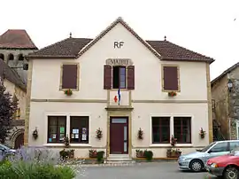 The town hall in Montcléra | |
Location of Montcléra 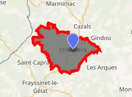
| |
 Montcléra  Montcléra | |
| Coordinates: 44°37′16″N 1°12′40″E | |
| Country | France |
| Region | Occitanie |
| Department | Lot |
| Arrondissement | Gourdon |
| Canton | Puy-l'Évêque |
| Intercommunality | Cazals-Salviac |
| Government | |
| • Mayor (2008–2014) | Jean-Claude Astorg |
| Area 1 | 20.91 km2 (8.07 sq mi) |
| Population (2017-01-01)[1] | 271 |
| • Density | 13/km2 (34/sq mi) |
| Time zone | UTC+01:00 (CET) |
| • Summer (DST) | UTC+02:00 (CEST) |
| INSEE/Postal code | 46200 /46250 |
| Elevation | 154–311 m (505–1,020 ft) (avg. 239 m or 784 ft) |
| 1 French Land Register data, which excludes lakes, ponds, glaciers > 1 km2 (0.386 sq mi or 247 acres) and river estuaries. | |
See also
References
- "Populations légales 2017". INSEE. Retrieved 6 January 2020.
| Wikimedia Commons has media related to Montcléra. |
| Authority control |
|
|---|
This article is issued from Wikipedia. The text is licensed under Creative Commons - Attribution - Sharealike. Additional terms may apply for the media files.