Gourdon, Lot
Gourdon (French pronunciation: [ɡuʁdɔ̃]; Occitan: Gordon) is a commune in the Lot department in south-western France.
Gourdon | |
|---|---|
Subprefecture and commune | |
_Gourdon_vers_le_sud.jpg.webp) Town and St Peter church | |
.svg.png.webp) Coat of arms | |
Location of Gourdon 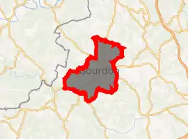
| |
 Gourdon  Gourdon | |
| Coordinates: 44°44′14″N 1°22′57″E | |
| Country | France |
| Region | Occitanie |
| Department | Lot |
| Arrondissement | Gourdon |
| Canton | Gourdon |
| Government | |
| • Mayor (2020–2026) | Jean-Marie Courtin |
| Area 1 | 45.52 km2 (17.58 sq mi) |
| Population (2017-01-01)[1] | 4,094 |
| • Density | 90/km2 (230/sq mi) |
| Time zone | UTC+01:00 (CET) |
| • Summer (DST) | UTC+02:00 (CEST) |
| INSEE/Postal code | 46127 /46300 |
| Elevation | 130–323 m (427–1,060 ft) (avg. 263 m or 863 ft) |
| 1 French Land Register data, which excludes lakes, ponds, glaciers > 1 km2 (0.386 sq mi or 247 acres) and river estuaries. | |
The small town, Gourdon, close to Rocamadour, is situated in the south west region of France. Gourdon has a rich prehistoric past, and a high concentration of prehistoric sites. Gourdon is the capital of the Bouriane, the natural region part of the Quercy, which extends up to the Dordogne River and neighbours the Périgord.
Geography
The town lies in the middle of the commune, above the right bank of the Bléou, a stream tributary of the Céou, which forms most of the commune's southern border.
Climate
| Climate data for Gourdon, Lot (1981–2010 averages) | |||||||||||||
|---|---|---|---|---|---|---|---|---|---|---|---|---|---|
| Month | Jan | Feb | Mar | Apr | May | Jun | Jul | Aug | Sep | Oct | Nov | Dec | Year |
| Record high °C (°F) | 19.9 (67.8) |
25.2 (77.4) |
27.5 (81.5) |
31.3 (88.3) |
32.9 (91.2) |
40.7 (105.3) |
40.7 (105.3) |
41.8 (107.2) |
36.8 (98.2) |
31.7 (89.1) |
24.5 (76.1) |
19.4 (66.9) |
41.8 (107.2) |
| Average high °C (°F) | 8.7 (47.7) |
10.6 (51.1) |
14.2 (57.6) |
16.9 (62.4) |
21.0 (69.8) |
24.6 (76.3) |
27.4 (81.3) |
27.1 (80.8) |
23.5 (74.3) |
18.7 (65.7) |
12.3 (54.1) |
9.2 (48.6) |
17.9 (64.2) |
| Average low °C (°F) | 1.6 (34.9) |
1.8 (35.2) |
3.9 (39.0) |
6.0 (42.8) |
9.5 (49.1) |
12.4 (54.3) |
14.3 (57.7) |
14.1 (57.4) |
11.4 (52.5) |
9.2 (48.6) |
4.6 (40.3) |
2.3 (36.1) |
7.6 (45.7) |
| Record low °C (°F) | −19.0 (−2.2) |
−14.2 (6.4) |
−12.8 (9.0) |
−4.5 (23.9) |
−1.4 (29.5) |
1.8 (35.2) |
5.7 (42.3) |
3.8 (38.8) |
0.6 (33.1) |
−4.7 (23.5) |
−9.0 (15.8) |
−13.2 (8.2) |
−19.0 (−2.2) |
| Average precipitation mm (inches) | 62.5 (2.46) |
55.8 (2.20) |
60.9 (2.40) |
85.1 (3.35) |
87.9 (3.46) |
79.0 (3.11) |
60.0 (2.36) |
63.6 (2.50) |
77.6 (3.06) |
78.3 (3.08) |
74.6 (2.94) |
71.4 (2.81) |
856.7 (33.73) |
| Average precipitation days | 10.6 | 9.3 | 10.0 | 11.5 | 11.9 | 8.7 | 7.1 | 8.0 | 8.6 | 10.4 | 10.9 | 10.9 | 117.9 |
| Average snowy days | 2.3 | 2.2 | 1.6 | 0.8 | 0.0 | 0.0 | 0.0 | 0.0 | 0.0 | 0.1 | 1.0 | 1.9 | 9.9 |
| Average relative humidity (%) | 84 | 78 | 74 | 70 | 73 | 73 | 70 | 73 | 76 | 81 | 84 | 85 | 76.8 |
| Mean monthly sunshine hours | 100.5 | 120.7 | 173.9 | 178.6 | 213.7 | 244.6 | 262.1 | 247.4 | 207.8 | 146.3 | 93.2 | 90.3 | 2,078.9 |
| Source 1: Météo France[2][3] | |||||||||||||
| Source 2: Infoclimat.fr (humidity and snowy days, 1961–1990)[4] | |||||||||||||
Monuments
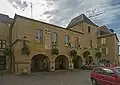 Town Hall
_Fa%C3%A7ace.jpg.webp) St. Peter Church facade
St. Peter Church facade_Vitraux_de_la_nef.jpg.webp) St. Peter Church interior
St. Peter Church interior
See also
| Wikimedia Commons has media related to Gourdon, Lot. |
References
- "Populations légales 2017". INSEE. Retrieved 6 January 2020.
- "Données climatiques de la station de Gourdon" (in French). Meteo France. Retrieved January 8, 2016.
- "Climat Midi-Pyrénées" (in French). Meteo France. Retrieved January 8, 2016.
- "Normes et records 1961-1990: Gourdon (46) - altitude 259m" (in French). Infoclimat. Archived from the original on March 4, 2016. Retrieved January 8, 2016.
| Authority control |
|---|
This article is issued from Wikipedia. The text is licensed under Creative Commons - Attribution - Sharealike. Additional terms may apply for the media files.