Landerd
Landerd (![]() pronunciation ) is a municipality within the province of North Brabant in the southern Netherlands.
pronunciation ) is a municipality within the province of North Brabant in the southern Netherlands.
Landerd | |
|---|---|
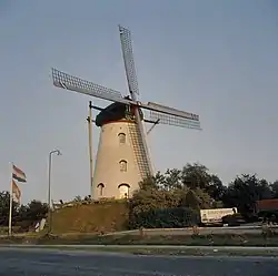 Windmill in Reek | |
 Flag  Coat of arms | |
.svg.png.webp) Location in North Brabant | |
| Coordinates: 51°42′N 5°40′E | |
| Country | Netherlands |
| Province | North Brabant |
| Established | 1 January 1994 |
| Government | |
| • Body | Municipal council |
| • Mayor | Marnix Bakermans |
| Area | |
| • Total | 70.71 km2 (27.30 sq mi) |
| • Land | 70.35 km2 (27.16 sq mi) |
| • Water | 0.36 km2 (0.14 sq mi) |
| Elevation | 20 m (70 ft) |
| Population (January 2019)[4] | |
| • Total | 15,529 |
| • Density | 221/km2 (570/sq mi) |
| • Uden-Veghel | 175,119 |
| Time zone | UTC+1 (CET) |
| • Summer (DST) | UTC+2 (CEST) |
| Postcode | 5374–5375, 5410–5411 |
| Area code | 0486 |
| Website | www |
History
Landerd is the result of a merger between the formerly independent municipalities of Schaijk and Zeeland on 1 January 1994. Schaijk and Reek had merged earlier on 1 July 1942.
Topography
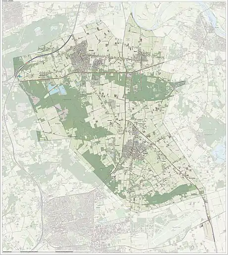
Dutch topographic map of the municipality of Landerd, June 2015
Notable people
- Monique van de Ven (born 1952 in Zeeland) a Dutch actress and director[5]
- Tonnie Dirks (born 1961 in Zeeland) a Dutch former long distance runner, competed in the 1992 Summer Olympics
- Daphny van den Brand (born 1978 in Zeeland) a Dutch cyclo-cross, road bicycle and mountain bike racer.
- Thijs Ploegmakers (born 1980 in Schaijk) performs as Adaro, is a Dutch DJ.
Gallery
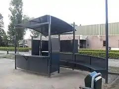 Trefpunt - panoramio
_beeldje_bij_woonzorgcomplex_Het_Wapen_van_Reek.JPG.webp) Reek (Landerd) Het Wapen van Reek
Reek (Landerd) Het Wapen van Reek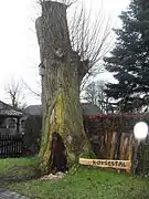 Kerststal - panoramio
_uitvliegende_vogel%252C_Jeop_Coppens%252C_ca._2000%252C_bij_voorm._klooster%252C_Heijtmorgen.JPG.webp) Reek (Landerd) Heijtmorgen
Reek (Landerd) Heijtmorgen Vos - panoramio
References
- "Samenstelling college" [Members of the board] (in Dutch). Gemeente Landerd. Retrieved 29 May 2014.
- "Kerncijfers wijken en buurten 2020" [Key figures for neighbourhoods 2020]. StatLine (in Dutch). CBS. 24 July 2020. Retrieved 19 September 2020.
- "Postcodetool for 5411EA". Actueel Hoogtebestand Nederland (in Dutch). Het Waterschapshuis. Archived from the original on 21 September 2013. Retrieved 29 May 2014.
- "Bevolkingsontwikkeling; regio per maand" [Population growth; regions per month]. CBS Statline (in Dutch). CBS. 1 January 2019. Retrieved 1 January 2019.
- IMDb Database retrieved 20 October 2019
External links
 Media related to Landerd at Wikimedia Commons
- Official website
Places adjacent to Landerd | ||||||||||
|---|---|---|---|---|---|---|---|---|---|---|
| ||||||||||

This article is issued from Wikipedia. The text is licensed under Creative Commons - Attribution - Sharealike. Additional terms may apply for the media files.
