Mill en Sint Hubert
Mill en Sint Hubert (Dutch pronunciation: [mɪl ɛn sɪnt ˈɦybɛrt] (![]() listen)) is a municipality in southern Netherlands.
listen)) is a municipality in southern Netherlands.
Mill en Sint Hubert | |
|---|---|
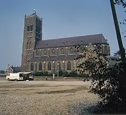 Church in Mill | |
 Flag  Coat of arms | |
.svg.png.webp) Location in North Brabant | |
| Coordinates: 51°41′N 5°47′E | |
| Country | Netherlands |
| Province | North Brabant |
| Government | |
| • Body | Municipal council |
| • Mayor | Antoine Walraven (VVD) |
| Area | |
| • Total | 53.17 km2 (20.53 sq mi) |
| • Land | 52.23 km2 (20.17 sq mi) |
| • Water | 0.94 km2 (0.36 sq mi) |
| Elevation | 17 m (56 ft) |
| Population (January 2019)[4] | |
| • Total | 10,891 |
| • Density | 209/km2 (540/sq mi) |
| Time zone | UTC+1 (CET) |
| • Summer (DST) | UTC+2 (CEST) |
| Postcode | 5450–5455 |
| Area code | 0485, 0486 |
| Website | www |
Population centres
- Langenboom
- Mill
- Sint Hubert
- Wilbertoord
Topography
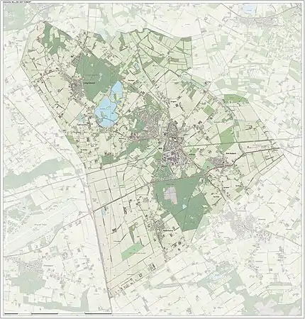
Dutch topographic map of the municipality of Mill en Sint Hubert, June 2015
Notable people
- Kees Bastiaans (1909 in Mill - 1986 in Mill) a Dutch Expressionist painter
- Reinout Oerlemans (born 1971 in Mill) a Dutch soap opera actor, film director, TV presenter and producer [5]
- Jochen Miller (born 1979 in Langenboom) a trance musician and progressive house DJ
- Janneke van Tienen (born 1979 in Mill) a volleyball player
Image gallery
.JPG.webp) Aldendriel Castle
Aldendriel Castle Church of Mill
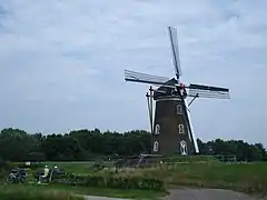 Heilmolen (mill)
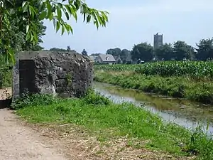 Defence canal and bunker Peel-Raam Line
References
- "College van B&W" [Board of mayor and aldermen] (in Dutch). Gemeente Mill en Sint Hubert. Archived from the original on 17 January 2014. Retrieved 21 April 2014.
- "Kerncijfers wijken en buurten 2020" [Key figures for neighbourhoods 2020]. StatLine (in Dutch). CBS. 24 July 2020. Retrieved 19 September 2020.
- "Postcodetool for 5451BM". Actueel Hoogtebestand Nederland (in Dutch). Het Waterschapshuis. Archived from the original on 21 September 2013. Retrieved 21 April 2014.
- "Bevolkingsontwikkeling; regio per maand" [Population growth; regions per month]. CBS Statline (in Dutch). CBS. 1 January 2019. Retrieved 1 January 2019.
- IMDb Database retrieved 23 November 2019
External links
 Media related to Mill en Sint Hubert at Wikimedia Commons
- Official website
Places adjacent to Mill en Sint Hubert | ||||||||||
|---|---|---|---|---|---|---|---|---|---|---|
| ||||||||||

| Authority control |
|---|
This article is issued from Wikipedia. The text is licensed under Creative Commons - Attribution - Sharealike. Additional terms may apply for the media files.