Leżajsk County
Leżajsk County (Polish: powiat leżajski) is a unit of territorial administration and local government (powiat) in Subcarpathian Voivodeship, south-eastern Poland. It came into being on January 1, 1999, as a result of the Polish local government reforms passed in 1998. Its administrative seat and largest town is Leżajsk, which lies 41 kilometres (25 mi) north-east of the regional capital Rzeszów. The only other town in the county is Nowa Sarzyna, lying 11 km (7 mi) north-west of Leżajsk.
Leżajsk County
Powiat leżajski | |
|---|---|
 Flag  Coat of arms | |
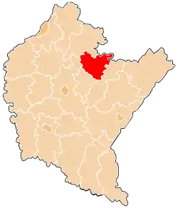 Location within the voivodeship | |
| Coordinates (Leżajsk): 50°16′N 22°26′E | |
| Country | |
| Voivodeship | |
| Seat | Leżajsk |
| Gminas | Total 5 (incl. 1 urban)
|
| Area | |
| • Total | 583.01 km2 (225.10 sq mi) |
| Population (2019) | |
| • Total | 69,479 |
| • Density | 120/km2 (310/sq mi) |
| • Urban | 19,687 |
| • Rural | 49,792 |
| Car plates | RLE |
| Website | http://www.starostwo.lezajsk.pl |
The county covers an area of 583.01 square kilometres (225.1 sq mi). As of 2019 its total population is 69,479, of which the population of Leżajsk is 13,853, that of Nowa Sarzyna is 5,834, and the rural population is 49,792.[1]
Neighbouring counties
Leżajsk County is bordered by Biłgoraj County to the north-east, Przeworsk County and Łańcut County to the south, Rzeszów County to the south-west, and Nisko County to the north-west.
Administrative division
The county is subdivided into five gminas (one urban, one urban-rural and three rural). These are listed in the following table, in descending order of population.
| Gmina | Type | Area (km²) |
Population (2019) |
Seat |
| Gmina Nowa Sarzyna | urban-rural | 144.6 | 21,585 | Nowa Sarzyna |
| Gmina Leżajsk | rural | 198.5 | 20,300 | Leżajsk * |
| Leżajsk | urban | 20.3 | 13,853 | |
| Gmina Grodzisko Dolne | rural | 78.4 | 8,008 | Grodzisko Dolne |
| Gmina Kuryłówka | rural | 141.3 | 5,733 | Kuryłówka |
| * seat not part of the gmina | ||||
Notable residents
- Moe Drabowsky, American major league baseball pitcher
References
- GUS. "Population. Size and structure and vital statistics in Poland by territorial divison in 2019. As of 30th June". stat.gov.pl. Retrieved 2020-09-14.
| Seat |
| |
|---|---|---|
| Urban-rural gmina | ||
| Rural gminas | ||
| City counties |
|  |
|---|---|---|
| Land counties | ||