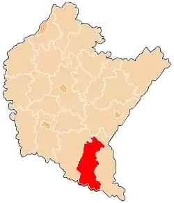
Lesko County
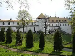
Lesko County (Polish: powiat leski) is a unit of territorial administration and local government (powiat) in Subcarpathian Voivodeship, south-eastern Poland, on the Slovak border. It was created in 2002 out of five gminas which previously made up the western part of Bieszczady County. Its administrative seat and only town is Lesko, which lies 67 kilometres (42 mi) south of the regional capital Rzeszów.
Lesko County
Powiat leski | |
|---|---|
 Location within the voivodeship | |
| Coordinates (Lesko): 49°28′28″N 22°19′44″E | |
| Country | |
| Voivodeship | |
| Seat | Lesko |
| Gminas | |
| Area | |
| • Total | 834.86 km2 (322.34 sq mi) |
| Population (2019) | |
| • Total | 26,532 |
| • Density | 32/km2 (82/sq mi) |
| • Urban | 5,424 |
| • Rural | 21,108 |
| Car plates | RLS |
| Website | http://www.powiat-leski.pl/ |
The county covers an area of 834.86 square kilometres (322.3 sq mi). As of 2019 its total population is 26,532, out of which the population of Lesko is 5,424, and the rural population is 21,108.[1]
Neighbouring counties
Lesko County is bordered by Sanok County to the west, Przemyśl County to the north and Bieszczady County to the east. It also borders Slovakia to the south.
Administrative division
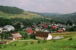
The county is subdivided into five gminas (one urban-rural and four rural). These are listed in the following table, in descending order of population.
| Gmina | Type | Area (km²) |
Population (2019) |
Seat |
| Gmina Lesko | urban-rural | 111.6 | 11,333 | Lesko |
| Gmina Solina | rural | 184.3 | 5,359 | Solina |
| Gmina Olszanica | rural | 94.0 | 4,889 | Olszanica |
| Gmina Baligród | rural | 158.1 | 3,176 | Baligród |
| Gmina Cisna | rural | 286.9 | 1,775 | Cisna |
References
- GUS. "Population. Size and structure and vital statistics in Poland by territorial divison in 2019. As of 30th June". stat.gov.pl. Retrieved 2020-09-14.