Les Pays-d'en-Haut Regional County Municipality
Les Pays-d'En-Haut (French pronunciation: [le pɛi dɑ̃ o]) is a regional county municipality in the Laurentides region of Quebec, Canada. The population according to the 2016 Canadian Census was 41,877.[3]
Les Pays-d'en-Haut | |
|---|---|
Logo | |
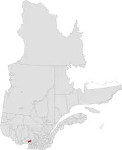 Location in province of Quebec. | |
| Coordinates: 45°57′N 74°08′W[1] | |
| Country | |
| Province | |
| Region | Laurentides |
| Effective | 1 January 1983 |
| County seat | Sainte-Adèle |
| Government | |
| • Type | Prefecture |
| • Prefect | André Genest |
| Area | |
| • Total | 737.40 km2 (284.71 sq mi) |
| • Land | 683.46 km2 (263.89 sq mi) |
| Population (2016)[3] | |
| • Total | 41,877 |
| • Density | 61.3/km2 (159/sq mi) |
| • Change 2011-2016 | |
| • Dwellings | 29,723 |
| Time zone | UTC−5 (EST) |
| • Summer (DST) | UTC−4 (EDT) |
| Area code(s) | 450 and 579 |
| Website | www |
Subdivisions
|
|
|
Demographics
Population
| Canada census – Les Pays-d'en-Haut Regional County Municipality, Quebec community profile | |||
|---|---|---|---|
| 2016 | 2011 | 2006 | |
| Population: | 41,877 (+3.8% from 2011) | 40,331 (+10.3% from 2006) | 36,573 (+18.5% from 2001) |
| Land area: | 683.46 km2 (263.89 sq mi) | 685.41 km2 (264.64 sq mi) | 682.72 km2 (263.60 sq mi) |
| Population density: | 61.3/km2 (159/sq mi) | 58.8/km2 (152/sq mi) | 53.6/km2 (139/sq mi) |
| Median age: | 54.5 (M: 54.5, F: 54.4) | 51.4 (M: 51.5, F: 51.4) | 48.6 (M: 48.6, F: 48.6) |
| Total private dwellings: | 29,723 | 28,593 | 25,587 |
| Median household income: | $58,800 | $52,232 | $49,227 |
| References: 2016[4] 2011[5] 2006[6] earlier[7] | |||
|
|
| |||||||||||||||||||||||||||
| [8][3] | |||||||||||||||||||||||||||||
Language
| Canada Census Mother Tongue - Les Pays-d'en-Haut Regional County Municipality, Quebec[8][3] | ||||||||||||||||||
|---|---|---|---|---|---|---|---|---|---|---|---|---|---|---|---|---|---|---|
| Census | Total | French |
English |
French & English |
Other | |||||||||||||
| Year | Responses | Count | Trend | Pop % | Count | Trend | Pop % | Count | Trend | Pop % | Count | Trend | Pop % | |||||
2016 |
41,685 |
36,635 | 87.9% | 3,170 | 7.6% | 460 | 1.1% | 1,420 | 3.4% | |||||||||
2011 |
39,830 |
34,795 | 87.36% | 3,350 | 8.41% | 460 | 1.15% | 1,225 | 3.08% | |||||||||
2006 |
36,120 |
31,115 | 86.14% | 3,280 | 9.08% | 340 | 0.94% | 1,385 | 3.83% | |||||||||
2001 |
30,460 |
26,135 | 85.80% | 3,025 | 9.93% | 345 | 1.13% | 955 | 3.14% | |||||||||
1996 |
27,855 |
23,695 | n/a | 85.06% | 3,020 | n/a | 10.84% | 400 | n/a | 1.44% | 740 | n/a | 2.66% | |||||
Transportation
References
- Reference number 141066 of the Commission de toponymie du Québec (in French)
- Geographic code 770 in the official Répertoire des municipalités (in French)
- "Census Profile, 2016 Census Les Pays-d'en-Haut, Municipalité régionale de comté [Census division], Quebec". Statistics Canada. Retrieved 26 November 2019.
- "2016 Community Profiles". 2016 Canadian Census. Statistics Canada. 21 February 2017. Retrieved 26 November 2019.
- "2011 Community Profiles". 2011 Canadian Census. Statistics Canada. 5 July 2013. Retrieved 3 March 2014.
- "2006 Community Profiles". 2006 Canadian Census. Statistics Canada. 30 March 2011. Retrieved 3 March 2014.
- "2001 Community Profiles". 2001 Canadian Census. Statistics Canada. 17 February 2012.
- Statistics Canada: 1996, 2001, 2006, 2011 census
- "Carte routière officielle du Québec" [Official Transport Quebec Road Map] (in French). Transports Québec. Retrieved 27 November 2019.
External links
Adjacent Counties & Equivalent Territories | ||||||||||
|---|---|---|---|---|---|---|---|---|---|---|
| ||||||||||
This article is issued from Wikipedia. The text is licensed under Creative Commons - Attribution - Sharealike. Additional terms may apply for the media files.