Deux-Montagnes Regional County Municipality
Deux-Montagnes is a regional county municipality in the Laurentides region of Quebec, Canada. It is located immediately north of Laval on the north shore of the Rivière des Mille-Îles and on the north shore of the Lake of Two Mountains. Its seat and largest city is Saint-Eustache.
Deux-Montagnes | |
|---|---|
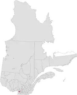 Location in province of Quebec. | |
| Coordinates: 45°28′N 74°06′W[1] | |
| Country | |
| Province | |
| Region | Laurentides |
| Effective | January 1, 1983 |
| County seat[2] | Saint-Eustache |
| Government | |
| • Type | Prefecture |
| • Prefect | Marc Lauzon |
| Area | |
| • Total | 294.10 km2 (113.55 sq mi) |
| • Land | 243.42 km2 (93.98 sq mi) |
| Population (2016)[3] | |
| • Total | 98,203 |
| • Density | 403.4/km2 (1,045/sq mi) |
| • Change 2011-2016 | |
| • Dwellings | 40,728 |
| Time zone | UTC−5 (EST) |
| • Summer (DST) | UTC−4 (EDT) |
| Area code(s) | 450 and 579 |
| Website | www |
| [4] | |
The municipality has a land area of 243.42 km2 and its population was 98,203 residents as of the 2016 Census.[3]
Subdivisions
There are 7 subdivisions and one native reserve within the RCM:[2]
|
|
|
Demographics
Population
| Canada census – Deux-Montagnes Regional County Municipality, Quebec community profile | |||
|---|---|---|---|
| 2016 | 2011 | 2006 | |
| Population: | 98,203 (+2.6% from 2011) | 95,670 (+9.6% from 2006) | 87,249 (+7.2% from 2001) |
| Land area: | 243.42 km2 (93.98 sq mi) | 243.39 km2 (93.97 sq mi) | 243.19 km2 (93.90 sq mi) |
| Population density: | 403.4/km2 (1,045/sq mi) | 393.1/km2 (1,018/sq mi) | 358.8/km2 (929/sq mi) |
| Median age: | 41.1 (M: 40.3, F: 41.9) | 39.8 (M: 38.8, F: 40.7) | 39.3 (M: 38.5, F: 40.0) |
| Total private dwellings: | 40,728 | 39,100 | 35,165 |
| Median household income: | $71,086 | $63,075 | $57,310 |
| References: 2016[5] 2011[4] 2006[6] earlier[7] | |||
|
| |||||||||||||||||||||||||||
| [8][3] (A) adjustment due to boundary change. | ||||||||||||||||||||||||||||
Language
| Canada Census Mother Tongue - Deux-Montagnes Regional County Municipality, Quebec[8][3] | ||||||||||||||||||
|---|---|---|---|---|---|---|---|---|---|---|---|---|---|---|---|---|---|---|
| Census | Total | French |
English |
French & English |
Other | |||||||||||||
| Year | Responses | Count | Trend | Pop % | Count | Trend | Pop % | Count | Trend | Pop % | Count | Trend | Pop % | |||||
2016 |
97,960 |
85,125 | 86.9% | 5,520 | 5.6% | 1,090 | 1.1% | 6,225 | 6.4% | |||||||||
2011 |
94,620 |
84,000 | 88.78% | 5,905 | 6.24% | 905 | 0.96% | 3,810 | 4.03% | |||||||||
2006 |
86,570 |
77,480 | 89.50% | 5,715 | 6.60% | 705 | 0.81% | 2,670 | 3.08% | |||||||||
2001 |
80,810 |
72,880 | 90.19% | 5,610 | 6.94% | 775 | 0.96% | 1,545 | 1.91% | |||||||||
1996 |
78,280 |
69,945 | n/a | 89.35% | 6,160 | n/a | 7.87% | 755 | n/a | 0.96% | 1,420 | n/a | 1.81% | |||||
Transportation
See also
References
- Reference number 141105 of the Commission de toponymie du Québec (in French)
- Geographic code 720 in the official Répertoire des municipalités (in French)
- "Census Profile, 2016 Census Deux-Montagnes, Municipalité régionale de comté [Census division], Quebec". Statistics Canada. Retrieved November 27, 2019.
- "2011 Community Profiles". 2011 Canadian Census. Statistics Canada. July 5, 2013. Retrieved 2014-04-12.
- "2016 Community Profiles". 2016 Canadian Census. Statistics Canada. February 21, 2017. Retrieved 2019-11-27.
- "2006 Community Profiles". 2006 Canadian Census. Statistics Canada. March 30, 2011. Retrieved 2014-04-12.
- "2001 Community Profiles". 2001 Canadian Census. Statistics Canada. February 17, 2012.
- Statistics Canada: 1996, 2001, 2006, 2011 census
- Official Transport Quebec Road Map
Adjacent Counties & Equivalent Territories | |
|---|---|
This article is issued from Wikipedia. The text is licensed under Creative Commons - Attribution - Sharealike. Additional terms may apply for the media files.