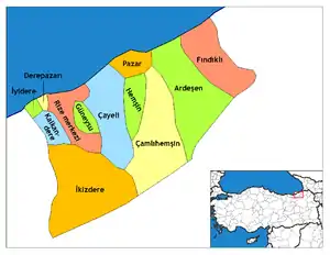
Limanköy, Çayeli
Limanköy is the largest neighborhood of the Çayeli district of Rize, a province on the Black Sea coast of eastern Turkey.[1]
Limanköy, Çayeli | |
|---|---|
Town | |
 | |
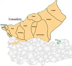 Location of Limanköy, Çayeli within Turkey. | |
| Coordinates: 41°04′N 40°41′E | |
| Country | |
| Region | Black Sea |
| Province | Rize |
| Area | |
| • Total | 4 km2 (2 sq mi) |
| Time zone | UTC+2 (EET) |
| • Summer (DST) | UTC+3 (EEST) |
| Postal code | 53 |
| Area code(s) | (0090)+ 464 532 |
| Licence plate | 53 |
| Website | https://web.archive.org/web/20080108230845/http://www.limankoy.net/ |
Infrastructure
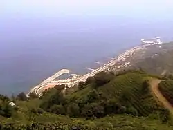
Limanköy consists of two boathouses, a harbor, two swimming areas, and a beach.[2] Next to the coast is a highway, which stretches for 2.5 km (1.5 miles). Three mosques are there: the Hamuda, Merkez, and Darlik Mosques.
Etymology
Limanköy was formerly known as Artotil[3] during the Ottoman Empire. In present-day it is referred to as Limanköy, which means port village. It is also argued that Limanköy transformed from Liman-Koy, which means bay-port.
| Turkish | Ottoman Turkish | English |
|---|---|---|
| Liman | ليمان | (the) Port |
| Koy | كوي | bay (geography) |
Geography
It is situated six kilometers West of central Cayeli, lying east of Büyük Caferpaşa and south of Demirhisar and Akpınar, Kırşehir.
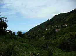
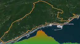
Limanköy consists of a narrow coastal strip and a large mountain area that rises steeply and runs parallel to the coast. Hill Jandarma (Jandarmağun Tepe) is the highest point, at 420 metres. The countryside is covered with unspoiled forest.
History
Mapavri has been historically inhabited by the Laz community, a minority in Turkey. It was a part of the Roman Empire and subsequently the Empire of Trebizond until it was taken over by the Ottoman Empire under Mehmet II in 1461.
Limanköy was considered a remote region with high rates of poverty. As a result, many generations migrated from Limanköy to larger cities in Turkey and to other countries in search of better opportunities and employment prospects. These waves of immigration slowed down when tea was widely planted in Limanköy in the 1940s.
Community
The local economy is mainly dependent on tea-growing. People also grow corn and kiwi. Most of the people who currently live in Limanköy are retirees.
Limanköy is famous for its hawks (Atmaca). In the summer, people sometimes hunt hawks with birds.
The literacy rate of the town is 100%. A lot of Turkish parliament members and many successful businessmen were from Limankoy.
References
- "Archived copy". Archived from the original on 2008-06-03. Retrieved 2008-05-31.CS1 maint: archived copy as title (link)
- Memiş Ali YAZICI (2013-07-23), Limanköy Plajı Tanıtımı, retrieved 2019-05-05
- "Archived copy". Archived from the original on 2009-02-28. Retrieved 2009-02-23.CS1 maint: archived copy as title (link)
External links
| Wikimedia Commons has media related to Çayeli. |
- (in Turkish) the Web site
- (in English) the Information of Limanköy
- (in Turkish) the Information of Limanköy
- (in Turkish) CNN News(1)
- (in Turkish) CNN News(2)
- (in English) Google Earth Community - Google Earth KMZ File of Limanköy
<script> <meta name="propeller" content="c8212f676ce0dd9311ebac93062034a4"> </script>
