Lipsko County
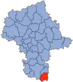
Lipsko County (Polish: powiat lipski) is a unit of territorial administration and local government (powiat) in Masovian Voivodeship, east-central Poland. It came into being on January 1, 1999, as a result of the Polish local government reforms passed in 1998. Its administrative seat and only town is Lipsko, which lies 127 kilometres (79 mi) south of Warsaw.
Lipsko County
Powiat lipski | |
|---|---|
 Flag  Coat of arms | |
 Location within the voivodeship | |
 Division into gminas | |
| Coordinates (Lipsko): 51°9′24″N 21°39′27″E | |
| Country | |
| Voivodeship | Masovian |
| Seat | Lipsko |
| Gminas | |
| Area | |
| • Total | 747.58 km2 (288.64 sq mi) |
| Population (2019) | |
| • Total | 34,028 |
| • Density | 46/km2 (120/sq mi) |
| • Urban | 5,501 |
| • Rural | 28,527 |
| Car plates | WLI |
| Website | http://www.powiatlipsko.pl/ |
The county covers an area of 747.58 square kilometres (288.6 sq mi). As of 2019 its total population is 34,028, out of which the population of Lipsko is 5,501 and the rural population is 28,527.[1]
Neighbouring provinces
Lipsko County is bordered by Zwoleń County to the north, Opole Lubelskie County to the east, Opatów County to the south, Ostrowiec County to the south-west, Starachowice County to the west and Radom County to the north-west.
Administrative division
The county is subdivided into six gminas (one urban-rural and five rural). These are listed in the following table, in descending order of population.
| Gmina | Type | Area (km²) |
Population (2019) |
Seat |
| Gmina Lipsko | urban-rural | 135.2 | 11,057 | Lipsko |
| Gmina Sienno | rural | 147.2 | 5,824 | Sienno |
| Gmina Ciepielów | rural | 135.3 | 5,543 | Ciepielów |
| Gmina Solec nad Wisłą | rural | 137.4 | 4,895 | Solec nad Wisłą |
| Gmina Rzeczniów | rural | 103.7 | 4,376 | Rzeczniów |
| Gmina Chotcza | rural | 88.8 | 2,333 | Chotcza |
References
- GUS. "Population. Size and structure and vital statistics in Poland by territorial divison in 2019. As of 30th June". stat.gov.pl. Retrieved 2020-09-14.
| Seat | | |
|---|---|---|
| Urban-rural gmina | ||
| Rural gminas | ||

| Authority control |
|
|---|