List of Indiana state historical markers in Lake County
This is a list of the Indiana state historical markers in Lake County.
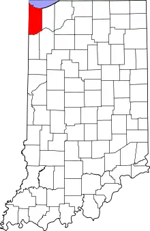
Location of Lake County in Indiana
This is intended to be a complete list of the official state historical markers placed in Lake County, Indiana, United States by the Indiana Historical Bureau. The locations of the historical markers and their latitude and longitude coordinates are included below when available, along with their names, years of placement and topics as recorded by the Historical Bureau. There are eight historical markers located in Lake County.[1]
Historical markers
| Marker title | Image | Year placed | Location | Topics |
|---|---|---|---|---|
| Dutch in the Calumet Region[2] | 1992 | 8941 Kleinman Road in Highland 41°33′2″N 87°26′14″W |
Immigration and Ethnic Groups, Agriculture | |
| First Physician[3] | 1949 | 2985 West 73rd Place in Merrillville 41°29′6″N 87°22′23″W |
Science, Medicine, and Inventions, Underground Railroad, African American | |
| Froebel School[4] | 2014 | 15th Avenue and Madison Street in Gary 41°35′16.9″N 87°20′29.9″W |
Education | |
| Great Sauk (Sac) Trail (east–west through this point)[5] | 1966 | Along Van Buren Street at its junction with West 73rd Avenue/Old U.S. Route 30/Lincoln Highway on a traffic median east of Calumet Cemetery and west of Broadway (State Road 53) in Merrillville 41°29′9″N 87°20′46.2″W |
Transportation, American Indian/Native American | |
| The Lincoln Highway – The "Ideal Section"[6] | 1996 | Northeastern corner of the junction of Joliet Street/U.S. Route 30 and Janice Drive in Schererville 41°29′27.6″N 87°28′52.5″W |
Transportation | |
| St. John Township School, District #2[7] | 1995 | 1515 Joliet Street/Lincoln Highway/U.S. Route 30, east of St. John Road at the St. John Township Community Center in Schererville 41°29′27.6″N 87°29′17.4″W |
Education | |
| St. John's Lutheran Church Tolleston[8] | 1976 | 2235 West 10th Avenue in Gary 41°35′34″N 87°21′57″W |
Religion, Immigration and Ethnic Groups | |
| Stewart Settlement House[9] | 2014 | 1501 East Massachusetts Street in Gary 41°35′16.0″N 87°20′06.2″W |
African American | |
See also
References
- "Indiana Historical Markers by County". State of Indiana. Retrieved 2012-03-15.
- Dutch in the Calumet Region, Indiana Historical Bureau, n.d. Accessed 2012-03-14.
- First Physician, Indiana Historical Bureau, n.d. Accessed 2012-03-14.
- Froebel School, Indiana Historical Bureau, n.d. Accessed 2016-10-15.
- Great Sauk (Sac) Trail (east–west through this point), Indiana Historical Bureau, n.d. Accessed 2012-03-14.
- The Lincoln Highway – The "Ideal Section", Indiana Historical Bureau, n.d. Accessed 2012-03-14.
- St. John Township School, District #2, Indiana Historical Bureau, n.d. Accessed 2012-03-14.
- St. John's Lutheran Church Tolleston, Indiana Historical Bureau, n.d. Accessed 2012-03-14.
- Stewart Settlement House, Indiana Historical Bureau, n.d. Accessed 2016-10-15.
External links
Municipalities and communities of Lake County, Indiana, United States | ||
|---|---|---|
| Cities | Map of Indiana highlighting Lake County | |
| Towns | ||
| Townships | ||
| CDPs | ||
| Other unincorporated communities | ||
| Ghost town | ||
| Footnotes | ‡This populated place also has portions in an adjacent county or counties. | |
| ||
This article is issued from Wikipedia. The text is licensed under Creative Commons - Attribution - Sharealike. Additional terms may apply for the media files.