St. John, Indiana
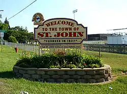
St. John is a town in Lake County, Indiana, United States. The town of St. John has homes in St. John Township, Hanover Township, and Center Township. St. John was founded in 1837. The population was 14,850 at the 2010 census. In 2009, St. John ranked 48th among CNN's top 100 places to live in the United States. In 2014, St. John was ranked as the 4th safest place in Indiana by Movoto Real Estate.[8] Since then the Town has won many awards for being the best place to live, safest community, the safest city, best city to raise a family, etc. For a full list of awards won by the Town of St. John click here.
Town of St. John, Indiana | |
|---|---|
 | |
Seal | |
 Location of St. John in Lake County, Indiana. | |
| Coordinates: 41°26′54″N 87°28′36″W | |
| Country | |
| State | |
| County | Lake |
| Townships | Center, Hanover and St. John |
| Founded | 1837 |
| Government | |
| • Type | Town |
| • Body | Town Council |
| • President | Gerald Swets (R, 3rd) |
| • Vice-President | Paul Panczuk (R, 1st) |
| • Members: | Bryan Blazak (R, AL), Wayne Pondinas (R, AL), Michael Schilling (R, 2nd) |
| • Clerk-Treasurer | Beth Hernandez (R) |
| Area | |
| • Total | 12.53 sq mi (32.46 km2) |
| • Land | 12.45 sq mi (32.24 km2) |
| • Water | 0.09 sq mi (0.22 km2) |
| Elevation | 725 ft (221 m) |
| Population | |
| • Total | 14,850 |
| • Estimate (2019)[4] | 18,796 |
| • Density | 1,510.20/sq mi (583.08/km2) |
| Standard of living (2008-12) | |
| • Per capita income | $36,490 |
| • Median home value | $254,600 |
| Time zone | UTC-6 (Central) |
| • Summer (DST) | UTC-5 (Central) |
| ZIP code | 46373 |
| Area code | 219 |
| FIPS code | 18-66852[5] |
| GNIS feature ID | 0442557[6] |
| Website | www.stjohnin.com |
| Demographics (2010)[7] | |||
|---|---|---|---|
| White | Black | Asian | |
| 93.5% | 1.3% | 1.3% | |
| Islander | Native | Other | Hispanic (any race) |
| 0.1% | 0.1% | 3.7% | 8.2% |
History
The St. John post office was established in 1846.[9] The town was named for John Hack, a pioneer settler.[10]
The Francis P. Keilman House was listed in the National Register of Historic Places in 2013.[11]
Geography
St. John is located at 41°26′54″N 87°28′36″W[12] in Lake County, Indiana.
According to the 2010 census, St. John has a total area of 11.481 square miles (29.74 km2), of which 11.39 square miles (29.50 km2) (or 99.21%) is land and 0.091 square miles (0.24 km2) (or 0.79%) is water.[13]
Demographics
| Historical population | |||
|---|---|---|---|
| Census | Pop. | %± | |
| 1880 | 40 | — | |
| 1920 | 279 | — | |
| 1930 | 332 | 19.0% | |
| 1940 | 383 | 15.4% | |
| 1950 | 684 | 78.6% | |
| 1960 | 1,128 | 64.9% | |
| 1970 | 1,757 | 55.8% | |
| 1980 | 3,974 | 126.2% | |
| 1990 | 4,921 | 23.8% | |
| 2000 | 8,382 | 70.3% | |
| 2010 | 14,850 | 77.2% | |
| 2019 (est.) | 18,796 | [4] | 26.6% |
| U.S. Decennial Census[14] | |||
2010 census
As of the census[3] of 2010, there were 14,850 people, 5,047 households, and 4,225 families living in the town. The population density was 1,303.8 inhabitants per square mile (503.4/km2). There were 5,201 housing units at an average density of 456.6 per square mile (176.3/km2). The racial makeup of the town was 93.5% White, 1.3% African American, 0.1% Native American, 1.3% Asian, 0.1% Pacific Islander, 2.4% from other races, and 1.2% from two or more races. Hispanic or Latino of any race were 8.2% of the population.
There were 5,047 households, of which 40.2% had children under the age of 18 living with them, 75.5% were married couples living together, 5.6% had a female householder with no husband present, 2.6% had a male householder with no wife present, and 16.3% were non-families. 13.9% of all households were made up of individuals, and 6% had someone living alone who was 65 years of age or older. The average household size was 2.94 and the average family size was 3.25.
The median age in the town was 40.2 years. 27.3% of residents were under the age of 18; 6.3% were between the ages of 18 and 24; 23.6% were from 25 to 44; 31.2% were from 45 to 64; and 11.3% were 65 years of age or older. The gender makeup of the town was 49.9% male and 50.1% female.
2000 census
As of the census[5] of 2000, there were 8,382 people, 2,800 households, and 2,441 families living in the town. The population density was 1,246.6 people per square mile (481.6/km2). There were 2,847 housing units at an average density of 423.4 per square mile (163.6/km2). The racial makeup of the town was 91.55% White, 0.13% African American, 0.17% Native American, 0.47% Asian, 0.75% from other races, and 0.93% from two or more races. Hispanic or Latino of any race were 4.20% of the population.
There were 2,800 households, out of which 43.3% had children under the age of 18 living with them, 79.8% were married couples living together, 5.1% had a female householder with no husband present, and 12.8% were non-families. 11.1% of all households were made up of individuals, and 4.9% had someone living alone who was 65 years of age or older. The average household size was 2.99 and the average family size was 3.24.
In the town, the population was spread out, with 28.4% under the age of 18, 6.5% from 18 to 24, 28.3% from 25 to 44, 28.0% from 45 to 64, and 8.9% who were 65 years of age or older. The median age was 39 years. For every 100 females, there were 100.9 males. For every 100 females age 18 and over, there were 98.0 males.
The median income for a household in the town was $71,378, and the median income for a family was $75,231. Males had a median income of $55,554 versus $30,603 for females. The per capita income for the town was $25,106. About 1.1% of families and 1.7% of the population were below the poverty line, including 0.9% of those under age 18 and 2.9% of those age 65 or over.
Education
St. John is served mostly by the Lake Central School Corporation (north of 101st Ave and west of Cline Ave), the Hanover Community School Corporation (south of 101st Ave and west of Cline Ave), and the Crown Point Community School Corporation (south of 101st Ave and east of Cline Ave). Three of the ten Lake Central schools are located in Saint John. These include:
- Lake Central High School
- Kolling Elementary School
- Clark Middle School
In addition to public schools, the community is home to Crown Point Christian School: an evangelical school headed by a parent-owned association. It is also home to St. John the Evangelist Catholic School, a Roman Catholic school.
Awards
For a complete list of Awards won by the Town of St. John please click here
In 2019 the following awards were given to the Town of St. John: WalletHub has ranked the Town of St. John as the 12th Best Place to Live in Indiana for Families. SafeWise has ranked the Town of St. John as the safest city in Indiana. SafeWise has ranked the Town of St. John as the 19th safest city in America. The National Council for Home Safety and Security has rated St. John the third safest community in Indiana for 2019. HomeSnacks has ranked the Town of St. John as the third best place to live in the state.
Many awards won between 2013 and 2019
In 2013, Business Week ranked the Town of St John as the Best Place to Raise Kids in Indiana.
In 2009, St. John was ranked 48th on the CNNMoney.com Top 100 "Best Places to Live" list.
| Wikimedia Commons has media related to St. John, Indiana. |
References
- "2014 Public Officials Directory". Lake County Board of Elections and Voter's Registration. Retrieved 2014-06-10.
- "2019 U.S. Gazetteer Files". United States Census Bureau. Retrieved July 16, 2020.
- "U.S. Census website". United States Census Bureau. Retrieved 2014-06-10.
- "Population and Housing Unit Estimates". United States Census Bureau. May 24, 2020. Retrieved May 27, 2020.
- "U.S. Census website". United States Census Bureau. Retrieved 2008-01-31.
- "US Board on Geographic Names". United States Geological Survey. 2007-10-25. Retrieved 2008-01-31.
- U.S. Census Bureau. American Community Survey, Profile of General Population and Housing Characteristics 2010, Table DP-1, 2010 Demographic Profile Data. U.S. Census website. Retrieved 2014-06-14.
- "These Are The 10 Safest Places In Indiana". Movoto Real Estate. Retrieved 2014-07-08.
- Howat, William Frederick (1915). A Standard History of Lake County, Indiana, and the Calumet Region, Volume 1. Lewis Publishing Company. p. 188.
- Baker, Ronald L. (October 1995). From Needmore to Prosperity: Hoosier Place Names in Folklore and History. Indiana University Press. p. 289. ISBN 978-0-253-32866-3.
...like the township it is in, was named for John Hack...
- "National Register of Historic Places Listings". Weekly List of Actions Taken on Properties: 3/18/13 through 3/22/13. National Park Service. 2013-03-29.
- "US Gazetteer files: 2010, 2000, and 1990". United States Census Bureau. 2011-02-12. Retrieved 2011-04-23.
- "G001 - Geographic Identifiers - 2010 Census Summary File 1". United States Census Bureau. Archived from the original on 2020-02-13. Retrieved 2015-07-25.
- "Census of Population and Housing". Census.gov. Retrieved June 4, 2015.
External links
Municipalities and communities of Lake County, Indiana, United States | ||
|---|---|---|
| Cities | Map of Indiana highlighting Lake County | |
| Towns | ||
| Townships | ||
| CDPs | ||
| Other unincorporated communities | ||
| Ghost town | ||
| Footnotes | ‡This populated place also has portions in an adjacent county or counties. | |
| ||
| Major city |  | |
|---|---|---|
| Cities (over 30,000 in 2010) | ||
| Towns and villages (over 30,000 in 2010) |
| |
| Counties | ||
| Regions | ||
| Sub-regions | ||

| Authority control |
|---|