St. John Township, Lake County, Indiana
St. John Township is one of eleven townships in Lake County, Indiana. As of the 2010 census, its population was 66,741 and it contained 25,691 housing units.[3]
St. John Township | |
|---|---|
 | |
| Coordinates: 41°28′36″N 87°27′45″W | |
| Country | United States |
| State | Indiana |
| County | Lake |
| founded | 1848 |
| Government | |
| • Type | Indiana township |
| Area | |
| • Total | 39.37 sq mi (102.0 km2) |
| • Land | 39.2 sq mi (102 km2) |
| • Water | 0.17 sq mi (0.4 km2) |
| Elevation | 679 ft (207 m) |
| Population (2010) | |
| • Total | 66,741 |
| • Density | 1,702.6/sq mi (657.4/km2) |
| FIPS code | 18-66870[2] |
| GNIS feature ID | 453819 |
History
St. John Township was established in 1848. It was named for John Hack, the first German settler.[4]
Geography
According to the 2010 census, the township has a total area of 39.37 square miles (102.0 km2), of which 39.2 square miles (102 km2) (or 99.57%) is land and 0.17 square miles (0.44 km2) (or 0.43%) is water.[3]
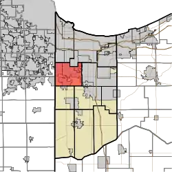
The township includes the towns of Dyer, Schererville and St. John as well as the unincorporated areas of these towns.[5]
Zip codes in the township include 46307, 46311, 46319, 46373, and 46375. The State House districts are IN-11 and IN-15, and the State Senate districts are IN-1, IN-6, and a small portion of IN-2.[6]
Demographics
The racial makeup of the township is 82.1% non-Hispanic White, 11.3% Hispanic, 2.73% African American, 2.23% Asian, 0.58% from other races, and 1.13% from two or more races. The percentages of Hispanic and African American residents are, respectively, 5.4 and 22.6 percent lower than Lake County as a whole.
Native-born citizens make up 91.9% of the population. Naturalized citizens are 5.3% of the population, while 1.9% are not citizens. The top ten countries of birth for foreign-born residents are Mexico, India, Croatia, Poland, Serbia, Greece, Macedonia, Philippines, Germany, and Bosnia and Herzegovina. The most common self-reported ancestries are: German (23.1%), Polish (17%), Irish (15.9%), Mexican (8.72%), Unclassified/Unreported (8.5%), Italian (8.1%), English (7.3%), Dutch (5.6%), American (4.7%), and Serbian (2.8%).[6]
References
- "US Board on Geographic Names". United States Geological Survey. 2007-10-25. Retrieved 2008-01-31.
- "U.S. Census website". United States Census Bureau. Retrieved 2008-01-31.
- "Population, Housing Units, Area, and Density: 2010 - County -- County Subdivision and Place -- 2010 Census Summary File 1". United States Census. Archived from the original on 2020-02-12. Retrieved 2013-05-10.
- Howat, William Frederick (1915). A Standard History of Lake County, Indiana, and the Calumet Region, Volume 1. Lewis Publishing Company. p. 105.
- "St. John Township Trustee". St. John Township Trustee. Retrieved 2 May 2015.
- "Overview of the St. John Township, Lake County, Indiana (Township) - Statistical Atlas". statisticalatlas.com. Retrieved 2017-02-02.
External links
Municipalities and communities of Lake County, Indiana, United States | ||
|---|---|---|
| Cities | Map of Indiana highlighting Lake County | |
| Towns | ||
| Townships | ||
| CDPs | ||
| Other unincorporated communities | ||
| Ghost town | ||
| Footnotes | ‡This populated place also has portions in an adjacent county or counties. | |
| ||