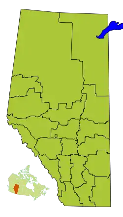
List of census divisions of Alberta
Statistics Canada divides the province of Alberta into nineteen census divisions. Unlike in some other provinces, census divisions do not reflect a level of local government in Alberta. These areas exist solely for the purposes of statistical analysis and presentation; they have no government of their own.
| Census divisions of Alberta | |
|---|---|
| Category | Federal unit |
| Location | Alberta |
| Number | 19 |
| Populations | 9,573 (Division No. 4) – 1,498,778 (Division No. 6) |
| Areas | 3,826 square miles (9,910 km2) (Division No. 8) – 74,176 square miles (192,110 km2) (Division No. 17) |
| Government | Municipal government |
| Subdivisions | Cities, towns, villages, summer villages, specialized municipalities, municipal districts, special areas, improvement districts, Indian reserves, Indian settlements |
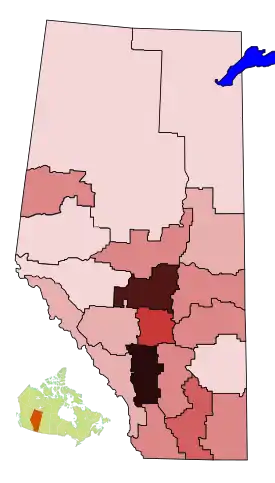
Population density map of Alberta census divisions (people/km²)
0-1
1.1-2
2.1-5
5.1-10
10.1-20
20.1-40
40.1-60
60.1-80
>80
Alberta's census divisions consist of numerous census subdivisions. The types of census subdivisions within an Alberta census division may include:[1][2]
- cities, towns, villages, and summer villages (urban municipalities);
- specialized municipalities;
- municipal districts, special areas, and improvement districts (rural municipalities);
- Indian reserves; and
- Indian settlements.
List of census divisions
The following is a list of Alberta's census divisions. Population, area, and density figures are from the 2016 Census.[3]
See also
- List of cities in Alberta
- List of communities in Alberta
- List of designated places in Alberta
- List of hamlets in Alberta
- List of Indian reserves in Alberta
- List of municipal districts in Alberta
- List of municipalities in Alberta
- List of population centres in Alberta
- List of summer villages in Alberta
- List of towns in Alberta
- List of villages in Alberta
- Specialized municipalities of Alberta
- Subdivisions of Canada
References
- "Interim List of Changes to Municipal Boundaries, Status, and Names" (PDF). Statistics Canada. April 2011. p. 7&8. Retrieved 2011-08-28.
- "Types Of Municipalities In Alberta". Alberta Municipal Affairs. Retrieved 2011-08-28.
- "Population and dwelling counts, for Canada, provinces and territories, and census divisions, 2016 and 2011 censuses (Alberta)". Statistics Canada.
| Subdivisions | |
|---|---|
| Communities | |
| Cities and urban service areas | |
| Census divisions | |
| |
| Provinces |
|
|---|---|
| Territories |
|
| |
This article is issued from Wikipedia. The text is licensed under Creative Commons - Attribution - Sharealike. Additional terms may apply for the media files.