List of historic places in the Alberni-Clayoquot Regional District
The following list includes all of the Canadian Register of Historic Places listings in Alberni-Clayoquot Regional District, British Columbia.
| Name | Address | Coordinates | IDF | IDP | IDM | Image | |
|---|---|---|---|---|---|---|---|
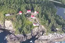
| Lighttower | Estevan Point, Alberni-Clayoquot B, BC | 49°22′59″N 126°32′39″W | 2929 20372 |
 | |||
| Lighttower | Pachena Point, Alberni-Clayoquot C, BC | 48°43′20″N 125°05′51″W | 4750 |  | |||
| Cape Beale Lighthouse | Cape Beale, Alberni-Clayoquot, BC | 48°47′11″N 125°12′56″W | 20777 |  | |||
| Kiix?in Village and Fortress National Historic Site of Canada | , Barkley Sound, BC | 48°48′24″N 125°10′44″W | 16368 |  | |||
| Alberni Post Office | 4888 Johnston Road, Port Alberni, BC | 49°15′30″N 124°48′36″W | 18182 |  | |||
| Carmoor Block | 3074 Kingsway Avenue, Port Alberni, BC | 49°14′04″N 124°48′43″W | 18425 |  | |||
| Federal Building | 4877 Argyle Street, Port Alberni, BC | 49°14′06″N 124°48′18″W | 18743 |  | |||
| McLean Mill National Historic Site of Canada | 5633 Smith Road, Port Alberni, BC | 49°18′39″N 124°49′37″W | 12267 |  | |||
| Port Alberni City Hall | 4850 Argyle Street, Port Alberni, BC | 49°14′04″N 124°48′18″W | 18427 |  | |||
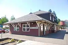
| Port Alberni Train Station | 3100 Kingsway Avenue, Port Alberni, BC | 49°14′06″N 124°48′43″W | 18261 |  | |||
| Rollin Art Centre and Garden | 3061 8th Avenue, Port Alberni, BC | 49°14′03″N 124°48′00″W | 18426 |  | |||
| Ericsson Shipwreck | In Barkely Sound near Folger Island, Bamfield, BC | 48°49′51″N 125°14′36″W | 19306 |  | |||
| Lord Western Shipwreck | Sidney Inlet, Hot Springs Cove, BC | 49°26′10″N 126°13′40″W | 19309 |  | |||
| Hera Shipwreck | Dufferin Passage, Tofino, BC | 49°09′16″N 125°54′57″W | 19308 |  |
References
- (references appear in the table above as external links)
This article is issued from Wikipedia. The text is licensed under Creative Commons - Attribution - Sharealike. Additional terms may apply for the media files.