Pinecone Burke Provincial Park
Pinecone Burke Provincial Park is a provincial park in British Columbia, Canada. It extends from the southwest corner of Garibaldi Provincial Park, west of Pitt Lake and Pitt River to include Burke Mountain in the City of Coquitlam. Most of the park is unserviced wilderness with very rough trails such as the Fools Gold Trail in the Boise Valley. There is canoe access to Widgeon Slough and from there hiking trails that lead to Widgeon Lake, and a network of old logging roads, hiking and mountain biking trails on Burke Mountain.[2]
| Pinecone-Burke Provincial Park | |
|---|---|
IUCN category II (national park)[1] | |
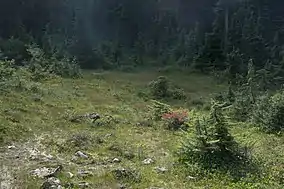 An alpine meadow in Pinecone Burke Park | |
 Location in British Columbia 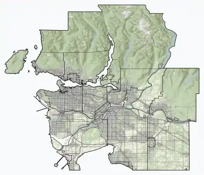 Location in Metro Vancouver | |
| Location | Metro Vancouver, British Columbia, Canada |
| Nearest city | Coquitlam |
| Coordinates | 49°23.6′N 122°42.4′W |
| Area | 380 km² |
| Established | 1995 |
| Governing body | BC Parks |
| Website | Pinecone Burke Provincial Park |
History
During the 1920s, the Canadian Robert Dollar Company of Dollarton logged the lower slopes of Burke Mountain with a steam railway. The peak was called Dollar Mountain by early residents. Rail lines snaked in from Port Moody along the sidehill of Westwood slope, across the Coquitlam River on a trestle bridge and up to the timber on Burke Mountain. As the area was depopulated for many years, bush logging and gravel mining continued with vigour.[2]
Geography
The highest mountain in the park is Pinecone Peak [3] 2027 m (6650 ft).
References
- "Protected Planet | Pinecone Burke Park". Protected Planet. Retrieved 2020-10-18.
- Environment, Ministry of. "Pinecone Burke Provincial Park - BC Parks". bcparks.ca. Retrieved 2020-10-29.
- Canadian Mountain Encyclopedia
- "Pinecone-Burke Provincial Park". Canadian Mountain Encyclopedia. Retrieved 2007-02-19.
External links
| Wikimedia Commons has media related to Pinecone Burke Provincial Park. |
| Features | |
|---|---|
| History | |
| Geography | |
| Politics | |
| Public services | |
| Education | |
| Culture | |
| Transportation | |
| |