List of submarine volcanoes
A list of active and extinct submarine volcanoes and seamounts located under the world's oceans. There are estimated to be 40,000 to 55,000 seamounts in the global oceans.[1] Almost all are not well-mapped and many may not have been identified at all. Most are unnamed and unexplored. This list is therefore confined to seamounts that are notable enough to have been named and/or explored.
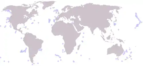
Map of world's major seamounts.
List
| Name (and country, if any) | Summit Elevation | Approximate elevation above seafloor | Location | Last known eruption |
|---|---|---|---|---|
| −39 m (−128 ft)[2] | 3,500 m (11,000 ft) | 25.37°S 129.27°W | 50 BC ± 1000 years | |
| Ampere Seamount | −4,800 m (−15,700 ft) | 35.08°N 12.55°W | ||
| −1,400 m (−4,590 ft) | 45.55°N 130.00°W | 2015 | ||
| −5 m (−16 ft)[3] | 400 m (1,300 ft) | 3.138°N 125.491°E | 1919 | |
| −1,100 m (−3,610 ft) | 2,000 m (6,560 ft) | 39.92°N 67.4°W | ||
| −450 m (−1,480 ft) | 3,950 m (13,000 ft) | 25°11′S 129°23′W | ||
| −24 m (−79 ft) | 3,000 m (9,800 ft) | 53.3°N 135.63°W | 18,000 BP | |
| −8 m (−26 ft)[4] | 1867 | |||
| −34 m (−110 ft) | 2,743 m (8,999 ft) | |||
| −1 m (−3.3 ft) | ||||
| −14 m (−46 ft) | 38.23°N 26.63°W | 1720 | ||
| −7 m (−23 ft) | 400 m (1,300 ft) | |||
| −2,850 m (−9,350 ft) | 6.62°S 124.22°E | |||
| −17 m (−55.8 ft) | ||||
| Foundation Seamounts | ||||
| −29 m (−95 ft)[5] | ||||
| −25 m (−82 ft) | ||||
| −8 m (−26 ft)[6] | 63 m (207 ft) | 1863 | ||
| −1,150 m (−3,770 ft) | 34.98°S 179.00°E | 1360 | ||
| −10 m (−33 ft)[7] | ||||
| 38.48°N 63.59°W | ||||
| −80 m (−262 ft)[8] | ||||
| −185 m (−607 ft) | 1,300 m (4,270 ft) | 12.30°N 61.64°W | 2015 | |
| −10 m (−33 ft) | 1650 | |||
| 16.85°S 168.52°E | ||||
| −969 m (−3,180 ft) | 3,000 m (9,840 ft) | 18.92°N 155.27°W | 1996 | |
| −40 m (−131 ft) | 4,200 m (13,800 ft) | 28°58.7′S 140°15.5′W | 1989 | |
| −450 m (−1,480 ft) | 3,000 m (9,800 ft) | 39°15′00″N 14°23′40″E | ||
| 2,500 m (8,200 ft) | ||||
| −197 m (−646 ft) | 37.6°N 25.88°W | 1911 | ||
| −132 m (−433 ft) | 25.887°S 177.188°W | 2008 | ||
| −16 m (−52.5 ft) | 4,800 m (16,000 ft) | 13°13′30″S 96°7′30″E | ||
| −11 m (−36.1 ft) | ||||
| −2,285 m (−7,500 ft) | 6.60°S 124.675°E | |||
| active | ||||
| 500 m (1,640 ft) | 62°26′00″S 58°24′00″W | inactive | ||
| −160 m (−520 ft)[9] | 3,900 m (12,795 ft) | |||
| −55 m (−180 ft) | 1,200 m (3,900 ft) | 1962 | ||
| 2,500 m (8,200 ft) | ||||
| −1,100 m (−3,610 ft) | 35.5°S 178.9°E | |||
| −880 m (−2,890 ft) | 35.4°S 178.6°E | |||
| −140 m (−459 ft) | 35.745°S 178.478°E | 1986 | ||
| −450 m (−1,480 ft) | 36.13°S 178.05°E | |||
| −1,100 m (−3,610 ft) | 36.139°S 178.197°E | |||
| −5,000 m (−16,400 ft) | 3.97°N 124.17°E | |||
| −1,418 m (−4,650 ft) | ||||
| −8 m (−26 ft)[10] | 20.13°N 145.1°E[10] | 1989[10] | ||
| 2011 | ||||
| 20.13°N 125.3375°E | ||||
| 36.6882°N 130.9°W | Holocene | |||
| −590 m (−1,940 ft) | ||||
| −800 m (−2,600 ft) | 39.86°N 12.59°E | |||
| −11 m (−36 ft) | 4,900 m (16,100 ft) | |||
| −24 m (−79 ft) | 20.33°N 121.75°E | 1854 | ||
| Walters Shoals | −18 m (−59.1 ft) | 4,750 m (15,580 ft) | ||
| −9,656 m (−31,700 ft) | 15.1°S 173.75°W | 2009 | ||
| −3,800 m (−12,500 ft) | 7.53°S 123.95°E |
See also
- Lists of volcanoes
- Submarine volcanoes topics
- Submarine topography
- List of seamounts in the Southern Ocean
References
- Kim, Seung-Sep; Wessel, Paul (2011). "New global seamount census from altimetry-derived gravity data". Geophysical Journal International. 186 (2): 615–631. doi:10.1111/j.1365-246X.2011.05076.x.
- "Adams Seamount". Global Volcanism Program. Smithsonian Institution. Retrieved 2017-02-28.
- "Campi Flegrei Mar Sicilia". Global Volcanism Program. Smithsonian Institution. Retrieved 2017-02-28.
- "Campi Flegrei Mar Sicilia". Global Volcanism Program. Smithsonian Institution. Retrieved 2017-02-28.
- "Fukutoku-Oka-no-Ba". Global Volcanism Program. Smithsonian Institution. Retrieved 2017-02-28.
- Bird, Maryann (20 March 2000). "Fire from the Sea". Time magazine. Accessed 4 January 2018.
- "Home Reef". Global Volcanism Program. Smithsonian Institution. Retrieved 2017-02-28.
- Leat, P. T.; Pearce, J. A.; Barker, P. F.; Millar, I. L.; Barry, T. L.; Larter, R. D. (30 October 2004). "Magma genesis and mantle flow at a subducting slab edge: the South Sandwich arc-basin system". Earth and Planetary Science Letters. 227 (1): 17–35. doi:10.1016/j.epsl.2004.08.016. ISSN 0012-821X.
- Chaytor, J. D.; Keller, R. A.; Duncan, R. A.; Dziak, R. P. (2007). "Seamount morphology in the Bowie and Cobb hot spot trails, Gulf of Alaska". Geochem. Geophys. Geosyst. 8 (9): Q09016. doi:10.1029/2007GC001712.
- "Supply Reef". Global Volcanism Program. Smithsonian Institution. Retrieved 2017-03-03.

This article is issued from Wikipedia. The text is licensed under Creative Commons - Attribution - Sharealike. Additional terms may apply for the media files.
