List of tourist attractions in Calgary
The city of Calgary is located in Alberta, Canada and has over one million inhabitants. Tourism is an important part of the economy.
List of attractions
Downtown
| Address | Type | Remarks | Image | |
|---|---|---|---|---|
| Arts Commons | 205 8 Avenue S.E 51.04528°N 114.06028°W | Arts venue | Performing arts venue, home of Calgary Philharmonic Orchestra | EPCOR Centre |
| Burns Building | 237 8 Ave SE 51.04583°N 114.05861°W | Building | Historic site built by Pat Burns in 1913 | Burns Building |
| Calgary Tower | 101 9 Ave SW 51.044444°N 114.063528°W | Tower | Observation tower | Calgary Tower |
| Chinese Cultural Centre | 197 1 St SW 51.05167°N 114.06556°W | Museum | Largest facility of its kind in North America | Chinese Cultural Centre |
| City Hall | 800 Macleod Trail SE 51.04500°N 114.05722°W | Building | National Historic Site | City Hall |
| Devonian Gardens | 409 8 Ave SW 51.046000°N 114.073167°W | Urban park | Botanical garden with seasonal exhibitions | Devonian Gardens |
| Dragon City Mall | 100 3 Ave SE 51.050611°N 114.062111°W | Shopping mall | Asian-themed mall | Dragon City Mall |
| Fairmont Palliser Hotel | 133 9 Ave SW 51.04444°N 114.06528°W | Hotel | One of Canada's grand railway hotels | Fairmont Palliser |
| Fort Calgary | 750 9 Ave SE 51.045139°N 114.045778°W | Museum | National Historic Site | Fort Calgary |
| Glenbow Museum | 130 9 Ave SE 51.04472°N 114.06083°W | Museum | Western Canada's largest museum | Glenbow Museum |
| Shaw Millennium Park | 800 11 St SW 51.04611°N 114.09167°W | Urban park | Skatepark | Millennium Park |
| National Music Centre | 134 11 Ave SE 51.04250°N 114.06083°W | Museum | Over 2,000 rare instruments and artifacts along with the Canadian Music Hall of Fame and Canadian Country Music Hall of Fame collections | National Music Centre |
| Olympic Plaza | 801 Macleod Trail SE 51.04583°N 114.05861°W | Urban park | Named for the 1988 Winter Olympics, site of open-air festivals | Olympic Plaza |
| Prince's Island Park | 100 2 St SW 51.05500°N 114.06750°W | Urban park | Hosts open-air festivals | Prince's Island Park |
| Stephen Avenue | 8 Ave SW 51.04556°N 114.06556°W | Street | Heritage buildings | Stephen Avenue |
| Telus Convention Centre | 120 9 Ave SE 51.04528°N 114.06083°W | Convention centre | Telus Convention Centre | |
| The Bow | 124 7th Ave SE 51.04778°N 114.06222°W | Skyscraper | Second-tallest building in Calgary | The Bow |
| Plus 15 | Downtown Calgary | Skyway | Skywalk network | +15 |
| West Eau Clair Park | Bow River Pathway | Urban park | re-development adjacent to the Peace Bridge | West Eau Clair Park |
| Peace Bridge | 51.05389°N 114.07883°W | Bridge | one of the most photographed sites in Calgary | Peace Bridge |
Northwest
| Address | Type | Remarks | Image | |
|---|---|---|---|---|
| Confederation Park | 24 Ave & 14 St NW 51.07667°N 114.08444°W | Urban park | Site of Lions Club Christmas Light Display | Confederation Park |
| Foothills Stadium | 2825 24 Ave NW 51.0734361°N 114.1206361°W | Sports venue | Baseball stadium | Foothills Stadium |
| Kensington | Kensington Rd NW 51.05250°N 114.09472°W | Street | Business Revitalisation Zone, shopping and restaurants, heritage buildings | Kensington |
| Market Mall | 3625 Shaganappi Trail NW 51.08472°N 114.15611°W | Shopping mall | One of the largest malls (by area) in Calgary | Market Mall |
| Parkdale | Parkdale Boulevard 51.05889°N 114.13861°W | Public art | Parkdale Plaza | "Outfall" |
| McMahon Stadium | 1817 Crowchild Trail NW 51.0703278°N 114.1213889°W | Sports venue | Canadian football stadium, home of the Calgary Stampeders (CFL) | McMahon Stadium |
| Baker Park | 1817 Crowchild Trail NW 51.09722°N 114.21556°W | Urban park | Most popular Calgary park for outdoor wedding. River observation point. | |
| Nose Hill Park | 14 St, Shaganappi Trail, John Laurie Blvd NW 51.117°N 114.117°W | Urban park | One of the largest municipal parks in Canada | Nose Hill Park |
| Olympic Oval | 111 University Gate NW 51.07694°N 114.13556°W | Sports venue | Speed skating oval, home of the Calgary Inferno CWHL hockey team | Olympic Oval |
| Southern Alberta Jubilee Auditorium | 1415 14 Ave NW 51.06250°N 114.09306°W | Music venue | Performing arts, culture and community facility, home of Calgary Opera | Southern Alberta Jubilee Auditorium |
| University of Calgary | 2500 University Dr NW 51.07750°N 114.13306°W | University | Public university | University of Calgary |
Northeast
| Address | Type | Remarks | Image | |
|---|---|---|---|---|
| Baitun Nur | 4353 54 Avenue NE 51.101743°N 113.972039°W |
Mosque | Largest mosque in Canada | Baitun Nur mosque |
| The Hangar Flight Museum | 4629 McCall Way NE 51.09417°N 114.01306°W | Museum | History of aviation and space technology of western Canada |  |
| YYC Calgary International Airport | 2000 Airport Rd NE 51.11389°N 114.02028°W | Airport | International airport, part of the National Airports System | Calgary International Airport |
| Calgary Zoo | 1300 Zoo Rd NE 51.04583°N 114.03333°W | Zoo | Second largest zoo in Canada | Calgary Zoo |
| Marlborough Mall | 433 Marlborough Way NE 51.05472°N 113.97833°W | Shopping mall | Opened in 1972 | Marlborough Mall |
| Sunridge Mall | 2525 36 St NE 51.07444°N 113.98583°W | Shopping mall | Opened in 1981 | Sunridge Mall |
| Telus Spark | 220 St. George's Drive NE 51.04778°N 114.08861°W | Museum | Interactive exhibits, multimedia presentations, educational demonstrations | Telus World of Science |
Southwest
| Address | Type | Remarks | Image | |
|---|---|---|---|---|
| Battalion Park | Signal Hill Ctr SW 51.02028°N 114.17139°W | Urban park | Formerly known as Camp Sarcee | Battalion Park |
| Canada Olympic Park | 88 Canada Olympic Rd NW 51.07972°N 114.19917°W | Ski resort | 1988 Winter Olympics venue now used for Recreation and Athletic training | Canada Olympic Park |
| Canada's Sports Hall of Fame | 169 Canada Olympic Road NW 51.08250°N 114.22111°W | Museum | The main national hall of fame for sports in general | Hall of Fame |
| Chinook Centre | 6455 Macleod Trail SW 50.99833°N 114.07389°W | Shopping mall | Opened in 1960 | Chinook Centre |
| Edworthy Park | Edworthy St SW 51.06139°N 114.15639°W | Urban park | Located along the Bow River | Edworthy Park |
| Fish Creek Park | SW Calgary 50.92778°N 114.12833°W | Provincial park | One of the largest urban parks in North America | Fish Creek Provincial Park |
| Glenmore Reservoir | 14th St & Glenmore Trail SW 50.98139°N 114.11389°W | Lake | Manmade reservoir on the Elbow River | Glenmore Reservoir |
| Heritage Park | Heritage Dr & 14th St SW 50.98528°N 114.10833°W | Museum | Historical Village | Heritage Park Historical Village |
| Marda Loop | 33rd Avenue SW 51.02389°N 114.11306°W | Street | Shopping, Business Revitalization Zone | Marda Loop |
| Spruce Meadows | Highway 22X (Spruce Meadows Trail) 50.88500°N 114.10056°W | Venue | Equestrian facility | Spruce Meadows |
| Repsol Sport Centre | 2225 Macleod Trail SW 51.03444°N 114.06333°W | Venue | Multi-sports complex | Talisman Centre |
| The Military Museums | 1820 - 24 Street SW 4520 Crowchild Trail SW 51.01444°N 114.11583°W | Museum | Comprises the Naval Museum of Alberta,the Air Force Museum of Alberta, Library and Archives | The Military Museums |
| 17th Avenue | 17 Ave SW 51.03778°N 114.08167°W | Street | Shopping and entertainment, site of Red Mile | Red Mile |
Southeast
| Address | Type | Remarks | Image | |
|---|---|---|---|---|
| Stampede Grounds | 1410 Olympic Way SE 51.03361°N 114.05389°W | Venue | Fair and Exhibition grounds | Calgary Stampede |
| Fish Creek Provincial Park | South Calgary 50.90333°N 114.01972°W | Provincial park | One of the largest urban parks in North America | Fish Creek Provincial Park |
| Inglewood | 9 Ave SE 51.04278°N 114.03944°W | Street | Heritage buildings[1] | Inglewood |
| International Avenue | 17 Ave SE (Highway 1A) 51.03778°N 113.98167°W | Street | Business Revitalization Zone,[2] cultural diverse neighbourhood, site of GlobalFest | 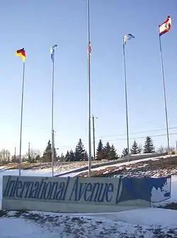 International Avenue |
| Max Bell Centre | 1001 Barlow Trail SE 51.04222°N 114.00361°W | Sports venue | Ice hockey arena | Max Bell Centre |
| Scotiabank Saddledome | 555 Saddledome Rise SE 51.03750°N 114.05194°W | Venue | Ice hockey arena, home of the Calgary Flames (NHL), performing arts | Scotiabank Saddledome |
| Sikome Lake | Bow Bottom Trail SE 50.89944°N 114.01556°W | Lake | Man-made lake, public beach | Sikome Lake |
| Southcentre Mall | 100 Anderson Rd SE 50.94167°N 114.06806°W | Shopping mall | Opened in 1974 | Southcentre Mall |
References
- Inglewood Main Street Archived 2007-02-27 at the Wayback Machine - Alberta Heritage
- Business Revitalization Zone - International Avenue
External links
- Places to see in Calgary
- Calgary Attractions - Travel Alberta
- Museums in Calgary - Alberta Heritage
| Landmarks | |
|---|---|
| Attractions | |
| Venues | |
| Parks | |
| Malls | |
| Recreation | |
| |
This article is issued from Wikipedia. The text is licensed under Creative Commons - Attribution - Sharealike. Additional terms may apply for the media files.