Ludgershall, Buckinghamshire
Ludgershall is a village and civil parish in the unitary authority area of Buckinghamshire, England. It is near the boundary with Oxfordshire, about 5.5 miles (9 km) south-east of Bicester and 5 miles (8 km) west of Waddesdon.
| Ludgershall | |
|---|---|
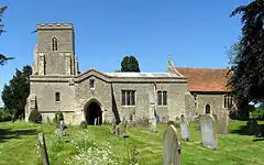
 St Mary the Virgin parish church | |
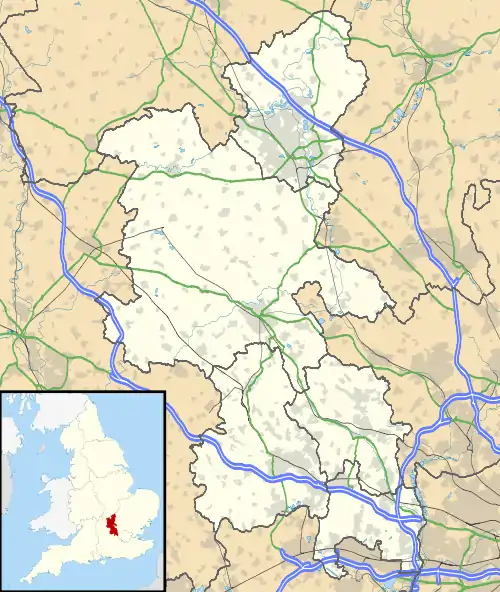
 Ludgershall Location within Buckinghamshire | |
| Population | 409 (2011 Census)[1] |
| OS grid reference | SP661174 |
| Civil parish |
|
| Unitary authority | |
| Ceremonial county | |
| Region | |
| Country | England |
| Sovereign state | United Kingdom |
| Post town | Aylesbury |
| Postcode district | HP18 |
| Dialling code | 01844 |
| Police | Thames Valley |
| Fire | Buckinghamshire |
| Ambulance | South Central |
| UK Parliament | |
| Website | Ludgershall Village Buckinghamshire |

Toponym
The toponym is said to be derived from the Old English for "nook with a trapping spear"[2] but this is disputed.[3] It occurs in more than one place in England (see Ludgershall (disambiguation)). The Domesday Book of 1086 records the village as Litlegarsele. The place spelt at Lotegarshale, seen in 1381, may refer to the Buckinghamshire village, or the one in Wiltshire.[4]
History
Henry II granted land in the parish to the priory of Santingfeld in Picardy, France. It is possible that a hospital was founded on this land, although it is uncertain. In the reign of Henry VI, when all alien church possessions were seized by the Crown, this land was given to King's College, Cambridge.[5][6]
The theologian John Wyclif was vicar of Ludgershall 1368–74.[7]
St Mary the Virgin Church
The parish church of St Mary the Virgin on Church Lane is a Grade I listed church, dating from the 14th century with 19th century additions. The Bible scholar John Wycliffe is reported to have been an early vicar.[8]
Ludgershall Bike Night
The village plays host to an annual charity motorbike night, typically on the first Monday in July. The free to attend meet sees riders of vintage, classic and contemporary motorcycles gather on the village green.[9] The event is attended by multiple motorcycle clubs and enthusiasts alike.
References
- "Key Figures for 2011 Census: Key Statistics 2011 Census". Neighbourhood Statistics. Office for National Statistics. Retrieved 3 February 2013.
- Tengstrand, Erik (1940). Genitival Composition in Old English Place-names. Uppsala: Almqvist & Wiksells. p. 219.
- Ekwall, Eilert (1960). The Concise Oxford Dictionary of English Place-names (4th ed.). Oxford: Oxford University Press. pp. 306–307. ISBN 0-19-869103-3.
- Plea Rolls of the Court of Common Pleas; National Archives; CP 40/483; http://aalt.law.uh.edu/AALT6/R2/CP40no483/483_0241.htm ; 5 entry
- Page 1905, p. 395.
- "King's College Estates Records". King's College, University of Cambridge. Archived from the original (Microsoft Word document) on 28 September 2006. Retrieved 30 October 2007.
- Page 1927, pp. 68–73.
- Historic England. "Church of St Mary, Ludgershall (1124276)". National Heritage List for England. Retrieved 18 August 2019.
- "Ludgershall Bike Night". Retrieved 29 June 2015.
Sources & further reading
- Page, William, ed. (1905). "Hospitals: Ludgershall". A History of the County of Buckingham, Volume 1. Victoria County History. p. 395.
- Page, William, ed. (1927). "Ludgershall with Kingswood". A History of the County of Buckingham, Volume 4. Victoria County History. pp. 68–73.
- Pevsner, Nikolaus (1973) [1966]. Buckinghamshire. The Buildings of England. Harmondsworth: Penguin Books. pp. 196–197. ISBN 0-14-071019-1.
External links
![]() Media related to Ludgershall, Buckinghamshire at Wikimedia Commons
Media related to Ludgershall, Buckinghamshire at Wikimedia Commons
