Madanpur, India
Madanpur is a census town in Kalyani Community Development Block in the Kalyani subdivision of the Nadia district in the Indian state of West Bengal.[1]
Madanpur | |
|---|---|
Census Town | |
 Madanpur Location in West Bengal, India  Madanpur Madanpur (India) | |
| Coordinates: 23.02°N 88.48°E | |
| Country | |
| State | West Bengal |
| District | Nadia |
| Government | |
| • Type | Gram Panchayat |
| • Body | Madanpur GP I |
| Elevation | 9 m (30 ft) |
| Population (2011) | |
| • Total | 13,675 |
| Languages | |
| • Official | Bengali, English |
| Time zone | UTC+5:30 (IST) |
| PIN | 741245 |
| Vehicle registration | WB |
| Website | nadia |
History
In the middle of the eighteenth century when the railway was yet to come in Bengal, this area was full of grassland and lush green on the bank of Ganges river. The current station area was totally in the river bed. After 1750 it became populated. The myth was that Thakur Madangopal accompanied with Sri Radha used to take rest at this place on the way to Krishnanagar via Chandirampur. The people of the village was very much happy with this, and they started worshipping Lord Madangopal. From then, people started calling this place 'Madanpur' which means a place for Madangopal. Here, we still have Madangopal temple near Birohi.[2]
Geography
| Cities and towns in Kalyani subdivision of Nadia district M: municipal town/ city/notified area, CT: census town, R: rural/ urban centre. Owing to space constraints in the small map, the actual locations in a larger map may vary slightly |
Cluster
According to the map of Chakdaha CD block, in the District Census Handbook 2011, Nadia, Chanduria, Priyanagar, Shimurali, Jangal, Madanpur, Saguna and Kulia form a cluster of census towns between Chakdaha and Kalyani/ Gayespur.[3]
Area overview
Nadia district is part of the large alluvial plain formed by the Ganges-Bhagirathi system. The Kalyani subdivision has the Bhagirathi/ Hooghly on the west. Topographically, Kalyani subdivision is a part of the Ranaghat-Chakdaha Plain, the low-lying area found in the south-eastern part of the district.[4] The smallest subdivision in the district, area-wise, has the highest level of urbanisation in the district. 76.73% of the population lives in urban areas and 23.27% lives in the rural areas.[5]
Note: The map alongside presents some of the notable locations in the subdivision. All places marked in the map are linked in the larger full screen map. All the four subdivisions are presented with maps on the same scale – the size of the maps vary as per the area of the subdivision.
Location
Madanpur is located at 23.02°N 88.48°E.[6] It has an average elevation of 9 m (30 ft). It is situated on the bank of Ganges which is called Hoogly River in this place. Madanpur is full of highly fertile agricultural land. It is spread till Kaliganj in the North, Ishwaripur in the West, Birohi in the East and Kalyani in the South. Madanpur has wide marsh area. Yamuna river, a feeder of Ganges flows through Madanpur to meet Ichhamoti. The source place of Yamuna river is called Tribeni. But, nowadays this river is almost in dying condition. The nearest Bangladesh border (Petrapole) is just about 51 km from Madanpur.
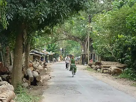
Most of the areas are full of lush green with various types of flora.
Demographics
According to the 2011 Census of India, Madanpur had a total population of 13,675, of which 6,993 were males and 6,682 were females. Population in the age range 0–6 years was 1,062. The total number of literate persons in Madanpur was 11,823 (93.74% of the population over 6 years).[7]
As of 2001 India census Madanpur had a population of 12,029. Males constitute 52% of the population and females 48%. Madanpur has an average literacy rate of 81%, higher than the national average of 59.5%: male literacy is 85%, and female literacy is 76%. In Madanpur, 9% of the population is under 6 years of age.[8]
Infrastructure
According to the District Census Handbook 2011, Nadia, Madanpur covered an area of 3.3 km2. Among the civic amenities, the protected water supply involved overhead tank, tubewell/ borewell, hand pump. It had 1,358 domestic electric connections. Among the medical facilities it had 1 veterinary hospital, 7 medicine shops. Among the educational facilities it had 4 primary schools, 2 senior secondary schools. Three important commodities it produced were paddy, jute, vegetables. It had the branch office of 1 nationalised bank.[9]
Economy
Financial Services
There are nationalized banks, cooperatives and micro-financing institutions supporting the agrarian economy of the region. However, unorganized money lenders dominate the financing needs of small traders in the urgency of money.
- State Bank of India (Near Indira More)
- Punjab National Bank formerly United Bank of India (Near Indira More)
- District Co-operative Bank (Near Purbapara)
Transport
Madanpur railway station is situated on the Sealdah-Ranaghat Line of the Kolkata Suburban Railway.[10]
Rickshaws, Auto-rickshaws and Totos are used for local conveyance.
Madanpur stands on State Highway 1 that links it to National Highway 12.[11]
Train Routes: Ranaghat-Sealdah Local, Santipur-Sealdah Local, Krishnagar-Sealdah Local, Gede-Sealdah Local, Lalgola Passenger, Lalgola Memu Local, Gede-Majerhat Local, Majerhat-Ranaghat Local.
Auto Routes: Madanpur-Kalyani Auto, Madanpur-Chakdaha Auto, Madanpur-Birohi Auto, Madanpur-Bakultala Auto, Madanpur-Doyla Auto, Madanpur-Saguna Auto, Madanpur-Gayeshpur Auto.
Education
There are three higher secondary schools following the "10+2" plan run by the state government : Madanpur Kendriya Adarsha Vidyalaya (HS) for Girls, Madanpur Kendriya Adarsha Vidyalaya (HS) for Boys and Alaipur Manorama Siksha Niketan (HS).
These schools are run by the state government. Bengali is the primary language of instruction. The schools are affiliated to the West Bengal Board of Secondary Education and to the West Bengal Council of Higher Secondary Education.
The government run primary schools are Purbapara Anganwari School, Purbapara Prathamik Vidyalaya, 1 No. Gobindnagar Primary School, Kalyan Nagar Math Para School.
Some of the privately run English medium schools are Deshbandhu Vidyalaya, Dreamdale School and Philomel School.
Privately run Bengali medium schools are Madanpur North Point School, Shantinagar School, and Kalyan Nagar School.
Attractions of Madanpur
- Temple of Madangopal (Lord Krishna) - Birohi, besides 34 National Highway, 6 km away from Madanpur Railway Station.
- Birla Family Laxmi narayan Mandir
- Sayantani Kali Mandir
- House of Bengali actor Bikash Roy near Kaliganj, Madanpur.[2]
- Alaipur 'Jamunapara' - a natural picnic spot and Kali Maa Mandir
- Dil Park - a family picnic spot near Iswaripur village
- Gouranga Mandir, at Gouranga para.
- Char Sarati Ganga beside valley near Alaipur (Madanpur)
- Gouranga Mela held in Madanpur in month of March–April
References
- "District Wise List of Statutory Towns". Census of India 2011, Urban Frame. Directorate of Census Operations, West Bengal. Archived from the original on 27 September 2007. Retrieved 3 August 2015.
- Bibartaner Dharay Madanpur (Bengali). Tarulata Prakashani. 1999. p. 4.
- "District Census Handbook Nadia, Census of India 2011, Series 20, Part XII A" (PDF). Map of Chakdaha CD block, page 511. Directorate of census Operations V, West Bengal. Retrieved 12 October 2020.
- "District Census Handbook, Nadia, 2011, Series 20, Part XII A" (PDF). Pages 13,14. Directorate of Census Operations, West Bengal. Retrieved 17 October 2020.
- "District Statistical Handbook 2014 Nadia". Table 2.2, 2.4(a). Department of Planning and Statistics, Government of West Bengal. Retrieved 17 October 2020.
- Falling Rain Genomics, Inc - Madanpur
- "2011 Census – Primary Census Abstract Data Tables". West Bengal – District-wise. Registrar General and Census Commissioner, India. Retrieved 18 May 2017.
- "Census of India 2001: Data from the 2001 Census, including cities, villages and towns (Provisional)". Census Commission of India. Archived from the original on 16 June 2004. Retrieved 1 November 2008.
- "District Census Handbook Nadia, Census of India 2011, Series 20, Part XII A" (PDF). Section II Town Directory, Pages 635-656; Statement I: Status and Growth History, Page 635; Statement II: Physical Aspects and Location of Towns, Page 641; Statement III: Civic and other Amenities, Page 643; Statement IV: Medical Facilities, Page 646; Statement V: Educational, Recreational and Cultural Facilities, Page 655; Statement VI:Industry and Banking ,Page 2833. Directorate of census Operations V, West Bengal. Retrieved 30 September 2020.
- "Sealdah Ranaghat Local". Time Table. IndiaRailInfo. Retrieved 11 October 2020.
- "List of State Highways in West Bengal". West Bengal Traffic Police. Retrieved 12 October 2020.
Cities, towns and locations in Nadia District | |||||||||
|---|---|---|---|---|---|---|---|---|---|
| Cities, municipal and census towns |
| ||||||||
| Locations other than cities and towns |
| ||||||||
| Related topics |
| ||||||||