Manila East Road
The Manila East Road or Laguna de Bay Bypass Road is a two-to-four lane secondary highway located in the provinces of Rizal and Laguna in the Philippines.[1][2][3]
.svg.png.webp) .svg.png.webp) | |
|---|---|
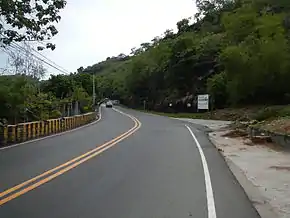 Manila East Road in Cardona | |
| Route information | |
| Maintained by Department of Public Works and Highways | |
| Length | 123.3 km (76.6 mi) |
| Component highways |
|
| Major junctions | |
| North end | |
| |
| South end | |
| Location | |
| Provinces | Rizal and Laguna |
| Towns | Taytay, Angono, Binangonan, Cardona, Morong, Baras, Tanay, Pililla, Santa Maria, Mabitac, Famy, Siniloan, Pangil, Pakil, Paete, Kalayaan, Lumban, Pagsanjan |
| Highway system | |
| |
Since 2014, the entire road is a part of the series of national highways by the Department of Public Works and Highways. From Taytay to Famy, it is a component as National Route 601 (N601), while the segment from Famy to Pagsanjan is a component of National Route 602 (N602).
Route description
It starts from the junctions of Ortigas Avenue, Cabuyao Road, and Imelda Avenue in Taytay. It will then follow a route that circumscribes the Laguna de Bay, passing through the municipalities of Angono, Binangonan, Cardona, Morong, Baras, Tanay, and Pililla in Rizal, Santa Maria, Mabitac, Famy, Siniloan, Pangil, Pakil, Paete, Kalayaan, Lumban, and Pagsanjan.
Intersections
Intersections are numbered by kilometer posts, with Rizal Park in Manila designated as kilometer zero.
References
- "Laguna 1st". www.dpwh.gov.ph. Retrieved 2018-08-19.
- "Rizal 1st". www.dpwh.gov.ph. Retrieved 2018-08-19.
- "Rizal 2nd". www.dpwh.gov.ph. Retrieved 2018-08-19.
| Expressways |
| ||||||
|---|---|---|---|---|---|---|---|
| National Roads |
| ||||||
| Expressways |
| ||||||
|---|---|---|---|---|---|---|---|
| National highways |
| ||||||
| Provincial roads and other major roads |
| ||||||