Map Rock Petroglyphs Historic District
Map Rock Petroglyphs Historic District in Canyon County, Idaho, is an archaeological site that includes petroglyphs believed to have been made by Northern Shoshone prior to contact with the 19th century Westward expansion of settlers in Idaho.
Map Rock Petroglyphs Historic District | |
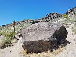
 Map Rock in 2018 | |
  | |
| Nearest city | Givens Springs, Idaho |
|---|---|
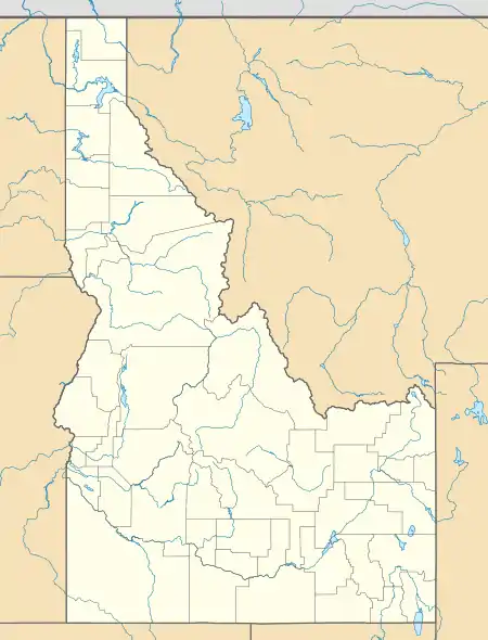
| Coordinates | 43.4206361°N 116.7041083°W |
| Area | 8 acres (3.2 ha) |
| NRHP reference No. | 82000325[1] |
| Added to NRHP | November 15, 1982 |
Map Rock
The historic district is named for Map Rock,[2] a massive basalt rock covered in petroglyphs, named by Robert Limbert in the early 1920s. Limbert believed that the rock depicts a map of the Snake River valley, and some authors have suggested that if it is a map then it may be the oldest map in the world.[3]
In 1924 a plan emerged either to move Map Rock to Boise or to cut the rock and move pieces to Boise to become a feature of the State Capitol grounds.[4][5] Although the plan soon was abandoned, the rock was found to have sustained damage.[6]
Map Rock and the surrounding 38 acres were acquired by Canyon County in 2012.[7]
References
- "National Register Information System". National Register of Historic Places. National Park Service. November 2, 2013.
- "Map Rock". Geographic Names Information System (GNIS). Retrieved December 28, 2018.
- Sharon Fisher (December 19, 2017). "Putting Idaho on the Map: The Mysterious Map Rock". Territory. Hailey, Idaho: Mandala Media, LLC. Archived from the original on December 29, 2018. Retrieved December 28, 2018.
- "Exchange Clubbers Will Visit Ancient Indian Map Rock". Idaho Statesman. Boise, Idaho. January 27, 1924. p. 3.
- "Caldwell Wins Fight to Keep Map Rock Intact". Idaho Statesman. Boise, Idaho. February 17, 1924. p. 6.
- "Exchange Club Inspects Relic: Ancient Indian Map-Rock Marred by Picnickers, Piece Broken Off". Idaho Statesman. Boise, Idaho. January 28, 1924. p. 3.
- "Map Rock". Canyon County, Idaho. Archived from the original on August 9, 2017. Retrieved December 28, 2018.
External links
- * "National Register of Historic Places Inventory/Nomination: Map Rock Petroglyphs Historic District". National Park Service. Retrieved December 28, 2018. With accompanying pictures
- Shoshone Map Rock, Northern Shoshone and Bannock Tribes
- Yu, Pei-Lin, Ethnographic and Archaeological Reference Knowledge for Cupule/Pit and Groove Boulders, (Boise State University Anthropology, 2016)
Further reading
- Erwin, R. P., "Indian Rock Writing in Idaho," Twelfth Biennial Report of the State Historical Society of Idaho for the Years 1929-30 (1930), pp 2, 35-111
- Zuhlke, Don, The Map Rock of Idaho Decoded, (CreateSpace, 2016)