Marlborough (CDP), New Hampshire
Marlborough is a census-designated place (CDP) and the main village in the town of Marlborough in Cheshire County, New Hampshire, United States. The population of the CDP was 1,094 at the 2010 census,[1] out of 2,063 people in the entire town of Marlborough.
Marlborough, New Hampshire | |
|---|---|
 Marlborough  Marlborough | |
| Coordinates: 42°54′11″N 72°12′20″W | |
| Country | United States |
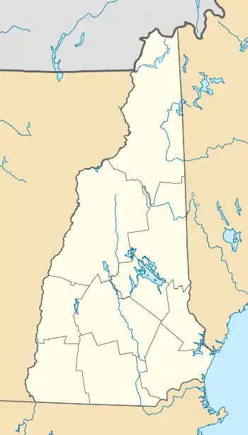
| State | New Hampshire |
| County | Cheshire |
| Town | Marlborough |
| Area | |
| • Total | 1.69 sq mi (4.38 km2) |
| • Land | 1.69 sq mi (4.38 km2) |
| • Water | 0.0 sq mi (0.0 km2) |
| Elevation | 739.8 ft (225.5 m) |
| Population (2010) | |
| • Total | 1,094 |
| • Density | 647/sq mi (249.8/km2) |
| Time zone | UTC-5 (Eastern (EST)) |
| • Summer (DST) | UTC-4 (EDT) |
| ZIP code | 03455 |
| Area code(s) | 603 |
| FIPS code | 33-45380 |
| GNIS feature ID | 2378080 |
Geography
The CDP is in the northwestern part of the town of Marlborough, in the valley of Minnewawa Brook, a west-flowing tributary of The Branch and part of the Connecticut River watershed. The CDP is bordered to the northwest by the city of Keene and to the west by the town of Swanzey. The southern border of the CDP follows Laurel Street, Hill Street, Bixby Street, and Ryan Road, to the easternmost extent of the CDP at New Hampshire Route 101. The eastern border of the CDP follows NH 101 and Roxbury Road until north of Minnewawa Brook, and the northern border strikes west to the Keene line near Heath Road.[2]
Route 101 (Marlborough's Main Street) leads east 15 miles (24 km) to Peterborough and west 5 miles (8 km) to its terminus at Route 9 on the west side of Keene. Route 124 has its western terminus at Route 101 in the center of the CDP, and leads southeast 12 miles (19 km) to Jaffrey.
According to the U.S. Census Bureau, the Marlborough CDP has a total area of 1.7 square miles (4.4 km2), all of it recorded as land.[1]
Demographics
As of the census of 2010, there were 1,094 people, 457 households, and 282 families residing in the CDP. There were 492 housing units, of which 35, or 7.1%, were vacant. The racial makeup of the town was 96.6% White, 0.6% African American, 0.0% Native American, 0.6% Asian, 0.0% Pacific Islander, 0.5% some other race, and 1.6% from two or more races. 1.1% of the population were Hispanic or Latino of any race.[3]
Of the 457 households in the CDP, 28.4% had children under the age of 18 living with them, 42.5% were headed by married couples living together, 13.3% had a female householder with no husband present, and 38.3% were non-families. 25.6% of all households were made up of individuals, and 11.4% were someone living alone who was 65 years of age or older. The average household size was 2.39, and the average family size was 2.85.[3]
21.2% of people in the CDP were under the age of 18, 7.7% were from 18 to 24, 26.7% were from 25 to 44, 27.1% were from 45 to 64, and 17.4% were 65 years of age or older. The median age was 40.1 years. For every 100 females, there were 97.8 males. For every 100 females age 18 and over, there were 94.6 males.[3]
For the period 2011-15, the estimated median annual income for a household was $44,391, and the median income for a family was $54,038. The per capita income for the CDP was $27,466. 13.3% of the population and 12.9% of families were below the poverty line.[4]
References
- "Geographic Identifiers: 2010 Demographic Profile Data (G001): Marlborough CDP, New Hampshire". U.S. Census Bureau, American Factfinder. Archived from the original on February 13, 2020. Retrieved August 29, 2017.
- "TIGERweb: Marlborough CDP, New Hampshire". Geography Division, U.S. Census Bureau. Retrieved August 29, 2017.
- "Profile of General Population and Housing Characteristics: 2010 Census Summary File 1 (DP-1): Marlborough CDP, New Hampshire". U.S. Census Bureau, American Factfinder. Archived from the original on February 13, 2020. Retrieved August 29, 2017.
- "Selected Economic Characteristics: 2011-2015 American Community Survey 5-Year Estimates (DP03): Marlborough CDP, New Hampshire". U.S. Census Bureau, American Factfinder. Archived from the original on February 13, 2020. Retrieved August 29, 2017.
Municipalities and communities of Cheshire County, New Hampshire, United States | ||
|---|---|---|
| City | 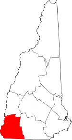 Map of New Hampshire highlighting Cheshire County | |
| Towns | ||
| CDPs | ||
| Other villages | ||
| ||