Matthie, Arizona
Matthie is a populated place situated in Maricopa County, Arizona.[2] It has an estimated elevation of 2,320 feet (710 m) above sea level.[1]
Matthie, Arizona | |
|---|---|
 Matthie Location within the state of Arizona  Matthie Matthie (the United States) | |
| Coordinates: 33°59′40″N 112°48′33″W | |
| Country | United States |
| State | Arizona |
| County | Maricopa |
| Elevation | 2,320 ft (710 m) |
| Time zone | UTC-7 (Mountain (MST)) |
| • Summer (DST) | UTC-7 (MST) |
| Area code(s) | 928 |
| FIPS code | 04-45040 |
| GNIS feature ID | 24509 |
In 1933, Matthie Station on the Atchison, Topea and Santa Fe railroad was used as a connecting stub from Phoenix, Arizona to the Prescott and Ash Fork line.[3] The service was proposed to be cut in 1934.[4]
Matthie was the location of the nearest train turnaround point to Wickenburg, Arizona in 1950, lying about five miles west of the town.[5]
The Matthie railroad junction was designated as a wildlife refuge in the 1950s by the state department due to drinking troughs laid out by the railroad engineer.[6]
The Arizona & California Railroad Company bought the tracks ending at Matthie in 1991.[7]
References
- "Feature Detail Report for: Matthie". Geographic Names Information System. United States Geological Survey.
- "Matthie (in Maricopa County, AZ) Populated Place Profile". AZ Hometown Locator. Retrieved December 22, 2016.
- "Phoenix Train Service Cut is Announced". Arizona Republic. 23 March 1933.
- "Train Service Hearing Closes". Arizona Republic. 29 May 1934.
- "Rail Unions hit Santa Fe Application". 24 March 1950.
- Heatwole, Thelma (19 May 1957). "End of the Line".
- "Arizona railway aims at excess California traffic". Arizona Daily Sun. 24 June 1991.
Municipalities and communities of Maricopa County, Arizona, United States | ||
|---|---|---|
| Cities | 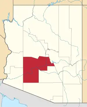 | |
| Towns | ||
| CDPs | ||
| Populated places |
| |
| Indian reservations | ||
| Ghost towns/ former populated places | ||
| Footnotes | ‡This populated place also has portions in an adjacent county or counties | |
| ||
This article is issued from Wikipedia. The text is licensed under Creative Commons - Attribution - Sharealike. Additional terms may apply for the media files.