Maugerville Parish, New Brunswick
Maugerville (/ˈmeɪdʒərvɪl/, MAJOR-ville) is a civil parish in Sunbury County, New Brunswick, Canada.[2]
Maugerville | |
|---|---|
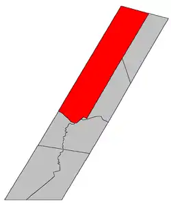 Location within Sunbury County, New Brunswick | |
| Coordinates: 45.8675°N 66.4525°W | |
| Country | |
| Province | |
| County | Sunbury |
| Erected | 1786 |
| Area | |
| • Land | 921.96 km2 (355.97 sq mi) |
| Population (2016)[1] | |
| • Total | 1,831 |
| • Density | 2.0/km2 (5/sq mi) |
| • Change 2011-2016 | |
| • Dwellings | 765 |
| Time zone | UTC-4 (AST) |
| • Summer (DST) | UTC-3 (ADT) |
For governance purposes it is divided between the local service districts of Noonan and the parish of Maugerville[3] (which further includes the special service area of Inner Maugerville), both of which are members of Regional Service Commission 11 (RSC11).[4]
Origin of name
The parish was named for Joshua Mauger, Nova Scotia's agent in England and first name on list of grantees in the township.[5]
History
Maugerville was first established in 1765 as a township of Nova Scotia.[6] The boundaries were significantly different, including part of Sheffield Parish but not extending as far inland.[7]
Maugerville was erected in 1786 as one of Sunbury County's original parishes.[8]
In 1850 Maugerville was extended to the county line, adding unassigned land to its rear.[9]
Delineation
Maugerville Parish is defined in the Territorial Division Act[2] as being bounded:
- Southwest by the Saint John River; northwest and northeast by the County lines, and southeast by the lower line of lot numbered four, granted to Nathaniel Underhill and D. Palmer, junior, and its northeastern prolongation, including Oromocto Island.
Communities
- Maugerville
- Noonan
- Sunbury
- Upper Maugerville
Bodies of water
Bodies of water at least partly in the parish
- Saint John River
Demographics
Population
|
LanguageMother tongue (2016)[1]
|
See also
References
- "Census Profile, 2016 Census: Maugerville, Parish [Census subdivision], New Brunswick". Statistics Canada. Retrieved September 29, 2019.
- "Chapter T-3 Territorial Division Act". Government of New Brunswick. Retrieved 13 November 2020.
- "New Brunswick Regulation 84-168 under the Municipalities Act (O.C. 84-582)". Government of New Brunswick. Retrieved 22 July 2020.
- "Communities in each of the 12 Regional Service Commissions (RSC) / Les communautés dans chacune des 12 Commissions de services régionaux (CSR)" (PDF), Government of New Brunswick, July 2017, retrieved 2 February 2021
- Ganong, William F. (1896). A Monograph of the Place-Nomenclature of the Province of New Brunswick. Royal Society of Canada. p. 250.
- Ganong, William F. (1899). A Monograph of Historic Sites in the Province of New Brunswick. Royal Society of Canada. p. 333.
- Ganong, William F. (1901). A Monograph of the Evolution of the Boundaries of the Province of New Brunswick. Royal Society of Canada. p. 431.
- "26 Geo. III Chapter I. An Act for the better ascertaining and confirming the Boundaries of the several Counties within this Province, and for subdividing them into Towns or Parishes.". Acts of the General Assembly of His Majesty's Province of New-Brunswick, passed in the year 1786. Saint John, New Brunswick: Government of New Brunswick. 1786. pp. 3–12.
- "13 Vic. c. 51 An Act to consolidate all the Laws now in force for the division of the Province into Counties, Towns and Parishes.". Acts of the General Assembly of Her Mjaesty's Province of New Brunswick, Passed in the Year 1850. Fredericton: Government of New Brunswick. 1850. pp. 142–152, 145–149. Book was poorly proofread, resulting in title typo and reuse of page numbers 145–152.
- Statistics Canada: 1996, 2001, 2006 census
- 2011 Statistics Canada Census Profile: Maugerville Parish, New Brunswick
Places adjacent to Maugerville Parish, New Brunswick | |
|---|---|
| Subdivisions | |
|---|---|
| Cities | |
| Counties | |
| |