Kent County, New Brunswick
Kent County (2016 population 30,475[1]) is located in east-central New Brunswick, Canada.[2] The county features a unique blend of cultures including Mi'kmaq, Acadian and English Speaking Settlers. Some larger tourist attractions include la dune de Bouctouche, Kouchibouguac National Park, and Bonar Law Commons.
Kent | |
|---|---|
[List of counties of New Brunswick | |
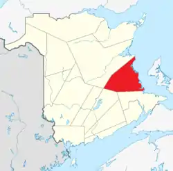 Location within New Brunswick. | |
| Country | |
| Province | |
| Established | 1826 |
| Area | |
| • Land | 4,552.92 km2 (1,757.89 sq mi) |
| Population (2016)[1] | |
| • Total | 30,475 |
| • Density | 6.7/km2 (17/sq mi) |
| • Change 2011–2016 | |
| • Dwellings | 16,251 |
| Time zone | UTC-4 (AST) |
| • Summer (DST) | UTC-3 (ADT) |
| Area code(s) | 506 |
| Wikimedia Commons has media related to Kent County, New Brunswick. |
It is in the Beauséjour federal electoral district, represented by Dominic LeBlanc of the Liberal Party of Canada. Provincially, it is within the electoral districts of Kent, Kent South, and Rogersville-Kouchibouguac.
History
Established in 1826 from Northumberland County: named for Prince Edward, Duke of Kent and Strathearn (1767–1820) and the father of Queen Victoria.
Census subdivisions
Communities
There are five municipalities within Kent County (listed by 2016 population):[3][2]
| Official Name | Designation | Area km2 | Population | Parish |
|---|---|---|---|---|
| Bouctouche | Town | 18.09 | 2,361 | Wellington |
| Saint-Antoine | Village | 6.32 | 1,733 | Dundas |
| Richibucto | Town | 11.93 | 1,266 | Richibucto |
| Saint-Louis-de-Kent | Village | 2.00 | 856 | Saint-Louis |
| Rexton | Village | 6.18 | 830 | Richibucto |
First Nations
There are three First Nations reserves in Kent County (listed by 2016 population):[3][2]
| Official Name | Designation | Area km2 | Population | Parish |
|---|---|---|---|---|
| Richibucto 15 | Reserve | 12.18 | 1,937 | Weldford |
| Indian Island 28 | Reserve | 0.28 | 138 | Richibucto |
| Buctouche 16 | Reserve | 0.35 | 96 | Wellington |
Note – Richibucto 15, formerly Big Cove Band is now called Elsipogtog First Nation
Parishes
The county is subdivided into twelve parishes (listed by 2016 population):[3][2]
| Official Name | Area km2 | Population | Municipalities | Unincorporated communities |
|---|---|---|---|---|
| Dundas | 174.63 | 3,914 | Cormierville / Caissie Cape / Grande-Digue / Guguen / Lower-Guguen / Notre-Dame / White's Settlement | |
| Wellington | 184.32 | 3,079 | Bouctouche (town) Buctouche 16 (reserve) |
Buctouche Baie / Buctouche-Sud / Caissie-Village / Chockpish / Cocagne / Collette-Village / Grand Saint-Antoine / Maria-de-Kent / McIntosh Hill / McKees Mills / Saint-David / Sainte-Anne-de-Kent / Saint-Édouard-de-Kent / Saint-François-de-Kent / Saint-Gabriel-de-Kent / Saint-Grégoire / Saint-Jean-Baptiste / Saint-Joseph-de-Kent / Saint-Maurice / Saint-Pierre-de-Kent / Saint-Thomas-de-Kent / St. Gabriel-de-Kent / Ste. Anne De Kent / Upper Saint-Maurice / / Village-des-Arsenault / Village-Sainte-Croix / Village-Saint-Irénée / Ward Corner / Wellington |
| Saint-Charles | 174.78 | 1,997 | Aldouane / Aldouane Station / Grande-Aldouane / Kent Lake / Kent Lake Siding / Lower Saint-Charles / Petite-Aldouane / Saint-Charles / Saint-Charles-Nord / Saint-Ignace Siding | |
| Saint Mary | 238.44 | 1,972 | Saint-Antoine (village) | Bastarache / Champdoré / Coates Mills / Dollard Settlement / Fisher Hill / Kent Boom / McNairn / Murphy Settlement / Roy / Saint-Cyrille / Saint-Fabien / Saint-Lazare / Sainte-Marie-de-Kent / South Saint-Norbert / Upper Buctouche |
| Richibucto | 249.05 | 1,887 | Richibucto (town) Rexton (village) Indian Island 28 (reserve) |
Bedec / Bells Mills / Cap-de-Richibouctou / Cap-Lumière / Côte-Sainte-Anne / East Galloway / Galloway / Jardineville / Peters Mills / Petit-Chockpish / Pirogue / Richibucto Village Cape / Richibucto-Village / Saint-Charles Station / Sainte-Anne-de-Kent / Village-La-Prairie / West Galloway |
| Saint-Louis | 258.74 | 1,802 | Saint-Louis-de-Kent (village) | Bretagneville / Camerons Mill / Canisto Road / Cap-de-Saint-Louis / Chemin Canisto / Desherbiers / Guimond-Village / Petit-Large / Pont-du-Milieu / Saint-Ignace / Saint-Olivier |
| Weldford | 611.30 | 1,338 | Richibucto 15 (reserve) | Balla Philip / Bass River / Bass River Point / Beersville / Browns Yard / Bryants Corner / Cails Mills / Coal Branch / Clairville / East Branch / Fords Mills / Jailletville / Kent Junction / Saint-Joseph / Lower Main River / Molus River / Mundleville / Normandie / Saint-Norbert / Smiths Corner / South Branch / Targettville / Village-Saint Augustin / West Branch |
| Saint-Paul | 228.72 | 842 | Birch Ridge / Bon-Secours / Légerville / McLean Settlement / Saint-Paul / Sweeneyville / Terrains de L'Évêque / Village-des-Belliveau / Village-des-Cormier / Village-des-Léger | |
| Acadieville | 332.22 | 709 | Acadie Siding / Acadieville / Barrieau / Branche du Nord / Centre-Acadie / Johnson Road / Noinville / Pineau / Richard-Village / Saint-Athanase / Saint-Luc / Vautour / Village-Saint-Jean / Village-Saint-Pierre | |
| Carleton | 435.95 | 708 | Carleton / Claire-Fontaine / Fontaine / Kouchibouguac / Laketon / Middle Kouchibouguac / Pointe-Sapin / Pointe-Sapin-Centre / Rivière-au-Portage / Saint-Camille / South Kouchibouguac / Tweedie Brook | |
| Harcourt | 1,170.96 | 346 | Adamsville / Coal Branch / Grangeville / Harcourt / Hébert / Mortimer / Saint-Sosime | |
| Huskisson | 369.33 | 15 | Huskisson |
Demographics
Population
| Canada census – Kent County, New Brunswick community profile | |||
|---|---|---|---|
| 2016 | 2011 | 2006 | |
| Population: | 30,475 (-1.2% from 2011) | 30,833 (-2.0% from 2006) | 31,449 (+0.2% from 2001) |
| Land area: | 4,552.55 km2 (1,757.75 sq mi) | 4,552.55 km2 (1,757.75 sq mi) | 4,551.03 km2 (1,757.16 sq mi) |
| Population density: | 6.7/km2 (17/sq mi) | 6.8/km2 (18/sq mi) | 6.9/km2 (18/sq mi) |
| Median age: | 50.5 (M: 50.2, F: 50.8) | 47.7 (M: 47.5, F: 47.9) | 44.4 (M: 44.0, F: 44.8) |
| Total private dwellings: | 16,251 | 16,030 | 15,795 |
| Median household income: | $54,123 | $46,410 | $39,286 |
| References: 2016[3] 2011[4] 2006[5] earlier[6] | |||
|
|
| |||||||||||||||||||||||||||
| [7][1] | |||||||||||||||||||||||||||||
Language
| Canada Census Mother Tongue – Kent County, New Brunswick[7] | ||||||||||||||||||
|---|---|---|---|---|---|---|---|---|---|---|---|---|---|---|---|---|---|---|
| Census | Total | French |
English |
French & English |
Other | |||||||||||||
| Year | Responses | Count | Trend | Pop % | Count | Trend | Pop % | Count | Trend | Pop % | Count | Trend | Pop % | |||||
2011 |
30,285 |
21,355 | 70.51% | 6,990 | 23.08% | 425 | 1.40% | 1,515 | 5.00% | |||||||||
2006 |
31,000 |
22,330 | 72.03% | 6,585 | 21.24% | 360 | 1.16% | 1,725 | 5.56% | |||||||||
2001 |
30,965 |
22,865 | 73.84% | 6,150 | 19.86% | 435 | 1.40% | 1,515 | 4.89% | |||||||||
1996 |
31,605 |
23,840 | n/a | 75.43% | 6,185 | n/a | 19.57% | 290 | n/a | 0.92% | 1,290 | n/a | 4.08% | |||||
Access routes
Highways and numbered routes that run through the county, including external routes that start or finish at the county limits:[8]
Protected areas and attractions
Notable people
See also
References
- "Census Profile, 2016 Census Kent, County [Census division], New Brunswick". Statistics Canada. Retrieved September 12, 2019.
- New Brunswick Provincial Archives – Kent County
- "2016 Community Profiles". 2016 Canadian Census. Statistics Canada. February 21, 2017. Retrieved 2019-09-12.
- "2011 Community Profiles". 2011 Canadian Census. Statistics Canada. July 5, 2013. Retrieved 2014-04-08.
- "2006 Community Profiles". 2006 Canadian Census. Statistics Canada. March 30, 2011. Retrieved 2014-04-08.
- "2001 Community Profiles". 2001 Canadian Census. Statistics Canada. February 17, 2012.
- Statistics Canada: 1996, 2001, 2006, 2011 census
- Atlantic Canada Back Road Atlas ISBN 978-1-55368-618-7
Places adjacent to Kent County, New Brunswick | |
|---|---|
| Subdivisions | |
|---|---|
| Cities | |
| Counties | |
| |