Gloucester County, New Brunswick
Gloucester County (2016 population 78,444[1]) is located in the northeastern corner of New Brunswick, Canada.[2] Fishing, mining and forestry are the major industries in the county. The eastern section of the county is known for its Acadian culture.
Gloucester | |
|---|---|
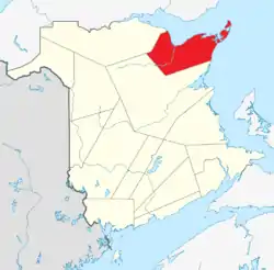 Location within New Brunswick. | |
| Country | |
| Province | |
| Established | 1826 |
| Area | |
| • Land | 4,743.67 km2 (1,831.54 sq mi) |
| Population (2016)[1] | |
| • Total | 78,444 |
| • Density | 16.5/km2 (43/sq mi) |
| • Change 2011-2016 | |
| • Dwellings | 38,789 |
| Time zone | UTC-4 (AST) |
| • Summer (DST) | UTC-3 (ADT) |
| Area code(s) | 506 |
Census subdivisions
Communities
There are nineteen municipalities within the county (listed by 2016 population):[3]
| Official Name | Designation | Area km2 | Population | Parish |
|---|---|---|---|---|
| Bathurst | City | 92.04 | 11,897 | Bathurst |
| Tracadie–Sheila | Town (dissolved) | 24.65 | 5,171 | Saumarez |
| Beresford | Town | 19.41 | 4,288 | Beresford |
| Caraquet | Town | 68.35 | 4,248 | Caraquet |
| Shippagan | Town | 10.02 | 2,580 | Shippagan |
| Petit-Rocher | Village | 4.52 | 1,897 | Beresford |
| Belledune | Village | 189.47 | 1,417 | Beresford |
| Bas-Caraquet | Village | 31.01 | 1,305 | Caraquet |
| Lamèque | Town | 12.51 | 1,285 | Shippagan |
| Bertrand | Village | 57.44 | 1,166 | Caraquet |
| Nigadoo | Village | 7.65 | 963 | Beresford |
| Grande-Anse | Village | 24.33 | 899 | New Bandon |
| Pointe-Verte | Village | 13.79 | 886 | Beresford |
| Sainte-Marie-Saint-Raphaël | Village | 15.90 | 879 | Shippagan |
| Le Goulet | Village | 5.49 | 793 | Shippagan |
| Saint-Isidore | Village | 22.94 | 764 | Saint-Isidore |
| Paquetville | Village | 9.26 | 720 | Paquetville |
| Saint-Léolin | Village | 19.73 | 647 | New Bandon |
| Maisonnette | Village | 12.90 | 495 | New Bandon |
First Nations
There is one First Nations reservation in Gloucester County (listed with 2016 population):[3]
| Official Name | Designation | Area km2 | Population | Parish |
|---|---|---|---|---|
| Pabineau 11 | Reservation | 4.92 | 134 | Bathurst |
Parishes
The county is subdivided into ten parishes (listed by 2016 population):[3]
| Official Name | Area km2 | Population | Municipalities | Unincorporated communities |
|---|---|---|---|---|
| Saumarez | 326.78 | 6,618 | Tracadie-Sheila (town) | Benoit / Charnisay / Commeau / Ferguson Point / Gauvreau / Haut-Sheila / Leech / Little Gaspereau / Losier Settlement / Petit-Tracadie / Pointe-à-Bouleau / Pont-Lafrance / Rivière-à-la-truite / Saint Irénée and Alderwood / Saint-Isidore Station / Saint-Pons / Saumarez / St. Pierre / Tracadie Beach / Val-Comeau |
| Beresford | 456.86 | 6,248 | Beresford (town) Petit-Rocher (village) Belledune (village) Nigadoo (village) Pointe-Verte (village) |
Alcida and Dauversière / Dempsey Settlement / Devereaux / Dunlop / Free Grant / LaPlante / Lincour / Madran / Massabielle / Nicholas-Denys / Robertville / Saint-Laurent / Sainte-Louise / Sainte-Rosette / Sormany / St. George / Tremblay / Val-Michaud |
| Shippegan | 208.08 | 4,800 | Shippagan (town) Lamèque (town) Le Goulet (village) Ste-Marie-St-Raphaël (village) |
Cap-Bateau / Chiasson-Savoy / Coteau Road / Haut-Lamèque / Haut-Shippagan / Herring Point / Miscou Centre / Miscou Harbour / Miscou Lighthouse / Miscou Plains / Petite-Lamèque / Petite-Rivière-de-l'lle / Petit-Shippagan / Pigeon Hill / Pointe-Alexandre / Pointe-Brûlé / Pointe-Canot / Sainte-Cécile / Shippagan Portage / Wilson Point |
| Bathurst | 1504.87 | 4,797 | Bathurst (city) Pabineau 11 (reservation) |
Bartibog Station / Bathurst Mines / Big Antler / Big Moose / Big River / Blue Mountain Settlement / Bruce / Brunswick Mines / Chamberlain Settlement / Goodwin Mill / Gloucester Junction / Hachey Siding / Lawson Brook Siding / Miller Brook / Nepisiguit Junction / North Tetagouche / Ottawa Road / Pitre Road / Red Pine / Rio Grande / Russell / Salmon Beach / South Tetagouche / Tetagouche Hill / Upper Rosehill |
| Inkerman | 107.56 | 2,366 | Boudreau Road / Cowans Creek / Evangeline / Four Roads / Gaspereau / Haché Road / Haut Pokemouche / Inkerman / Inkerman Ferry / Landry / Maltampec / Pokemouche / Pokemouche Junction / Sainte-Rose-Gloucester / Six Roads | |
| Paquetville | 220.51 | 2,329 | Paquetville (village) | Burnsville / Notre-Dame-des-Érables / Petit-Paquetville / Rang-Saint-Georges / Saint-Amateur / Trudel / Val-Doucet |
| Allardville | 654.69 | 2,032 | Allardville / Allardville East / Veniot / Bear Landing / Beaubois / Butte-d'Or / Daulnay / Goodwin Mill / Jeanne-Mance / Saint-Sauveur | |
| Saint-Isidore | 173.25 | 1,361 | Saint-Isidore (village) | Bois-Blanc / Bois-Gagnon / Boishébert / Duguayville / Hacheyville / Haut-Saint-Isidore / Haut Tilley Road / Pokemouche Landing / Pont-Landry / Spruce Brook / Tilley Road |
| Caraquet | 109.97 | 1,337 | Caraquet (town) Bas-Caraquet (village) Bertrand (village) |
Blanchard Settlement / Caraquet Island / Haut-Saint-Simon / Marsoliau / Pokesudie / Saint-Simon / Saint-Simon Centre |
| New Bandon | 359.11 | 1,214 | Grande-Anse (village) Maisonnette (village) Saint-Léolin (village) |
Anse-Bleue / Bertrand Station / Black Rock / Canobie / Clifton / Dugas / Janeville / Johnson / Lobster Beach / New Bandon-Salmon Beach / Pokeshaw / Rocheville / Springfield / Stonehaven / Village-des-Poirier / Village-Saint-Paul / Waterloo Settlement |
Demographics
Population
| Canada census – Gloucester County, New Brunswick community profile | |||
|---|---|---|---|
| 2016 | 2011 | 2006 | |
| Population: | 78,444 (+0.8% from 2011) | 77,792 (-1.5% from 2006) | 78,948 (-4.8% from 2001) |
| Land area: | 4,743.67 km2 (1,831.54 sq mi) | 4,675.21 km2 (1,805.11 sq mi) | 4,673.36 km2 (1,804.39 sq mi) |
| Population density: | 16.5/km2 (43/sq mi) | 16.6/km2 (43/sq mi) | 16.9/km2 (44/sq mi) |
| Median age: | 51.1 (M: 50.5, F: 51.6) | 47.9 (M: 47.4, F: 48.4) | 44.2 (M: 43.8, F: 44.7) |
| Total private dwellings: | 38,789 | 36,482 | 36,192 |
| Median household income: | $52,793 | $46,728 | $40,028 |
| References: 2016[3] 2011[4] 2006[5] earlier[6] | |||
|
|
| ||||||||||||||||||||||||||||||
| The 2011 population count was revised[7][1] | ||||||||||||||||||||||||||||||||
Language
| Canada Census Mother Tongue - Gloucester County, New Brunswick[7] | ||||||||||||||||||
|---|---|---|---|---|---|---|---|---|---|---|---|---|---|---|---|---|---|---|
| Census | Total | French |
English |
French & English |
Other | |||||||||||||
| Year | Responses | Count | Trend | Pop % | Count | Trend | Pop % | Count | Trend | Pop % | Count | Trend | Pop % | |||||
2011 |
76,515 |
64,270 | 84.00% | 11,105 | 14.51% | 745 | 0.97% | 395 | 0.52% | |||||||||
2006 |
77,675 |
65,210 | 83.95% | 11,165 | 14.37% | 625 | 0.80% | 675 | 0.87% | |||||||||
2001 |
81,760 |
68,440 | 83.71% | 12,255 | 14.99% | 845 | 1.03% | 220 | 0.27% | |||||||||
1996 |
86,620 |
72,060 | n/a | 83.19% | 13,545 | n/a | 15.64% | 780 | n/a | 0.90% | 235 | n/a | 0.27% | |||||
Access Routes
Highways and numbered routes that run through the county, including external routes that start or finish at the county limits:[8]
|
|
|
|
|
|
Protected areas and attractions
Notable people
See also
References
- "Census Profile, 2016 Census: Gloucester, County [Census division], New Brunswick". Statistics Canada. Retrieved September 8, 2019.
- New Brunswick Provincial Archives - Gloucester County
- "2016 Community Profiles". 2016 Canadian Census. Statistics Canada. February 21, 2017. Retrieved 2019-09-08.
- "2011 Community Profiles". 2011 Canadian Census. Statistics Canada. July 5, 2013. Retrieved 2014-03-28.
- "2006 Community Profiles". 2006 Canadian Census. Statistics Canada. March 30, 2011. Retrieved 2014-03-28.
- "2001 Community Profiles". 2001 Canadian Census. Statistics Canada. February 17, 2012.
- Statistics Canada: 1996, 2001, 2006, 2011 census
- Atlantic Canada Back Road Atlas ISBN 978-1-55368-618-7
External links
| Wikivoyage has a travel guide for Acadian Coast. |
Places adjacent to Gloucester County, New Brunswick | |
|---|---|
| Subdivisions | |
|---|---|
| Cities | |
| Counties | |
| |
This article is issued from Wikipedia. The text is licensed under Creative Commons - Attribution - Sharealike. Additional terms may apply for the media files.