May Township, Washington County, Minnesota
May Township is a township in Washington County, Minnesota, United States. The population was 2,928 at the 2000 census.
May Township, Minnesota | |
|---|---|
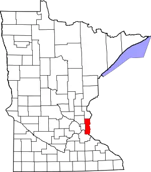
 May Township, Minnesota Location within the state of Minnesota  May Township, Minnesota May Township, Minnesota (the United States) | |
| Coordinates: 45°9′59″N 92°50′5″W | |
| Country | United States |
| State | Minnesota |
| County | Washington |
| Area | |
| • Total | 37.6 sq mi (97.4 km2) |
| • Land | 35.3 sq mi (91.4 km2) |
| • Water | 2.3 sq mi (6.0 km2) |
| Elevation | 912 ft (278 m) |
| Population (2000) | |
| • Total | 2,928 |
| • Density | 82.9/sq mi (32.0/km2) |
| Time zone | UTC-6 (Central (CST)) |
| • Summer (DST) | UTC-5 (CDT) |
| Area code(s) | 651 |
| FIPS code | 27-41120[1] |
| GNIS feature ID | 0664932[2] |
May Township was organized in 1893, and named for Morgan May, an English settler.[3]
Geography
According to the United States Census Bureau, the township has a total area of 37.6 square miles (97.4 km2), of which 35.3 square miles (91.4 km2) is land and 2.3 square miles (6.0 km2) (6.14%) is water. Minnesota State Highway 95 serves as a main route in the township.
The unincorporated communities of Arcola and Maple Island are both located within May Township. The township contains two properties listed on the National Register of Historic Places, the 1847 John and Martin Mower House and Arcola Mill Site and the 1922 Benjamin B. Sheffield House.[4]
Demographics
As of the census[1] of 2000, there were 2,928 people, 1,007 households, and 842 families residing in the township. The population density was 82.9 people per square mile (32.0/km2). There were 1,102 housing units at an average density of 31.2/sq mi (12.1/km2). The racial makeup of the township was 97.75% White, 0.10% African American, 0.31% Native American, 0.75% Asian, 0.48% from other races, and 0.61% from two or more races. Hispanic or Latino of any race were 1.26% of the population.
There were 1,007 households, out of which 42.4% had children under the age of 18 living with them, 75.9% were married couples living together, 4.6% had a female householder with no husband present, and 16.3% were non-families. 12.7% of all households were made up of individuals, and 3.8% had someone living alone who was 65 years of age or older. The average household size was 2.90 and the average family size was 3.19.
In the township the population was spread out, with 29.0% under the age of 18, 5.5% from 18 to 24, 25.4% from 25 to 44, 32.5% from 45 to 64, and 7.6% who were 65 years of age or older. The median age was 41 years. For every 100 females, there were 103.1 males. For every 100 females age 18 and over, there were 102.9 males.
The median income for a household in the township was $80,374, and the median income for a family was $84,953. Males had a median income of $58,355 versus $41,492 for females. The per capita income for the township was $32,765. About 0.8% of families and 2.1% of the population were below the poverty line, including 3.0% of those under age 18 and 2.4% of those age 65 or over.
References
- "U.S. Census website". United States Census Bureau. Retrieved 2008-01-31.
- "US Board on Geographic Names". United States Geological Survey. 2007-10-25. Retrieved 2008-01-31.
- Upham, Warren (1920). Minnesota Geographic Names: Their Origin and Historic Significance. Minnesota Historical Society. p. 570.
- "Minnesota National Register Properties Database". Minnesota Historical Society. 2009. Retrieved 2017-12-31.
Municipalities and communities of Washington County, Minnesota, United States | ||
|---|---|---|
| Cities |
|  Map of Minnesota highlighting Washington County |
| Townships | ||
| Unincorporated communities | ||
| Ghost towns/Neighborhoods | ||
| Footnotes | ‡This populated place also has portions in an adjacent county or counties | |
| ||