Aksay Kazakh Autonomous County
Aksay Kazakh Autonomous County is an autonomous county under the prefecture-level city of Jiuquan in Gansu Province, China.[2][3] The county borders Qinghai Province to the south and Xinjiang Uygur Autonomous Region to the west.[3]
Aksay County
| |
|---|---|
| Aksay Kazak Autonomous County 阿克塞哈萨克族自治县 (Chinese) اقساي قازاق اۆتونوميالى اۋدانى (Kazakh) | |
.png.webp) Location of Aksay Kazak Autonomous County (pink) within Jiuquan City (yellow), Gansu Province (light grey) and the People’s Republic of China (dark grey) | |
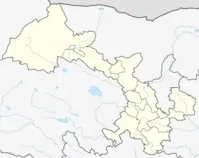 Aksai Location of the seat in Gansu | |
| Coordinates: 39°39′48″N 94°20′12″E | |
| Country | People's Republic of China |
| Province | Gansu |
| Prefecture-level city | Jiuquan |
| Seat | Hongliuwan |
| Area | |
| • Total | 31,374 km2 (12,114 sq mi) |
| Population (2018) | |
| • Total | 9,360[1] |
| Time zone | UTC+8 (China Standard) |
| Postal code | 736400 |
| Aksay Kazakh Autonomous County | |||||||||||
|---|---|---|---|---|---|---|---|---|---|---|---|
| Chinese name | |||||||||||
| Simplified Chinese | 阿克塞哈萨克族自治县 | ||||||||||
| Traditional Chinese | 阿克塞哈薩克族自治縣 | ||||||||||
| |||||||||||
| Kazakh name | |||||||||||
| Kazakh | اقساي قازاق اۆتونوميالى اۋدانى Aqsaı Qazaq aýtonomııalyq aýdany Ақсай Қазақ аутономиялық ауданы | ||||||||||
The westernmost county-level division of Gansu, the county has an area of 32,374 km2 (12,500 sq mi),[3] and a population of 10,545 as of 2010.[4] The postal code is 736400.[3]
History
The Aksai Kazakh Autonomous Region Preparatory Committee was set up in 1953, south of Dunhuang.[4] On April 26, 1954, the Aksai Kazak Autonomous Region was established.[4] In 1955, it was renamed Aksai Kazakh Autonomous County.[4]
Geography
The county lies on the northern edge of the Tibetan Plateau and has an average elevation of about 3,200 meters.[3]
The county is bordered by the city of Dunhuang to the north, Qinghai to the south, Subei Mongol Autonomous County to the east, and Xinjiang to the west.[3]
The Big Harteng River (Chinese: 大哈尔腾河) and the Little Harteng River (Chinese: 小哈尔腾河) both flow through the southern portion of the county.[3] The Sugan Lake, which actually comprises the Big Sugan Lake (Chinese: 大苏干湖) and the Little Sugan Lake (Chinese: 小苏干湖) is located in the county.[3]
Climate
The county experiences an average annual rainfall of 100 mm, an average annual temperature is 5.4°C, and an annual frost-free period of 90 days.[3]
Administrative divisions
The county governs one town and three townships.[5]
Hongliuwan is the county's sole town and administrative center.[3][5]
The county's three townships are Akqi Township, Alteng Township and Aina Township.[5]
Demographics
As of 2010, the county had a permanent population of 10,545, of which, 10,079 lived in Hongliuwan.[4]
The county is the only Kazakh autonomous county in the province of Gansu.[4] As of 2005, 41.3% of the county's population were ethnic Kazakhs, up slightly from the 40.7% recorded in 1996.[4] Other ethnic groups in the county include the Han, the Hui, the Uighur, the Tibetans and 6 other ethnic minorities.[3]
Transport
China National Highway 215 passes through the county, as does Gansu Provincial Highway 314.[3]
Golmud–Dunhuang Railway also passes through the county.
References
- "China : Population - ceicdata.com". ceicdata. Retrieved 2020-12-30.
- 2019年统计用区划代码 (in Chinese). National Bureau of Statistics of China. 2019. Retrieved 2020-08-17.
- 阿克塞哈萨克族自治县概况地图. xzqh.org (in Chinese). 2016-06-27. Archived from the original on 2020-08-17. Retrieved 2020-08-17.
- 阿克塞哈萨克族自治县历史沿革. xzqh.org (in Chinese). 2016-06-27. Archived from the original on 2020-08-17. Retrieved 2020-08-17.
- 2019年统计用区划代码 (in Chinese). National Bureau of Statistics of China. 2019. Archived from the original on 2020-08-17. Retrieved 2020-08-17.