Minnesota State Highway 40
Minnesota State Highway 40 (MN 40) is a 72.723-mile-long (117.036 km) state highway in west-central Minnesota, which travels from South Dakota Highway 20 (SD 20) at the South Dakota state line near Marietta and continues east to its eastern terminus at its intersection with County State-Aid Highway 5 (CSAH 5) in Willmar.
| ||||
|---|---|---|---|---|
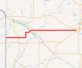
MN 40 highlighted in red | ||||
| Route information | ||||
| Maintained by MnDOT | ||||
| Length | 72.723 mi (117.036 km) | |||
| Existed | 1933–present | |||
| Major junctions | ||||
| West end | ||||
| East end | ||||
| Location | ||||
| Counties | Lac qui Parle, Chippewa, Kandiyohi | |||
| Highway system | ||||
| ||||

Route description
MN 40 serves as an east–west route between Madison and Willmar in west-central Minnesota.
The route is also known as:
- 1st Street in Madison
- Lac qui Parle Avenue in Milan
- 60th Street throughout Chippewa County
MN 40 crosses Lac qui Parle Lake west of Milan.
Lac qui Parle State Park is located seven miles (11 km) south of the junction of MN 40 and US Highway 59 (US 59) at Milan. The park entrance is located on CSAH 13 near US 59 at Watson.[1]
MN 40 parallels US 12 and US 212 throughout its route in west-central Minnesota.
History
Most of MN 40 was authorized in 1933.
The section of the route between US 75 at Madison and the South Dakota state line was authorized c. 1950.
MN 40 was still gravel in 1940. The route was mostly paved by 1953, except for just west of Willmar. MN 40 was completely paved by 1958.
In 2009, its eastern terminus was moved from US 12 in Willmar to CSAH 5 (30th Street SW).
Major intersections
| County | Location | mi | km | Destinations | Notes |
|---|---|---|---|---|---|
| Lac qui Parle | Augusta Township | 0.000 | 0.000 | Western terminus; continuation into South Dakota | |
| Madison | 12.600 | 20.278 | Southern end of US 75 concurrency | ||
| 12.679 | 20.405 | Northern end of US 75 concurrency | |||
| Hantho Township | 24.057 | 38.716 | |||
| Minnesota River/Lac qui Parle | 28.573– 28.615 | 45.984– 46.051 | Milan Bridge | ||
| Chippewa | Milan | 32.413 | 52.164 | ||
| Mandt Township | 41.737 | 67.169 | Western end of MN 29 concurrency | ||
| Grace Township | 47.725 | 76.806 | Eastern end of MN 29 concurrency | ||
| Louriston Township | 53.699 | 86.420 | Former MN 277 south | ||
| Kandiyohi | Willmar | 72.723 | 117.036 | Eastern terminus | |
1.000 mi = 1.609 km; 1.000 km = 0.621 mi
| |||||
