North Shore (Sydney)
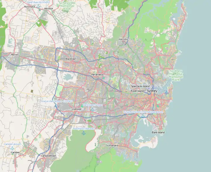
The North Shore is a region of Sydney, New South Wales, Australia, a subset of the Northern Sydney region. The region is customary, not legal or administrative, and in customary usage generally includes the suburbs located on the northern side of Sydney Harbour up to Hornsby, and between Middle Harbour and the Lane Cove River.
| North Shore Sydney, New South Wales | |||||||||||||||
|---|---|---|---|---|---|---|---|---|---|---|---|---|---|---|---|
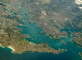 Sydney Harbour with the North Shore extending from its northern side (right) with Sydney CBD (left) and Eastern Suburbs (bottom) on its southern shore. | |||||||||||||||
 North Shore Approximate centre of the North Shore in Sydney | |||||||||||||||
| Coordinates | 33°47′S 151°10′E | ||||||||||||||
| Time zone | AEST (UTC+10) | ||||||||||||||
| • Summer (DST) | AEDT (UTC+11) | ||||||||||||||
| LGA(s) | |||||||||||||||
| State electorate(s) |
| ||||||||||||||
| Federal Division(s) | |||||||||||||||
| |||||||||||||||
History
Before British settlement, the Lower North Shore was home to the Gorualgal (Mosman and southern Willoughby) and Cammeraygal (North Sydney and Eastern Lane Cove).[1]
After the establishment of Sydney in 1788, settlement on the North Shore of the harbour was quite limited. One of the first settlers was James Milson who lived in the vicinity of Jeffrey Street in Kirribilli, directly opposite Sydney Cove. The north shore was more rugged than the southern shore and western areas of the harbour and had limited agricultural potential. The early activities in the area included tree felling, boatbuilding and some orchard farming in the limited areas of good soil. The North Shore railway line was built in the 1890s. Access to the Sydney CBD, located on the southern shore of the harbour remained difficult until the completion of the Sydney Harbour Bridge in 1932. This led to the commencement of the development of suburbs on the North Shore. [2]
The four local governments that together form the Lower North Shore (the City of Willoughby and the municipalities of Mosman, Lane Cove and North Sydney) were created from the Parish of Willoughby, a cadastral unit used for land titles that was created in the early years of European settlement. "North Sydney" was formerly known as St. Leonards. [3]
Geography
As the "North Shore" is customary, not administrative or legal, its boundaries amorphous and variable. Generally, the "North Shore" includes the peninsula immediately north of Sydney Harbour and an area further north. In this general conception, the North Shore is bounded in the south by Sydney Harbour, in the west by the Lane Cove River, in the southeast by Middle Harbour, and in the northeast by Ku-ring-gai Chase National Park. East and north of this boundary are the Northern Beaches region and to the west is the Hills District.
This conception of the North Shore includes the local government areasof the City of Willoughby, Municipality of Lane Cove, North Sydney Council, Municipality of Mosman and Ku-ring-gai Council.[4]
In this conception, the North Shore roughly corresponds with the cadastral parishes (used for land title purposes) of the Willoughby (in the south) and Gordon (in the north).[5][6]
However, these boundaries are not fixed, and those suburbs that sit close to the boundary between, for example, the cadastral Parish of Gordon and the neighbouring Parish of Manly Cove in the east, may be identified in different contexts as part of either the Upper North Shore region or the Northern Beaches region. The entirety of the Lane Cove National Park is often regarded as part of the North Shore region.
Likewise, while the Municipality of Hunters Hill is west of the Lane Cove River and in the Parish of Hunters Hill, the suburbs in that parish along the northern shore of the Parramatta River are sometimes referred (especially in commercial contexts) as part of the Lower North Shore.[7][8]
Most of the North Shore suburbs are part of the Hornsby Plateau, a large sandstone plateau overlaid by a system of ridges and gullies. The Plateau begins north of the Port Jackson and runs up until the Hawkesbury River. Thus much of the North Shore is hilly with many steep valleys running down into the harbour and the rivers on either side.[9]
Parks and areas of sclerophyll forest are present throughout the area. The Lane Cove National Park, Garigal National Park and Sydney Harbour National Park contain remnant bushland along the Lane Cove River, Middle Harbour and Sydney Harbour respectively. Bushwalking, abseiling and bouldering opportunities can be found around Lindfield and North Turramurra. Gordon has one of Sydney's largest bat colonies in a bat reserve leading to Middle Harbour.[10]
Upper North Shore
The "Upper North Shore" usually refers to the suburbs between Roseville and Hornsby, or suburbs adjoining the upper (northern) section of Lane Cove National Park, and suburbs located to the West of Ku-ring-gai Chase National Park. It is located to the north-west of the Sydney CBD. It roughly corresponds with the cadastral Parish of Gordon.[11] It is made up of suburbs located within the Ku-ring-gai and Hornsby Council areas.
In 2015, the NSW government proposed merging Ku-ring-gai and Hornsby Councils. In July 2017, the Berejiklian government decided to abandon the forced merger of the Hornsby and Ku-ring-gai local government areas, along with several other proposed forced mergers on the North Shore.[12]
Lower North Shore
In a general sense, the Lower North Shore refers to the land that is located to the north of the Sydney Harbour Bridge.
When used in a narrow sense, the Lower North Shore refers only to the peninsula situated immediately north of the Sydney CBD, which is surrounded on three sides by three bodies of water: the Lane Cove River on its western border, Sydney Harbour on its south side, and Middle Harbour on its east. The northern boundary is around the narrowest point of the peninsula, in other words the point where Middle Harbour and the Lane Cove River are the closest. In this narrow sense, the Lower North Shore roughly corresponds with the Parish of Willoughby, a cadastral unit used for land title purposes. These suburbs belong to the local government areas of Mosman Council, City of Willoughby, Municipality of Lane Cove, North Sydney Council and some suburbs of City of Ryde.
"Lower North Shore" is sometimes - especially in commercial contexts - also used in a broader sense to cover a number of suburbs west of the Lane Cove River but north of the Parramatta River, in the cadastral Parish of Hunters Hill and the Municipality of Hunter's Hill local government area (Hunters Hill, Woolwich, Huntleys Point, Henley and Gladesville).[13]
In 2016, the NSW government proposed merging three of the four lower north shore councils (Mosman, Willoughby, and North Sydney councils). In July 2017, the Berejiklian government decided to abandon the forced merger of the North Sydney, Willoughby and Mosman local government areas.[14] The other lower north shore council, Lane Cove, was similarly proposed to be merged with nearby Hunters Hill and Ryde councils, but that plan was also eventually abandoned.
The Lower North Shore suburbs adjacent to Sydney Harbour are Neutral Bay, Greenwich, Waverton, Wollstonecraft, Mosman, Cremorne, Lavender Bay, Milsons Point, Cammeray, and North Sydney.
Port Jackson, including the Parramatta River, Lane Cove River, Sydney Harbour, and Middle Harbour, defines the region's southernmost extent.
Transport
The main transport routes on the North Shore are Military Road, the Pacific Highway, the Warringah Expressway as well as parts of the Pennant Hills Road, Ryde Road, Epping Road and Mona Vale Road. Smaller but major arterial roads on the Upper North Shore include the Eastern Arterial Road at St Ives, East Killara and East Lindfield, the Comenarra Parkway at Thornleigh, Wahroonga, Turramurra, South Turramurra and West Pymble, as well as Lady Game Drive at West Pymble, Gordon, Killara, Lindfield and West Chastwood, providing access to major commercial hubs such as Chatswood. The North Shore & Western Line provides access to the central business district of Sydney over the Sydney Harbour Bridge. Many bus routes also serve the area, particularly the lower North Shore, and ferries connect many of the harbourside suburbs with Circular Quay in the central business district.[15]
Much of the North Shore is accessible to Railway Transport with the T1 North Shore line providing rail services between Sydney's Central Business District, North Sydney and Hornsby via Chatswood. The T9 Northern Line also serves parts of the Upper North Shore, while the Sydney Metro Northwest which opened on 26 May 2018, serves the suburbs of Chatswood, North Ryde, Macquarie Park, Macquarie University and Epping before continuing to Tallawong in the Hills District, replacing the previous Epping to Chatswood railway line after almost 10 years of service. The remaining Sydney Metro City & Southwest stage to the Lower North Shore and Bankstown, is projected to be completed in 2024. The completed metro line will provide rapid transit between North West Sydney and South West Sydney via the Lower North Shore.
Transdev NSW provide frequent bus services to the Upper North Shore.[16] Busses on the Lower North Shore are mainly serviced by the State Transit Authority.[17]
Commercial areas
Significant commercial and retail centres on the North Shore include North Sydney, Crows Nest, Macquarie Park, Chatswood, St Leonards, Neutral Bay, Gordon and Hornsby.
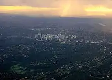
The North Shore's largest commercial centres are at North Sydney and Chatswood. A number of international companies having their Australian or Asia–Pacific Headquarters in this part of Sydney. North Sydney does not have any of Sydney's major shopping centres, however, it has a number of speciality stores and cafés. Chatswood is one of the largest retail precincts in Sydney, and has a large amount of high density residential buildings. It is home to large shopping centres such as Westfield Chatswood and Chatswood Chase. Nearby Chatswood, Macquarie Park is home to one of Sydney’s largest shopping centres, Macquarie Centre. Macquarie Park also has a substantial amount of high density residential buildings and office space. St Leonards is another large commercial area featuring mostly office space and apartments.
Attractions
The Lower North Shore has many unique landmarks such as: The Sydney Harbour Bridge, Taronga Zoo in Mosman, Admiralty House (Sydney residence of the Governor-General of Australia), Kirribilli House (Sydney residence of the Prime Minister of Australia), Luna Park, and Balmoral Beach. At a Sydney or local level, however, landmarks are more plentiful and include: The Lane Cove Azalea Beds, Blues Point Tower, Eden Gardens, the Balmoral Rotunda, the Stanton Library in North Sydney, Lane Cove Plaza, Zenith Towers at Chatswood, Northpoint Tower in North Sydney, Cammeray suspension bridge at Cammeray, Echo Point Park in Roseville Chase, the Royal North Shore Hospital, the Hornsby Water Clock, and 'The Forum' in St Leonards.[18]
The region is home to hundreds of parks and reserves, including Sydney Harbour National Park and the Lane Cove National Park. Major local sports grounds include North Sydney Oval, the region's largest in capacity, and Chatswood Oval.
Events and celebrations
The Willoughby Spring Festival is held throughout the Willoughby local government area, in September each year. The festival lasts for a month and features over 40 events including live music/entertainment, exhibitions, cultural celebrations, business events and many more community activities. The highlight is the annual Willoughby StreetFair where the Chatswood CBD is taken over by market stalls, performers, dancers and musicians. The StreetFair features the Willoughby Street Parade which included over 1,000 participants in 2007.
The Lower North Shore's other main festivals/events include: Tartan Day at Lane Cove, the Guringgai Festival honouring northern Sydney's Aboriginals, the Moocooboola Festival at Hunters Hill, the Mosman Festival, Lane Cove's Cammeraygal Festival, Chinese New Year at Chatswood. Mosman, North Sydney, Willoughby also holds an annual art prize. All local government areas in the region and around the country celebrate Australia Day, which is on 26 January.[19]
Media
The local newspapers are the Sydney Observer, Hornsby and Upper North Shore Advocate, The North Shore Times, The Mosman Daily, Northern District Times and the North Shores' local lifestyle publication Northside.
Climate
Like the rest of the Sydney basin, the North Shore has a humid subtropical climate (Köppen Cfa). Turramurra receives one of the highest rainfalls in the Sydney area, with an average of 1,400 millimetres (55 in) per year.[20] The inland parts of the North Shore are somewhat cooler than other areas of the surrounding Sydney basin in the winter months, particularly the CBD, and the further inland the area (particularly the Upper North Shore), the cooler the weather.
Gallery
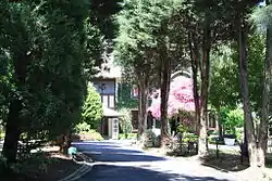 A historic home turned function centre in the suburb of Lane Cove.
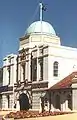 Taronga Zoo, Mosman
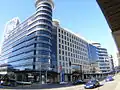 The Forum, St Leonards
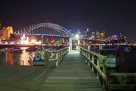 Lavender Bay Wharf
_Royal_North_Shore_Hospital.jpg.webp) Royal North Shore Hospital, St Leonards
Royal North Shore Hospital, St Leonards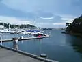 Wollstonecraft, Bay Marina
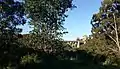 Long Gully Bridge viewed from Naremburn
List of suburbs
This list is not exhaustive.
The suburbs and localities of the region generally known as North Shore are:
Other suburbs in Northern Sydney sometimes identified as part of the North Shore
Localities that are not official suburbs
References
- "Inside-sydney-australia.com". Inside-sydney-australia.com. Retrieved 21 January 2021.
- "North Sydney Council - 'We will see a town rising': A history of North Sydney". www.northsydney.nsw.gov.au. Retrieved 21 January 2021.
- "Trove". trove.nla.gov.au. Retrieved 21 January 2021.
- "About | Northside Radio". Retrieved 21 January 2021.
- New South Wales. Department of Lands. (1927), "1 map on 3 sheets : colour ; 63 x 110 cm. or smaller.", [Map of the County of Cumberland, New South Wales], County maps of New South Wales., [Sydney: Dept. of Lands, nla.obj-233887649, retrieved 26 October 2020 – via Trove
- New South Wales. Department of Lands (1906), Parish of Gordon, County of Cumberland : Metropolitan Land District, Eastern Division N.S.W. (5th ed.), Dept. of Lands, retrieved 26 October 2020
- Domain. "Liveable Sydney: The lower north shore's suburbs ranked by liveability". Domain. Retrieved 21 January 2021.
- "Domain Property Guide 2016" (PDF). Retrieved 21 January 2021.
- "North Shore". www.visitsydneyaustralia.com.au. Retrieved 21 January 2021.
- Looking north: Sydney's Upper North Shore, State Library of NSW
- Knaus, Christopher; agencies (27 July 2017). "NSW council amalgamations: plan to merge 14 Sydney councils abandoned". The Guardian. ISSN 0261-3077. Retrieved 27 May 2020.
- Best, Paul (30 January 2020). "No stone unturned: Inside the renovation of a 1861 sandstone cottage on Sydney's lower north shore". Domain. Retrieved 21 January 2021.
- Blumer, Clare; Chettle, Nicole (27 July 2017). "NSW council amalgamations: Mayors fight to claw back court dollars after backflip on merger". ABC News. Australia. Retrieved 27 July 2017.
- "North Shore and West Map" (PDF). transportnsw.info. Retrieved 23 January 2021.
- Upper North Shore timetables Transdev NSW
- Region 8 bus services Effective December 2020 NSW Government Transport Retrieved 21 January 2021
- Smith, Tom. "Top Things to See and Do North of the Bridge in Sydney". Culture Trip. Retrieved 21 January 2021.
- "Sydney North Events | Sydney, Australia - Official Travel & Accommodation Website". Sydney.com. Retrieved 21 January 2021.
- Ku-ring-gai Historical Society. "Turramurra". Ku-ring-gai Historical Society.
- By Matt_SSR • 10 months ago. "Beecroft Suburb Review & Profile". Sydney Suburb Reviews. Retrieved 21 January 2021.CS1 maint: multiple names: authors list (link)
- Jul 28, 2016 (28 July 2016). "Normanhurst amongst most livable Upper North Shore Suburbs ''Domain''". Domain.com.au. Retrieved 21 January 2021.
- "Postcodes Australia". Postcodez.com.au. Retrieved 21 January 2021.
- Thornleigh profiled by local North Shore community North Shore Mums
- By Matt_SSR • 1 year ago. "Epping Suburb Review & Profile". Sydney Suburb Reviews. Retrieved 21 January 2021.CS1 maint: multiple names: authors list (link)
External links
| Wikivoyage has a travel guide for Lower North Shore. |
| Wikivoyage has a travel guide for Upper North Shore. |