Mount Emily
Mount Emily (Tolowa: en-may [3]) is a mountain in the Klamath Mountains of southwestern Oregon in the United States. It is located in southern Curry County in the extreme southwest corner of the state, near Brookings, approximately 5 miles (8.0 km) from the Pacific Ocean and 5 miles (8.0 km) from the California state line.
| Mount Emily | |
|---|---|
 Mount Emily Location in Oregon | |
| Highest point | |
| Elevation | 2,925 ft (892 m) [1] |
| Prominence | 1,285 ft (392 m) [1] |
| Coordinates | 42°06′09″N 124°09′10″W [2] |
| Geography | |
| Location | Curry County, Oregon, U.S. |
| Parent range | Klamath Mountains |
| Topo map | USGS Mount Emily |
Wheeler Ridge Japanese Bombing Site
Wheeler Ridge Japanese Bombing Site | |
.jpg.webp) | |
  | |
| Nearest city | Brookings, Oregon |
|---|---|
| Coordinates | 42°4′42″N 124°6′40″W |
| Area | less than one acre |
| Built | 1942 |
| NRHP reference No. | 06000589[4] |
| Added to NRHP | July 6, 2006 |
On September 9, 1942, the Japanese submarine I-25 surfaced near Cape Blanco, Oregon, and launched a Yokosuka E14Y "Glen" seaplane piloted by Nubuo Fujita, who dropped incendiary bombs on Mount Emily in an unsuccessful attempt to start a major forest fire. This made Mount Emily the second place in the continental United States to be bombed by an enemy aircraft, with Dutch Harbor occurring three months earlier in Unalaska, Alaska. The site of the bombing was listed in the National Register of Historic Places as the Wheeler Ridge Japanese Bombing Site in July 2006.[5]
See also
References
- "Mount Emily". Peakbagger.com. Retrieved 2010-05-17.
- "Mount Emily Lookout Tower". NGS data sheet. U.S. National Geodetic Survey. Retrieved 2008-03-31.
- "Siletz Talking Dictionary". Retrieved 2012-06-04.
- "National Register Information System". National Register of Historic Places. National Park Service. July 9, 2010.
- "National Register of Historic Places". National Park Service. 2006-07-14. Retrieved 2008-04-01.
External links
| Lists by county | 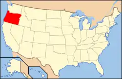 | |
|---|---|---|
| Portland lists | ||
| Other lists |
| |
