National Register of Historic Places listings in Josephine County, Oregon
This list presents the full set of buildings, structures, objects, sites, or districts designated on the National Register of Historic Places in Josephine County, Oregon, and offers brief descriptive information about each of them. The National Register recognizes places of national, state, or local historic significance across the United States.[1] Out of over 90,000 National Register sites nationwide,[2] Oregon is home to over 2,000,[3] and 61 of those are found in Josephine County.
- This National Park Service list is complete through NPS recent listings posted January 29, 2021.[4]
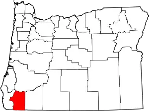
Location of Josephine County in Oregon
Current listings
| [5] | Name on the Register | Image | Date listed[6] | Location | City or town | Description |
|---|---|---|---|---|---|---|
| 1 | John and Susanna Ahlf House | 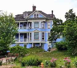 John and Susanna Ahlf House |
May 9, 1983 (#83002154) |
762 NW 6th St. 42°26′44″N 123°19′26″W |
Grants Pass | Built in 1902, this is the finest remaining example of the Queen Anne style in Grants Pass, and was the most prominent home in the city prior to World War I. It was built for John Ahlf (1856–1932), a German immigrant and meat packer who became one of the leading businessmen of the Rogue Valley.[7] |
| 2 | Allen Gulch Mill | October 4, 2001 (#01001148) |
Approx. 1 mi. SE of Jct. of Waldo Rd. and Waldo Lookout Rd. 42°03′00″N 123°38′16″W |
Cave Junction vicinity | ||
| 3 | Allen Gulch Townsite | October 4, 2001 (#01001136) |
Approx. 1 mi. SE. of Jct. of Waldo Rd. and Waldo Lookout Rd. 42°02′50″N 123°37′55″W |
Cave Junction vicinity | ||
| 4 | George Calhoun House | 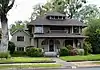 George Calhoun House |
December 2, 1981 (#81000495) |
612 NW 5th St. 42°26′38″N 123°19′34″W |
Grants Pass | |
| 5 | Cameron Mine | October 4, 2001 (#01001144) |
Approx. 2 mi. S. of Jct. of Waldo Rd. and Waldo Lookout Rd. 42°02′29″N 123°38′15″W |
Cave Junction vicinity | ||
| 6 | Cedar Guard Station No. 1019 | 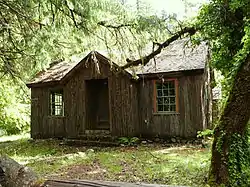 Cedar Guard Station No. 1019 |
April 8, 1986 (#86000837) |
Oregon Route 46, Rogue River – Siskiyou National Forest 42°08′26″N 123°27′24″W |
Cave Junction | |
| 7 | Clark–McConnell House | 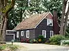 Clark–McConnell House |
June 3, 1998 (#98000628) |
961 SE 8th St. 42°25′52″N 123°19′43″W |
Grants Pass | |
| 8 | Clark–Norton House | 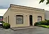 Clark–Norton House |
February 27, 1986 (#86000290) |
127 NW D St. 42°26′29″N 123°19′36″W |
Grants Pass | |
| 9 | Michael Clemens House | 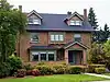 Michael Clemens House |
April 29, 1982 (#82003728) |
612 NW 3rd St. 42°26′41″N 123°19′43″W |
Grants Pass | |
| 10 | Albert B. and Mary Cornell House | 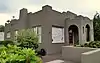 Albert B. and Mary Cornell House |
October 31, 2002 (#02001279) |
121 NE B St. 42°26′33″N 123°19′28″W |
Grants Pass | |
| 11 | Thomas Croxton House | 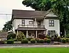 Thomas Croxton House |
March 29, 1979 (#79002076) |
1002 NW Washington Blvd. 42°26′53″N 123°19′32″W |
Grants Pass | |
| 12 | Deep Gravel Mine | October 4, 2001 (#01001141) |
Approx. 1 mile (1.6 km) north of the junction of Waldo Rd. and BLM Rd. 40-8-28 42°04′07″N 123°38′43″W |
Cave Junction vicinity | ||
| 13 | Dimmick–Judson House | 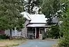 Dimmick–Judson House |
June 3, 1998 (#98000629) |
906 NE 8th St. 42°26′47″N 123°19′13″W |
Grants Pass | |
| 14 | Esterly Pit #2 / Llano de Oro Mine | October 4, 2001 (#01001145) |
Approx. 1.5 miles (2.4 km) north of the junction of Waldo Rd. and BLM Rd. 40-8-28 42°04′24″N 123°38′16″W |
Cave Junction vicinity | ||
| 15 | Joseph Fetzner House | 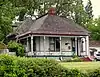 Joseph Fetzner House |
October 25, 1990 (#90001595) |
314 NE. Fetzner St. 42°26′49″N 123°19′08″W |
Grants Pass | |
| 16 | Dr. William H. Flanagan House | 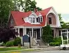 Dr. William H. Flanagan House |
May 9, 1983 (#83002155) |
720 NW 6th St. 42°26′40″N 123°19′27″W |
Grants Pass | |
| 17 | Fry Gulch Mine | 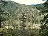 Fry Gulch Mine |
October 4, 2001 (#01001143) |
Approx. 0.75 miles (1.21 km) from the junction of Waldo Rd. and BLM Rd. 40-8-28 42°03′06″N 123°39′10″W |
Cave Junction vicinity | |
| 18 | Golden Historic District | 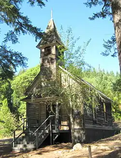 Golden Historic District |
July 25, 2002 (#02000825) |
3482 Coyote Creek Rd. 42°40′55″N 123°20′09″W |
Wolf Creek | |
| 19 | Grants Pass City Hall and Fire Station | 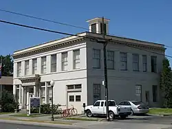 Grants Pass City Hall and Fire Station |
September 7, 1984 (#84003017) |
4th and H Sts. 42°26′21″N 123°19′48″W |
Grants Pass | |
| 20 | Grants Pass G Street Historic District | 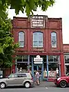 Grants Pass G Street Historic District |
October 7, 1993 (#93001030) |
Bounded by SW G and H Sts. and 4th and 6th Sts. 42°26′20″N 123°19′43″W |
Grants Pass | |
| 21 | Grants Pass Supervisor's Warehouse |  Grants Pass Supervisor's Warehouse |
March 6, 1991 (#91000163) |
1012 SW L St. 42°26′14″N 123°20′20″W |
Grants Pass | |
| 22 | Grave Creek Bridge | _(josD0015b).jpg.webp) Grave Creek Bridge |
November 29, 1979 (#79002077) |
N of Grants Pass 42°38′10″N 123°22′39″W |
Sunny Valley | |
| 23 | High Gravel Mine | 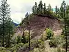 High Gravel Mine |
October 4, 2001 (#01001142) |
Approx. 1.3 miles (2.1 km) south of the junction of Waldo Rd. and Waldo Lookout Rd. 42°02′54″N 123°38′37″W |
Cave Junction vicinity | |
| 24 | Hotel Josephine Annex | 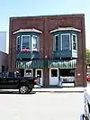 Hotel Josephine Annex |
February 21, 1997 (#97000133) |
118 NW E St. 42°26′28″N 123°19′36″W |
Grants Pass | |
| 25 | Hugo Community Baptist Church | 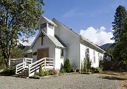 Hugo Community Baptist Church |
October 25, 1990 (#90001587) |
6501 Hugo Rd. 42°35′05″N 123°24′07″W |
Grants Pass vicinity | |
| 26 | Kienlen–Harbeck Building | _(josD0071).jpg.webp) Kienlen–Harbeck Building |
May 13, 1982 (#82003729) |
147 SW G St. 42°26′21″N 123°19′42″W |
Grants Pass | |
| 27 | William J. and Sarah Wagner Lippincott House | 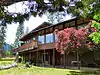 William J. and Sarah Wagner Lippincott House |
May 18, 2015 (#15000239) |
14601 Watergap Road 42°16′26″N 123°15′41″W |
Williams vicinity | |
| 28 | Logan Cut | October 4, 2001 (#01001154) |
Historic channel of Logan Cut 42°06′17″N 123°38′30″W |
Cave Junction vicinity | ||
| 29 | Logan Drain Ditches | Logan Drain Ditches |
October 4, 2001 (#01001155) |
Approx. 2 miles (3.2 km) north of the junction of Waldo Rd. and BLM Rd. 40-8-28 42°04′48″N 123°37′43″W |
Cave Junction vicinity | |
| 30 | Logan Wash Ditch | 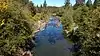 Logan Wash Ditch |
October 4, 2001 (#01001153) |
Historic Channel of Logan Wash Ditch 42°04′02″N 123°37′06″W |
Cave Junction vicinity | |
| 31 | George H. Lundburg House | 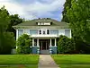 George H. Lundburg House |
March 6, 1987 (#87000365) |
404 NW A St. 42°26′42″N 123°19′42″W |
Grants Pass | |
| 32 | Robert and Lucy McLean House | 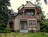 Robert and Lucy McLean House |
April 5, 1984 (#84003020) |
724 NW 4th St. 42°26′43″N 123°19′36″W |
Grants Pass | |
| 33 | Middle Ditch | Middle Ditch |
October 4, 2001 (#01001150) |
Historic channel of the Logan/Esterly Middle Ditch 42°03′53″N 123°37′53″W |
Cave Junction vicinity | |
| 34 | William and Nannie Naucke House | 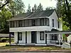 William and Nannie Naucke House |
August 5, 1999 (#99000946) |
24195 Redwood Highway 42°11′50″N 123°39′02″W |
Kerby | |
| 35 | Edwin Newell House | 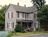 Edwin Newell House |
November 15, 1979 (#79002078) |
591 SW G St. 42°26′25″N 123°20′05″W |
Grants Pass | |
| 36 | Newman United Methodist Church | _(josD0007).jpg.webp) Newman United Methodist Church |
December 23, 1977 (#77001103) |
128 NE B St. 42°26′35″N 123°19′28″W |
Grants Pass | |
| 37 | Old Placer Mine | October 4, 2001 (#01001140) |
Approximately .65 miles (1.05 km) west of the junction of Rockydale Road and BLM Road 40-8-15 42°05′35″N 123°38′02″W |
Cave Junction vicinity | ||
| 38 | Oregon Caves Chateau | 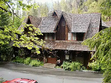 Oregon Caves Chateau |
May 28, 1987 (#87001346) |
Oregon Caves National Monument, 19000 Caves Highway 42°05′58″N 123°24′27″W |
Cave Junction vicinity | |
| 39 | Oregon Caves Historic District | 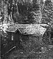 Oregon Caves Historic District |
February 25, 1992 (#92000058) |
Oregon Caves National Monument and Preserve, 19000 Caves Highway 42°05′58″N 123°24′25″W |
Cave Junction vicinity | |
| 40 | Osgood Ditch |  Osgood Ditch |
October 4, 2001 (#01001151) |
Historic channel of Osgood Ditch (See also Del Norte County, California.) 42°02′31″N 123°38′17″W |
Cave Junction vicinity | |
| 41 | Plataurica Mine | October 4, 2001 (#01001146) |
Approx. .75 mi. SE. of Jct. of Waldo Rd. and Waldo Lookout Rd. 42°03′10″N 123°38′07″W |
Cave Junction vicinity | ||
| 42 | Rand Ranger Station | 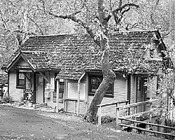 Rand Ranger Station |
June 10, 1999 (#99000703) |
14335 Galice Rd. 42°35′53″N 123°34′59″W |
Merlin | |
| 43 | Redwoods Hotel | 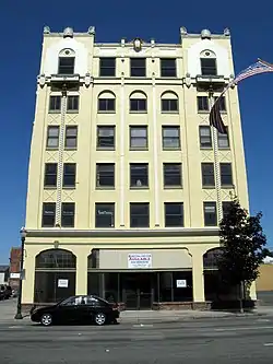 Redwoods Hotel |
October 25, 1979 (#79002079) |
310 NW 6th St 42°26′28″N 123°19′34″W |
Grants Pass | |
| 44 | Reed–Cobb–Bowser House and Barn | 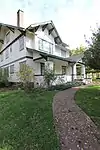 Reed–Cobb–Bowser House and Barn |
October 30, 2017 (#100001772) |
1700 Merlin Rd. 42°30′19″N 123°23′52″W |
Merlin |
Riverside Park, 304 SE Park St., Grants Pass, SG100005722, LISTED, 10/23/2020 |
| 45 | Riverside Park | October 23, 2020 (#100005722) |
304 SE Park St. 42°25′40″N 123°19′44″W |
Grants Pass | ||
| 46 | Rogue River Valley Grange No. 469 | March 9, 1992 (#92000130) |
2064 Upper River Rd. 42°26′27″N 123°21′09″W |
Grants Pass | Destroyed by fire in June 2012.[8][9] | |
| 47 | Rogue Theatre | _(josDA0165).jpg.webp) Rogue Theatre |
June 30, 2005 (#05000640) |
143 SE H St. 42°26′16″N 123°19′36″W |
Grants Pass | |
| 48 | St. Patrick's Roman Catholic Cemetery | 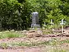 St. Patrick's Roman Catholic Cemetery |
October 4, 2001 (#01001137) |
Approx. 1 mile (1.6 km) southeast of the junction of Waldo Rd. and Waldo Lookout Rd. 42°03′05″N 123°38′09″W |
Cave Junction vicinity | |
| 49 | Claus and Hannchen Schmidt House | 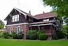 Claus and Hannchen Schmidt House |
January 21, 2004 (#03001478) |
508 SW 5th St. 42°26′14″N 123°19′48″W |
Grants Pass | |
| 50 | Siskiyou Smokejumper Base |  Siskiyou Smokejumper Base |
November 17, 2006 (#06001035) |
Smokejumper Way 42°06′14″N 123°40′52″W |
Cave Junction vicinity | |
| 51 | Herbert and Katherine Smith House | 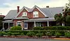 Herbert and Katherine Smith House |
May 9, 1983 (#83002156) |
139 SW I St. 42°26′15″N 123°19′45″W |
Grants Pass | |
| 52 | Speed's Place on the Rogue | June 21, 1991 (#91000808) |
11407 Merlin-Galice Rd. 42°33′53″N 123°35′55″W |
Galice | ||
| 53 | Store Gulch Guard Station No. 1020 | 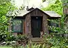 Store Gulch Guard Station No. 1020 |
April 8, 1986 (#86000838) |
Illinois Valley Rd., Rogue River – Siskiyou National Forest 42°17′50″N 123°45′06″W |
Cave Junction | |
| 54 | Upper Ditch | October 4, 2001 (#01001149) |
Historic channel of the Logan/Esterly Upper Ditch (See also Del Norte County, California.) 42°01′10″N 123°38′06″W |
Cave Junction vicinity | This ditch, built in 1854 to supply water from the East Fork Illinois River to several hydraulic mines, quickly returned a large profit to its investors. The ditch supplied mines worked by its own owners, as well as providing water for sale to other nearby diggings. It continued in operation until 1942, when the last hydraulic mining operations in the upper Illinois Valley ceased.[10] | |
| 55 | Amos E. Voorhies House | 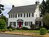 Amos E. Voorhies House |
February 23, 1990 (#90000282) |
421 NW B St. 42°26′39″N 123°19′47″W |
Grants Pass | |
| 56 | Waldo Cemetery | 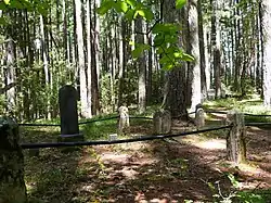 Waldo Cemetery |
October 4, 2001 (#01001138) |
Approx. 0.5 miles (0.80 km) southwest of the junction of Waldo Rd. and BLM Rd. 40-8-28 42°03′28″N 123°39′14″W |
Cave Junction vicinity | |
| 57 | Waldo Chinese Cemetery | 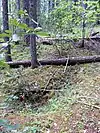 Waldo Chinese Cemetery |
October 4, 2001 (#01001139) |
Approx. 0.5 miles (0.80 km) southwest of the junction of Waldo Rd. and BLM Rd. 40-8-28 42°03′28″N 123°39′11″W |
Cave Junction vicinity | |
| 58 | Waldo Mine | 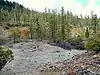 Waldo Mine |
October 4, 2001 (#01001147) |
Southwest of the junction of Waldo Rd. and BLM Rd. 40-8-28 42°03′32″N 123°38′55″W |
Cave Junction vicinity | |
| 59 | Whisky Creek Cabin | .jpg.webp) Whisky Creek Cabin |
September 5, 1975 (#75001584) |
10 mi. W of Wolf Creek at Rogue River 42°39′38″N 123°37′59″W |
Wolf Creek | |
| 60 | Wimer Ditch | Wimer Ditch |
October 4, 2001 (#01001152) |
Historic Channel of Wimer Ditch 42°04′01″N 123°38′19″W |
Cave Junction vicinity | |
| 61 | Wolf Creek Tavern | 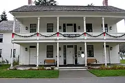 Wolf Creek Tavern |
September 22, 1972 (#72001081) |
West side, Old Pacific Highway, OR 99, About .5 mi N of US 5 42°41′43″N 123°23′46″W |
Wolf Creek |
Former listings
| [5] | Name on the Register | Image | Date listed | Date removed | Location | City or town | Summary |
|---|---|---|---|---|---|---|---|
| 1 | Christie–Eismann House | December 2, 1985 (#85003078) | December 7, 1992 | 5791 Upper River Rd. |
Grants Pass vicinity |
See also
References
- Andrus, Patrick W.; Shrimpton, Rebecca H.; et al. (2002), How to Apply the National Register Criteria for Evaluation, National Register Bulletin, National Park Service, U.S. Department of the Interior, OCLC 39493977, archived from the original on April 6, 2014, retrieved June 20, 2014.
- National Park Service, National Register of Historic Places Program: Research, archived from the original on February 1, 2015, retrieved January 28, 2015.
- Oregon Parks and Recreation Department, Oregon Historic Sites Database, retrieved August 6, 2015. Note that a simple count of National Register records in this database returns a slightly higher total than actual listings, due to duplicate records. A close reading of detailed query results is necessary to arrive at the precise count.
- "National Register of Historic Places: Weekly List Actions". National Park Service, United States Department of the Interior. Retrieved on January 29, 2021.
- Numbers represent an alphabetical ordering by significant words. Various colorings, defined here, differentiate National Historic Landmarks and historic districts from other NRHP buildings, structures, sites or objects.
- The eight-digit number below each date is the number assigned to each location in the National Register Information System database, which can be viewed by clicking the number.
- Atwood, Kay (August 4, 1982), National Register of Historic Places Inventory — Nomination Form: Ahlf, John and Susanna, House (PDF), retrieved April 16, 2014.
- Brown, Ron (June 18, 2012), "Fire At Rogue River Grange Hall", KDRV.com, Medford, Oregon, archived from the original on April 11, 2013, retrieved March 30, 2013.
- National Grange of the Order of Patrons of Husbandry, Possible Arson Destroys Grange Hall in Oregon, archived from the original on July 12, 2012, retrieved March 30, 2013.
- Atwood, Katherine C.; Tonsfeldt, Ward (August 17, 2000), National Register of Historic Places Registration Form: Upper Ditch (PDF), retrieved April 21, 2014.
External links
- Oregon Parks and Recreation Department, National Register Program
- National Park Service, National Register of Historic Places site
 Media related to National Register of Historic Places in Josephine County, Oregon at Wikimedia Commons
| Lists by county | 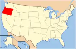 | |
|---|---|---|
| Portland lists | ||
| Other lists |
| |
| Topics | |
|---|---|
| Lists by state |
|
| Lists by insular areas | |
| Lists by associated state | |
| Other areas | |
| Related | |
| |
Municipalities and communities of Josephine County, Oregon, United States | ||
|---|---|---|
| Cities | Josephine County map | |
| CDPs | ||
| Other unincorporated communities | ||
| Ghost towns | ||
| ||
This article is issued from Wikipedia. The text is licensed under Creative Commons - Attribution - Sharealike. Additional terms may apply for the media files.