National Register of Historic Places listings in Lane County, Oregon
This list presents the full set of buildings, structures, objects, sites, or districts designated on the National Register of Historic Places in Lane County, Oregon, and offers brief descriptive information about each of them. The National Register recognizes places of national, state, or local historic significance across the United States.[1] Out of over 90,000 National Register sites nationwide,[2] Oregon is home to over 2,000,[3] and 137 of those are found partially or wholly in Lane County.
- This National Park Service list is complete through NPS recent listings posted January 29, 2021.[4]
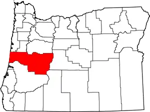
Location of Lane County in Oregon
Current listings
| [5] | Name on the Register | Image | Date listed[6] | Location | City or town | Description |
|---|---|---|---|---|---|---|
| 1 | Alpha Phi Sorority House | .jpg.webp) Alpha Phi Sorority House |
October 24, 1991 (#91001564) |
1050 Hilyard St. 44°02′53″N 123°04′52″W |
Eugene | |
| 2 | Alpha Tau Omega Fraternity House (Old) |  Alpha Tau Omega Fraternity House (Old) |
September 1, 1983 (#83002158) |
1143 Oak St. 44°02′50″N 123°05′23″W |
Eugene | |
| 3 | Archeological site 35LA1 | September 10, 1997 (#97001014) |
Address restricted[7] |
Searose Beach | ||
| 4 | Archeological site 35LA2 | September 10, 1997 (#97001016) |
Address restricted[7] |
Searose Beach | ||
| 5 | Archeological site 35LA4 | September 10, 1997 (#97001018) |
Address restricted[7] |
Searose Beach | ||
| 6 | Archeological site 35LA5 | September 10, 1997 (#97001019) |
Address restricted[7] |
Searose Beach | ||
| 7 | Archeological site 35LA6 | September 10, 1997 (#97001020) |
Address restricted[7] |
Searose Beach | ||
| 8 | Archeological site 35LA7 | September 10, 1997 (#97001021) |
Address restricted[7] |
Searose Beach | ||
| 9 | Archeological Site 35LA11 | September 10, 1997 (#97001025) |
Address restricted[7] |
Searose Beach | ||
| 10 | Archeological Site 35LA13 | September 10, 1997 (#97001026) |
Address restricted[7] |
Searose Beach | ||
| 11 | Archeological Site 35LA16 | September 10, 1997 (#97001027) |
Address restricted[7] |
Searose Beach | ||
| 12 | Archeological Site 35LA227 | September 10, 1997 (#97001024) |
Address restricted[7] |
Searose Beach | ||
| 13 | Archeological site 35LA228 | September 10, 1997 (#97001015) |
Address restricted[7] |
Searose Beach | ||
| 14 | Ax Billy Department Store |  Ax Billy Department Store |
August 26, 1982 (#82003731) |
E. 10th Ave. and Willamette St. 44°02′56″N 123°05′28″W |
Eugene | Occupied by the Downtown Athletic Club, Conference Center, and the Ax Billy Grill & Sports Bar[8] |
| 15 | Baldwin Market | .jpg.webp) Baldwin Market |
May 29, 1996 (#96000619) |
765–781 Monroe St. 44°03′05″N 123°06′17″W |
Eugene | |
| 16 | Abraham and Phoebe Ball House | .jpg.webp) Abraham and Phoebe Ball House |
November 21, 2003 (#03001181) |
1312 Lincoln St. 44°02′44″N 123°05′46″W |
Eugene | |
| 17 | Belknap Bridge |  Belknap Bridge |
November 29, 1979 (#79002097) |
Off SR 126 44°10′06″N 122°13′37″W |
Rainbow | |
| 18 | Edwin E. Benedict House | .jpg.webp) Edwin E. Benedict House |
October 18, 1979 (#79002090) |
East of Florence on Cox Island 43°58′31″N 124°04′01″W |
Florence | |
| 19 | Beta Theta Pi Fraternity House, Old |  Beta Theta Pi Fraternity House, Old |
October 30, 1989 (#89001858) |
379–381 E. 12th Ave. 44°02′49″N 123°05′08″W |
Eugene | |
| 20 | Big Creek Bridge No. 01180 | 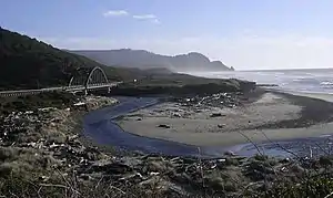 Big Creek Bridge No. 01180 |
August 5, 2005 (#05000819) |
OR Coast 9, US 101, MP175.02 44°10′28″N 124°06′51″W |
Heceta Head | |
| 21 | The Big "O" | .jpg.webp) The Big "O" |
September 23, 2010 (#10000800) |
Skinner Butte 44°03′28″N 123°05′34″W |
Eugene | |
| 22 | Bob Creek Site 35LA10 | September 10, 1997 (#97001023) |
Address restricted[7] |
Searose Beach | ||
| 23 | Clarence and Ethel Boyer House | .jpg.webp) Clarence and Ethel Boyer House |
February 25, 2009 (#09000061) |
1138 E. 22nd Ave. 44°02′07″N 123°04′32″W |
Eugene | |
| 24 | Windsor W. Calkins House | .jpg.webp) Windsor W. Calkins House |
December 9, 1981 (#81000498) |
588 E. 11th Ave. 44°02′51″N 123°04′58″W |
Eugene | |
| 25 | Robert E. Campbell House | .jpg.webp) Robert E. Campbell House |
November 1, 1979 (#79002088) |
890 Aspen Dr. 44°03′14″N 123°02′31″W |
Springfield | |
| 26 | Cape Creek Bridge No. 01113 |  Cape Creek Bridge No. 01113 |
August 5, 2005 (#05000820) |
OR Coast 9, US101, MP178.35 44°08′01″N 124°07′14″W |
Heceta Head | |
| 27 | Chambers Bridge | 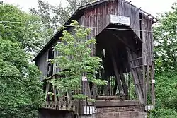 Chambers Bridge |
November 29, 1979 (#79002081) |
S. River Rd. 43°47′22″N 123°04′11″W |
Cottage Grove | |
| 28 | Frank L. and Ida H. Chambers House | .jpg.webp) Frank L. and Ida H. Chambers House |
September 14, 1987 (#87001537) |
1006 Taylor St. 44°02′56″N 123°06′47″W |
Eugene | |
| 29 | Fred E. Chambers House and Grounds | .jpg.webp) Fred E. Chambers House and Grounds |
September 27, 1996 (#96001047) |
1151 Irving Rd. 44°06′14″N 123°09′10″W |
Eugene | |
| 30 | Chase Gardens Residential Grouping | .jpg.webp) Chase Gardens Residential Grouping |
August 5, 1999 (#99000943) |
274 S. Garden Way 44°03′32″N 123°03′06″W |
Eugene | |
| 31 | Chi Psi Fraternity House | .jpg.webp) Chi Psi Fraternity House |
March 18, 1993 (#91001563) |
1018 Hilyard St. 44°02′55″N 123°04′52″W |
Eugene | |
| 32 | Daniel and Catherine Christian House† | .jpg.webp) Daniel and Catherine Christian House |
January 29, 2008 (#07001507) |
170 E. 12th Ave. 44°02′47″N 123°05′20″W |
Eugene | |
| 33 | Christian-Patterson Rental Property | .jpg.webp) Christian-Patterson Rental Property |
October 24, 1991 (#91001567) |
244 E. 16th Ave. 44°02′32″N 123°05′16″W |
Eugene | |
| 34 | Jacob Clearwater House | July 3, 2017 (#100001273) |
1656 Clearwater Lane 44°01′35″N 122°57′04″W |
Springfield | ||
| 35 | Coburg Historic District | .jpg.webp) Coburg Historic District |
January 7, 1986 (#86000036) |
Roughly bounded by Van Duyn Rd., Diamond and Miller Sts., Dixon St. and Tax lots 1700 and 201, and Bottom Loop Rd. 44°08′22″N 123°03′57″W |
Coburg | |
| 36 | Cochran-Rice Farm Complex | .jpg.webp) Cochran-Rice Farm Complex |
October 17, 1991 (#91001558) |
993 N. Lane St. 43°48′19″N 123°03′09″W |
Cottage Grove | Dismantled in 2012.[9] |
| 37 | Cottage Grove Armory | .jpg.webp) Cottage Grove Armory |
March 7, 2012 (#12000081) |
628 E. Washington Avenue 43°47′48″N 123°03′41″W |
Cottage Grove | |
| 38 | Cottage Grove Downtown Commercial Historic District | 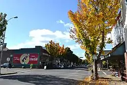 Cottage Grove Downtown Commercial Historic District |
January 28, 1994 (#93001568) |
Area surrounding Main St. between Coast Fork Willamette R. and Ninth St. 43°47′51″N 123°03′38″W |
Cottage Grove | |
| 39 | Coyote Creek Bridge | .jpg.webp) Coyote Creek Bridge |
November 29, 1979 (#79002084) |
Southeast of Crow 43°58′12″N 123°19′08″W |
Crow | |
| 40 | Creswell Public Library and Civic Improvement Club Clubhouse | 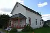 Creswell Public Library and Civic Improvement Club Clubhouse |
January 29, 2008 (#07001508) |
195 S. 2nd St. 43°54′59″N 123°01′13″W |
Creswell | |
| 41 | Currin Bridge | 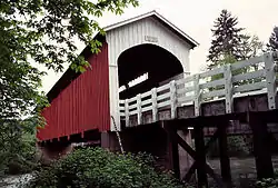 Currin Bridge |
November 29, 1979 (#79002082) |
East of Cottage Grove 43°47′37″N 122°59′43″W |
Cottage Grove | |
| 42 | Dads' Gates | .jpg.webp) Dads' Gates |
August 11, 2004 (#04000829) |
11th Ave. E. bet. Kincaid St. and Franklin Blvd. 44°02′52″N 123°04′35″W |
Eugene | |
| 43 | Deadwood Creek Bridge | .jpg.webp) Deadwood Creek Bridge |
November 29, 1979 (#79002099) |
Northeast of Swisshome 44°08′37″N 123°43′13″W |
Swisshome | |
| 44 | Deady Hall | 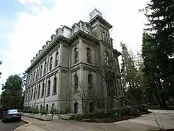 Deady Hall |
April 11, 1972 (#72001082) |
University of Oregon campus 44°02′48″N 123°04′31″W |
Eugene | |
| 45 | Devil's Elbow Site (35LA17) | September 10, 1997 (#97001028) |
Address restricted[7] |
Searose Beach | ||
| 46 | Dorena Bridge | 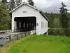 Dorena Bridge |
November 29, 1979 (#79002086) |
Northwest of Dorena 43°44′14″N 122°53′01″W |
Dorena | |
| 47 | Dorris Apartments | .jpg.webp) Dorris Apartments |
October 24, 1991 (#91001565) |
963 Ferry Ln. 44°02′57″N 123°05′00″W |
Eugene | |
| 48 | Dorris Ranch | _(Eugene%252C_Oregon).jpg.webp) Dorris Ranch |
June 22, 1988 (#88000724) |
S. Second St. at Dorris Ave. 44°01′41″N 123°01′02″W |
Springfield | |
| 49 | Benjamin Franklin Dorris House | .jpg.webp) Benjamin Franklin Dorris House |
February 23, 1996 (#96000171) |
707 E. 17th Ave. 44°02′29″N 123°04′51″W |
Eugene | |
| 50 | East Skinner Butte Historic District | .jpg.webp) East Skinner Butte Historic District |
September 23, 1982 (#82003732) |
Pearl and High Sts., and 2nd and 3rd Aves. 44°03′25″N 123°05′17″W |
Eugene | |
| 51 | Ernest Bridge | 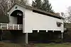 Ernest Bridge |
November 29, 1979 (#79002094) |
Northeast of Marcola 44°12′04″N 122°50′10″W |
Marcola | |
| 52 | Eugene Blair Boulevard Commercial Historic District | _4.jpg.webp) Eugene Blair Boulevard Commercial Historic District |
September 21, 1993 (#93000928) |
Blair Blvd. between W. 3rd and W. 5th Aves., including Van Buren St. between Blair and W. 3rd 44°03′20″N 123°06′30″W |
Eugene | |
| 53 | Eugene Hotel |  Eugene Hotel |
October 7, 1982 (#82001508) |
222 E. Broadway 44°02′59″N 123°05′21″W |
Eugene | Built in 1925; Americanized-Spanish architecture.[10] |
| 54 | Eugene Pioneer Cemetery | 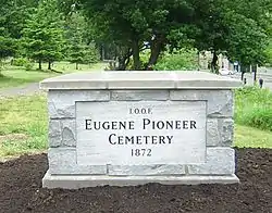 Eugene Pioneer Cemetery |
August 1, 1997 (#97000850) |
Jct. of E. Eighteenth Ave. and University St. 44°02′30″N 123°04′30″W |
Eugene | |
| 55 | First Congregational Church | .jpg.webp) First Congregational Church |
February 12, 1980 (#80003333) |
492 E. 13th Ave. 44°02′43″N 123°05′08″W |
Eugene | |
| 56 | First Presbyterian Church | .jpg.webp) First Presbyterian Church |
December 31, 1974 (#74001690) |
216 S. 3rd St. 43°47′42″N 123°03′48″W |
Cottage Grove | |
| 57 | Charles C. Fitch Farmstead | .jpg.webp) Charles C. Fitch Farmstead |
June 16, 1989 (#89000510) |
26689 Pickens Rd. 44°01′47″N 123°16′51″W |
Eugene | |
| 58 | Flanagan Site (35 LA 218) | July 20, 1977 (#77001106) |
Address restricted[7] |
Eugene | ||
| 59 | Foster–Simmons House | 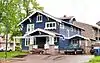 Foster–Simmons House |
October 30, 2017 (#100001773) |
417 E. 13th Ave. 44°02′45″N 123°05′11″W |
Eugene | |
| 60 | Gamma Phi Beta Sorority House | .jpg.webp) Gamma Phi Beta Sorority House |
October 24, 1991 (#91001566) |
1021 Hilyard St. 44°02′55″N 123°04′50″W |
Eugene | |
| 61 | Goodpasture Bridge |  Goodpasture Bridge |
November 29, 1979 (#79002100) |
West of Vida 44°08′54″N 122°35′10″W |
Vida | |
| 62 | Howard A. Hall House | .jpg.webp) Howard A. Hall House |
July 14, 1988 (#88001036) |
1991 Garden Ave. 44°02′47″N 123°03′46″W |
Eugene | |
| 63 | Elmer Harlow House | .jpg.webp) Elmer Harlow House |
February 12, 1980 (#80003334) |
2991 Harlow Rd. 44°04′12″N 123°03′49″W |
Eugene | Built in 1922, this bungalow is a representative example of the style promoted by The Craftsman magazine. It is especially notable for fine detailing, including in woodwork and windows. The use of two-tone brickwork emphasizes the refined and careful construction.[11] |
| 64 | Hayse Blacksmith Shop | .jpg.webp) Hayse Blacksmith Shop |
November 7, 1980 (#80003335) |
357 Van Buren St. 44°03′21″N 123°06′29″W |
Eugene | |
| 65 | Heceta Head Lighthouse and Keepers Quarters | 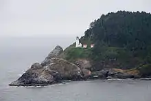 Heceta Head Lighthouse and Keepers Quarters |
November 28, 1978 (#78002296) |
North of Florence on U.S. 101 44°08′15″N 124°07′37″W |
Florence | |
| 66 | Jessie M. Honeyman Memorial State Park Historic District | 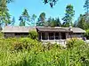 Jessie M. Honeyman Memorial State Park Historic District |
November 28, 1984 (#84000473) |
U.S. 101 43°55′48″N 124°06′26″W |
Dunes City | |
| 67 | Johnson Hall | 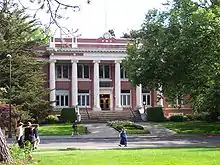 Johnson Hall |
June 20, 1985 (#85001351) |
E. 13th between University and Kincaid Sts. 44°02′43″N 123°04′29″W |
Eugene | |
| 68 | William Kyle and Sons Building | 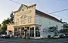 William Kyle and Sons Building |
December 2, 1981 (#81000499) |
1297 Bay St. 43°58′00″N 124°06′19″W |
Florence | |
| 69 | Lake Creek Bridge | .jpg.webp) Lake Creek Bridge |
November 29, 1979 (#79002091) |
West of Greenleaf 44°06′16″N 123°40′25″W |
Greenleaf | |
| 70 | Lane County Clerk's Building | .jpg.webp) Lane County Clerk's Building |
November 25, 1983 (#83004174) |
740 W. 13th Ave. 44°02′41″N 123°06′09″W |
Eugene | |
| 71 | Lane County Farmers' Union Cooperative Wholesalers' Association Building |  Lane County Farmers' Union Cooperative Wholesalers' Association Building |
October 17, 1991 (#91001560) |
532 Olive St. 44°03′14″N 123°05′37″W |
Eugene | |
| 72 | Leaburg Hydroelectric Project Historic District | .jpg.webp) Leaburg Hydroelectric Project Historic District |
June 29, 2015 (#15000375) |
14348 McKenzie River Highway 44°06′05″N 122°41′20″W |
Leaburg vicinity | |
| 73 | Dr. Norman L. Lee House | .jpg.webp) Dr. Norman L. Lee House |
November 2, 1977 (#77001108) |
655 Holly St. 44°13′12″N 123°12′09″W |
Junction City | |
| 74 | Log Cabin Inn Ensemble | .jpg.webp) Log Cabin Inn Ensemble |
December 4, 2002 (#02001486) |
56483 McKenzie Highway 44°10′27″N 122°09′33″W |
McKenzie Bridge | |
| 75 | Lowell Bridge | 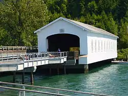 Lowell Bridge |
November 29, 1979 (#79002085) |
East of Dexter 43°54′33″N 122°46′42″W |
Lowell | |
| 76 | Lowell Grange | .jpg.webp) Lowell Grange |
August 10, 2005 (#05000849) |
51 E 2nd St. 43°55′17″N 122°46′54″W |
Lowell | |
| 77 | Marx-Schaefers House† | .jpg.webp) Marx-Schaefers House |
August 2, 2006 (#06000662) |
1718 Lincoln St. 44°02′28″N 123°05′45″W |
Eugene | |
| 78 | Masonic Cemetery and Hope Abbey Mausoleum | .JPG.webp) Masonic Cemetery and Hope Abbey Mausoleum |
September 15, 1980 (#80003336) |
25th and University Sts. 44°01′53″N 123°04′24″W |
Eugene | |
| 79 | Nelson and Margret Mathews House | .jpg.webp) Nelson and Margret Mathews House |
June 14, 1984 (#84003025) |
231 E. Pearl St. 44°08′13″N 123°03′50″W |
Coburg | |
| 80 | McCracken Brothers Motor Freight Building | .jpg.webp) McCracken Brothers Motor Freight Building |
September 21, 2005 (#05001055) |
375 W. 4th St. 44°03′21″N 123°05′50″W |
Eugene | |
| 81 | McDonald Theater Building |  McDonald Theater Building |
August 26, 1982 (#82003733) |
1004–1044 Willamette St. 44°02′55″N 123°05′30″W |
Eugene | |
| 82 | Old McKenzie Fish Hatchery | 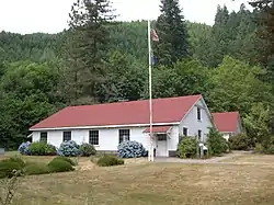 Old McKenzie Fish Hatchery |
February 23, 1996 (#96000142) |
44645 McKenzie Hwy. 44°08′31″N 122°36′31″W |
Leaburg | |
| 83 | McKenzie Highway Historic District | _(lanD0021).jpg.webp) McKenzie Highway Historic District |
February 7, 2011 (#10001215) |
OR 242 44°14′55″N 121°50′18″W |
Belknap Springs vicinity | Extends into Linn and Deschutes counties. |
| 84 | McMorran and Washburne Department Store Building | 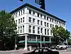 McMorran and Washburne Department Store Building |
March 2, 1989 (#89000125) |
795 Willamette St. 44°03′05″N 123°05′29″W |
Eugene | |
| 85 | Methodist Episcopal Church of Goshen | .jpg.webp) Methodist Episcopal Church of Goshen |
October 17, 1991 (#91001559) |
85896 First St. 43°59′45″N 123°00′37″W |
Goshen | |
| 86 | Wayne Morse Farm | 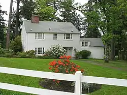 Wayne Morse Farm |
February 12, 1999 (#99000066) |
595 Crest Dr. 44°01′23″N 123°05′55″W |
Eugene | |
| 87 | Mosby Creek Bridge | 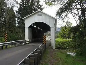 Mosby Creek Bridge |
November 29, 1979 (#79002083) |
East of Cottage Grove 43°46′41″N 123°00′13″W |
Cottage Grove | |
| 88 | Musick Guard Station | 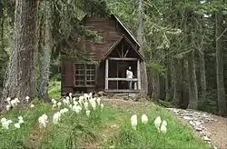 Musick Guard Station |
March 6, 1991 (#91000170) |
Northeast of Bohemia Mtn., Umpqua NF 43°34′51″N 122°38′25″W |
Cottage Grove | |
| 89 | The Neptune Site (35LA3) | September 10, 1997 (#97001017) |
Address restricted[7] |
Searose Beach | ||
| 90 | Office Bridge | 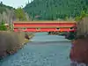 Office Bridge |
November 29, 1979 (#79003768) |
Crosses N. Fork Middle Fork Willamette River 43°46′04″N 122°29′40″W |
Westfir | |
| 91 | Oregon Electric Railway Passenger Station | 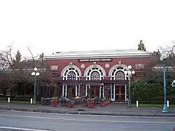 Oregon Electric Railway Passenger Station |
March 13, 1979 (#79002087) |
27 E. 5th St. 44°03′17″N 123°05′28″W |
Eugene | |
| 92 | Oregon Power Company's Springfield Substation | 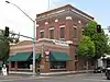 Oregon Power Company's Springfield Substation |
February 23, 1996 (#96000170) |
590 Main St. 44°02′47″N 123°01′02″W |
Springfield | |
| 93 | Oregon Railway and Navigation Company Bridge | .jpg.webp) Oregon Railway and Navigation Company Bridge |
March 13, 1980 (#80003332) |
Southeast of Coburg 44°06′45″N 123°02′44″W |
Coburg | |
| 94 | Our Lady of Perpetual Help Roman Catholic Church | .jpg.webp) Our Lady of Perpetual Help Roman Catholic Church |
February 21, 1997 (#97000127) |
147 N. H St. 43°47′57″N 123°03′54″W |
Cottage Grove | |
| 95 | Pacific Cooperative Poultry Producers Egg-Taking Station | Pacific Cooperative Poultry Producers Egg-Taking Station |
September 8, 1988 (#88001523) |
506 Olive St. 44°03′12″N 123°05′37″W |
Eugene | |
| 96 | Palace Hotel | .jpg.webp) Palace Hotel |
December 23, 1977 (#77001105) |
488 Willamette St. 44°03′16″N 123°05′35″W |
Eugene | |
| 97 | Parvin Bridge | .jpg.webp) Parvin Bridge |
November 29, 1979 (#79003767) |
South of Dexter off Lost Creek Rd. 43°53′59″N 122°49′17″W |
Dexter | |
| 98 | Patterson-Stratton House | .jpg.webp) Patterson-Stratton House |
September 29, 1992 (#92001262) |
1605 Pearl St. 44°02′32″N 123°05′18″W |
Eugene | |
| 99 | Pengra Bridge | %252C_Jasper_vicinity_(Lane_County%252C_Oregon).jpg.webp) Pengra Bridge |
November 29, 1979 (#79002092) |
Spanning Fall Creek on Place Road[12] 43°57′58″N 122°50′43″W |
Jasper vicinity | |
| 100 | A. V. Peters House |  A. V. Peters House |
October 25, 1990 (#90001597) |
1611 Lincoln St. 44°02′32″N 123°05′44″W |
Eugene | |
| 101 | Petersen Apartments† |  Petersen Apartments |
December 16, 2005 (#05001420) |
1263 Oak St. 44°02′46″N 123°05′23″W |
Eugene | |
| 102 | Wallace and Glenn Potter House | .jpg.webp) Wallace and Glenn Potter House |
April 24, 2007 (#07000360) |
120 Fir Ln. 44°03′56″N 123°06′54″W |
Eugene | |
| 103 | Psi Alpha Chapter, Chi Omega House | .jpg.webp) Psi Alpha Chapter, Chi Omega House |
December 28, 2001 (#01001402) |
1461 Alder St. 44°02′37″N 123°04′50″W |
Eugene | |
| 104 | Quackenbush Hardware Store |  Quackenbush Hardware Store |
September 23, 1982 (#82003734) |
160 E. Broadway 44°02′56″N 123°05′20″W |
Eugene | |
| 105 | Rice Apartments† | .jpg.webp) Rice Apartments |
November 15, 2006 (#06001031) |
360 W. 13th Ave. 44°02′43″N 123°05′52″W |
Eugene | |
| 106 | Schaefers Building | .jpg.webp) Schaefers Building |
October 30, 1979 (#79003735) |
1001 Willamette St. 44°02′55″N 123°05′28″W |
Eugene | |
| 107 | Shelton-McMurphey House and Grounds |  Shelton-McMurphey House and Grounds |
June 14, 1984 (#84003028) |
303 Willamette St. 44°03′28″N 123°05′25″W |
Eugene | |
| 108 | Horace J. and Ann S. Shinn Cottage | .jpg.webp) Horace J. and Ann S. Shinn Cottage |
March 5, 1998 (#98000206) |
1308 Ash Ave. 43°47′56″N 123°04′10″W |
Cottage Grove | |
| 109 | Siuslaw River Bridge No. 01821 | 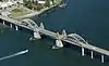 Siuslaw River Bridge No. 01821 |
August 5, 2005 (#05000816) |
OR Coast 9, US101, MP109.98 43°57′52″N 124°06′27″W |
Florence | |
| 110 | Smeede Hotel | .jpg.webp) Smeede Hotel |
January 17, 1974 (#74001691) |
767 Willamette St. 44°03′06″N 123°05′28″W |
Eugene | |
| 111 | Southern Pacific Passenger Depot | 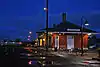 Southern Pacific Passenger Depot |
August 16, 2007 (#07000823) |
433 Willamette St. 44°03′18″N 123°05′29″W |
Eugene | |
| 112 | Southern Pacific Railroad Passenger Station and Freight House | 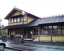 Southern Pacific Railroad Passenger Station and Freight House |
February 24, 1993 (#82005088) |
101 S. A St. 44°02′41″N 123°00′56″W |
Springfield | |
| 113 | Springfield General Hospital | .jpg.webp) Springfield General Hospital |
September 1, 1983 (#83002159) |
846 F St. 44°03′06″N 123°00′52″W |
Springfield | |
| 114 | Springfield Motors Buick Dealership | .jpg.webp) Springfield Motors Buick Dealership |
June 1, 2011 (#11000328) |
702 North A St. 44°02′50″N 123°01′00″W |
Springfield | |
| 115 | Stewart Bridge | 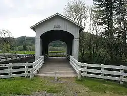 Stewart Bridge |
November 29, 1979 (#79002102) |
Southeast of Walden 43°45′59″N 122°59′35″W |
Walden | |
| 116 | LaSells D. Stewart House | .jpg.webp) LaSells D. Stewart House |
January 28, 1994 (#93001569) |
1807 E. Main St. 43°47′50″N 123°02′50″W |
Cottage Grove | |
| 117 | Strawberry Hill Site (35LA8) | September 10, 1997 (#97001022) |
Address restricted[7] |
Searose Beach | ||
| 118 | John Sutherland House | .jpg.webp) John Sutherland House |
February 2, 1995 (#94001631) |
83246 Lorane Hwy. 43°55′06″N 123°14′19″W |
Eugene | |
| 119 | Ten Mile Creek Bridge No. 01181 | 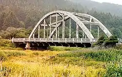 Ten Mile Creek Bridge No. 01181 |
August 5, 2005 (#05000818) |
OR Coast 9, US101, MP171.44 44°13′27″N 124°06′35″W |
Yachats vicinity | |
| 120 | Thompson-Roach Building | .jpg.webp) Thompson-Roach Building |
November 15, 2006 (#06001032) |
544–550 E. 13th Ave. 44°02′43″N 123°04′59″W |
Eugene | Included in Eugene West University Neighborhood MPS |
| 121 | Triangle Lake Round Barn | _(lanDB3995).jpg.webp) Triangle Lake Round Barn |
July 3, 2017 (#100001274) |
19941 Highway 36 44°11′20″N 123°33′47″W |
Blachly vicinity | |
| 122 | Unity Bridge | .jpg.webp) Unity Bridge |
November 29, 1979 (#79002093) |
North of Lowell 43°56′43″N 122°46′26″W |
Lowell | |
| 123 | University of Oregon Library and Memorial Quadrangle | 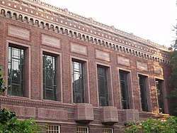 University of Oregon Library and Memorial Quadrangle |
March 9, 1990 (#90000370) |
Kincaid St. at E. Fifteenth Ave. 44°02′38″N 123°04′39″W |
Eugene | Includes the Knight Library |
| 124 | University of Oregon Museum of Art | 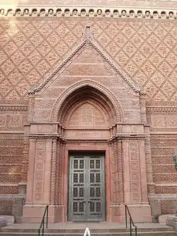 University of Oregon Museum of Art |
June 5, 1986 (#86001224) |
1430 Johnson Lane 44°02′39″N 123°04′37″W |
Eugene | Also known as the "Jordan Schnitzer Museum of Art" |
| 125 | U.S. Post Office | 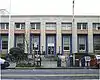 U.S. Post Office |
August 14, 1985 (#85001805) |
520 Willamette St. 44°03′14″N 123°05′35″W |
Eugene | |
| 126 | Villard Hall |  Villard Hall |
April 11, 1972 (#72001083) |
University of Oregon 44°02′50″N 123°04′35″W |
Eugene | |
| 127 | Washburne Historic District | .jpg.webp) Washburne Historic District |
February 10, 1987 (#87000042) |
Roughly bounded by G, N. Tenth, A, and N. Second Sts. 44°03′01″N 123°01′00″W |
Springfield | |
| 128 | Wendling Bridge |  Wendling Bridge |
November 29, 1979 (#79002095) |
Northeast of Marcola 44°11′29″N 122°47′56″W |
Wendling | |
| 129 | Wildcat Creek Bridge | .jpg.webp) Wildcat Creek Bridge |
November 29, 1979 (#79002089) |
West of Eugene 44°00′13″N 123°39′09″W |
Walton | |
| 130 | Wilder Apartments† | .jpg.webp) Wilder Apartments |
August 23, 2006 (#06000727) |
259 E. 13th Ave. 44°02′45″N 123°05′15″W |
Eugene | |
| 131 | Willakenzie Grange Hall | .jpg.webp) Willakenzie Grange Hall |
January 22, 2009 (#08001368) |
3055 Willakenzie Rd. 44°04′55″N 123°03′47″W |
Eugene | |
| 132 | C. S. Williams House | .jpg.webp) C. S. Williams House |
July 14, 1988 (#88001037) |
1973 Garden Ave. 44°02′48″N 123°03′42″W |
Eugene | |
| 133 | Lew Williams Chevrolet Dealership | .jpg.webp) Lew Williams Chevrolet Dealership |
June 1, 2011 (#11000329) |
2020 Franklin Blvd. 44°02′39″N 123°03′44″W |
Eugene | |
| 134 | Woodrow Wilson Junior High School | 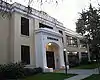 Woodrow Wilson Junior High School |
October 25, 1990 (#90001602) |
650 W. Twelfth Ave. 44°02′47″N 123°06′04″W |
Eugene | |
| 135 | Women's Memorial Quadrangle Ensemble |  Women's Memorial Quadrangle Ensemble |
October 2, 1992 (#92001320) |
Bounded by University St., Johnson Ln. and Pioneer Cemetery on the University of Oregon campus 44°02′38″N 123°04′28″W |
Eugene | |
| 136 | Woodmen of the World Hall | 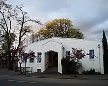 Woodmen of the World Hall |
June 3, 1996 (#96000618) |
291 W. 8th Ave. 44°03′04″N 123°05′50″W |
Eugene | |
| 137 | James W. Working Flats | .jpg.webp) James W. Working Flats |
August 26, 1994 (#94001024) |
614 Lawrence St. 44°03′12″N 123°05′52″W |
Eugene |
Former listings
| [5] | Name on the Register | Image | Date listed | Date removed | Location | City or town | Summary |
|---|---|---|---|---|---|---|---|
| 1 | Amazon Family Housing Complex | 1995 (#95000090) | October 22, 1996 | 24th Ave and Patterson St. |
Eugene | Originally listed in 1995 | |
| 2 | Brattain–Hadley House | .jpg.webp) Brattain–Hadley House |
September 14, 1995 (#95001099) | May 8, 2012 | 1260 Main St. 44°02′47″N 123°00′22″W |
Springfield | |
| 3 | Brumbaugh Bridge | November 29, 1979 (#79002101) | November 25, 1986 | SE of Walden |
Walden vicinity | ||
| 4 | Eugene Civic Stadium | 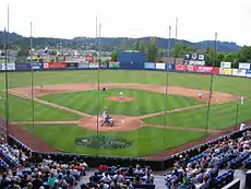 Eugene Civic Stadium |
October 6, 2008 (#08000183) | March 8, 2016 | 2077 Willamette St. 44°02′13″N 123°05′29″W |
Eugene | Destroyed by fire June 29, 2015[13] |
| 5 | Horse Creek Bridge |  Horse Creek Bridge |
November 29, 1979 (#79002096) | July 27, 1988 | S of McKenzie Bridge |
McKenzie Bridge | Moved to Douglas County |
| 6 | Jacob C. Spores House | November 2, 1977 (#77001107) | August 1, 2001 | N of Eugene at 90311 Coburg Rd. |
Eugene vicinity | ||
| 7 | Charles S. Williams House | October 31, 1985 (#85003479) | June 16, 1987 | 228 E. Twelfth |
Eugene vicinity |
Key
| † | part of Residential Architecture of Eugene, Oregon MPS |
|---|---|
| Building, site, object, or structure | |
| ∞ | Historic district |
See also
References
- Andrus, Patrick W.; Shrimpton, Rebecca H.; et al. (2002), How to Apply the National Register Criteria for Evaluation, National Register Bulletin, National Park Service, U.S. Department of the Interior, OCLC 39493977, archived from the original on April 6, 2014, retrieved June 20, 2014.
- National Park Service, National Register of Historic Places Program: Research, archived from the original on February 1, 2015, retrieved January 28, 2015.
- Oregon Parks and Recreation Department, Oregon Historic Sites Database, retrieved August 6, 2015. Note that a simple count of National Register records in this database returns a slightly higher total than actual listings, due to duplicate records. A close reading of detailed query results is necessary to arrive at the precise count.
- "National Register of Historic Places: Weekly List Actions". National Park Service, United States Department of the Interior. Retrieved on January 29, 2021.
- Numbers represent an alphabetical ordering by significant words. Various colorings, defined here, differentiate National Historic Landmarks and historic districts from other NRHP buildings, structures, sites or objects.
- The eight-digit number below each date is the number assigned to each location in the National Register Information System database, which can be viewed by clicking the number.
- Federal and state laws and practices restrict general public access to information regarding the specific location of this resource. In some cases, this is to protect archeological sites from vandalism, while in other cases it is restricted at the request of the owner. See: Knoerl, John; Miller, Diane; Shrimpton, Rebecca H. (1990), Guidelines for Restricting Information about Historic and Prehistoric Resources, National Register Bulletin, National Park Service, U.S. Department of the Interior, OCLC 20706997.
- "Downtown Athletics Club Eugene". Archived from the original on 2011-03-11.
- http://www.registerguard.com/web/newslocalnews/28746033-41/barn-stout-cottage-grove-pierce.html.csp
- "Eugene Hotel". Archived from the original on 2011-10-08.
- Grant, Philip (April 16, 1979), National Register of Historic Places Inventory — Nomination Form: Harlow, Elmer, House (PDF), retrieved December 17, 2014.
- Thematic Group Nomination: Oregon Covered Bridges: Pengra Bridge, Index No. 25 (PDF), c. 1979, retrieved October 12, 2014.
- Johnson, Alex (June 30, 2015), 'Tragic Loss': Historic Oregon Stadium Engulfed in Flames, NBC News, archived from the original on January 17, 2016, retrieved February 3, 2016.
External links
- Oregon Parks and Recreation Department, National Register Program
- National Park Service, National Register of Historic Places site
 Media related to National Register of Historic Places in Lane County, Oregon at Wikimedia Commons
| Lists by county | 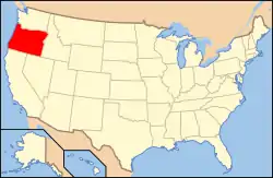 | |
|---|---|---|
| Portland lists | ||
| Other lists |
| |
| Topics | |
|---|---|
| Lists by state |
|
| Lists by insular areas | |
| Lists by associated state | |
| Other areas | |
| Related | |
| |
Municipalities and communities of Lane County, Oregon, United States | ||
|---|---|---|
| Cities | Lane County map | |
| Unincorporated communities |
| |
| Ghost towns | ||
| Indian reservation | ||
| Footnotes | ‡This populated place also has portions in an adjacent county or counties | |
| ||
This article is issued from Wikipedia. The text is licensed under Creative Commons - Attribution - Sharealike. Additional terms may apply for the media files.