Mountain Top, Pennsylvania
Mountain Top is an unincorporated area and census-designated place (CDP) in Luzerne County, Pennsylvania, United States. As of the 2010 census, the CDP population was 10,982.[2]
Mountain Top, Pennsylvania | |
|---|---|
 Blue Giant Meadow Lake in Mountain Top | |
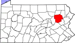
 Mountain Top Location in Pennsylvania  Mountain Top Location in the United States | |
| Coordinates: 41°10′12″N 75°52′36″W | |
| Country | United States |
| State | Pennsylvania |
| County | Luzerne |
| Townships | Fairview, Wright, Rice |
| Area | |
| • Total | 15.1 sq mi (39.0 km2) |
| • Land | 15.1 sq mi (39.0 km2) |
| • Water | 0 sq mi (0 km2) |
| Elevation | 1,580 ft (480 m) |
| Population | |
| • Total | 10,982 |
| • Density | 730/sq mi (281.9/km2) |
| Time zone | UTC-5 (Eastern (EST)) |
| • Summer (DST) | UTC-4 (EDT) |
| ZIP code | 18707 |
| Area code(s) | 570 and 272 |
| FIPS code | 42-51384 |
| GNIS feature ID | 2389520 |
The Mountain Top CDP is located along Pennsylvania Route 309 (south of Wilkes-Barre) in Fairview, Wright, and Rice townships. The "Mountain Top" ZIP code extends west into Dorrance Township.
Name
The area's name is properly spelled "Mountain Top".[3] The United States Postal Service uses the spelling "Mountain Top" for ZIP Code 18707, and the Pennsylvania Department of Transportation spells it "Mountain Top" on a Pennsylvania driver's license. However, some businesses in Mountain Top spell their community as a single word, "Mountaintop".
Geography

Mountain Top, once named "Penobscot",[4] is located in central Luzerne County at 41°8′7″N 75°54′16″W (41.1353022, -75.9044749). The CDP extends north to Solomon Gap, which separates Penobscot Mountain to the west from Haystack Mountain to the east. To the south, the CDP includes the settlements of Fairview Heights, Wech Corners, Rita, Albert, Rippletown, and Lindbergh. [4] The ridge of Nescopeck Mountain is in the southeast part of the CDP. According to the United States Census Bureau, the CDP has a total area of 15.1 square miles (39.0 km2), all of it land.[1]
The Mountain Top CDP is within the Susquehanna River watershed. The village center sits on a drainage divide between Solomon Creek, which flows north through Solomon Gap to the Susquehanna near Wilkes-Barre, and Big Wapwallopen Creek, which flows to the southwest to the Susquehanna at Wapwallopen. East of the CDP the ground rises to Arbutus Peak and Stony Cabin Ridge, both 2,080 feet (630 m) above sea level, beyond which is the Lehigh River basin leading to the Delaware River. Mountain Top is 10 miles (16 km) northwest of White Haven, at the head end of the Lehigh River, 16 miles (26 km) northeast of Hazleton, and 8 miles (13 km) south of Wilkes-Barre on Pennsylvania Route 309. Consequently, even though regional railroads are much diminished in scope and influence, Mountain Top Yard, once used as a marshaling yard at the top of the Ashley Planes funicular (cable-driven) railway, is still an important regional element of the transportation infrastructure connecting Allentown and Philadelphia with points north and west via trackage to several yards in New York state.
The elevation within the Mountain Top CDP ranges from 1,070 feet (330 m) above sea level along Big Wapwallopen Creek in the southwest, to 1,860 feet (570 m) atop Nescopeck Mountain southwest of Rita, to 1,871 feet (570 m) at the east end of Penobscot Mountain in the north of the CDP. The central village of Mountain Top sits at 1,580 feet (480 m) just south of Penobscot Mountain.
Demographics
As of the census[5] of 2000, there were 15,269 people, 5,556 households, and 4,394 families residing in the CDP. The population density was 224.0 people per square mile (86.5/km2). There were 5,774 housing units at an average density of 84.7/sq mi (32.7/km2). The racial makeup of the CDP was 97.02% White, 0.54% African American, 0.03% Native American, 1.62% Asian, 0.24% from other races, and 0.56% from two or more races. Hispanic or Latino of any race were 1.08% of the population.
There were 5,556 households, out of which 36.8% had children under the age of 18 living with them, 68.2% were married couples living together, 8.1% had a female householder with no husband present, and 20.9% were non-families. 18.4% of all households were made up of individuals, and 8.5% had someone living alone who was 65 years of age or older. The average household size was 2.72 and the average family size was 3.10.
In the CDP, the population was spread out, with 26.0% under the age of 18, 6.0% from 18 to 24, 28.7% from 25 to 44, 25.7% from 45 to 64, and 13.6% who were 65 years of age or older. The median age was 39 years. For every 100 females, there were 95.5 males. For every 100 females age 18 and over, there were 92.9 males.
The median income for a household in the CDP was $51,655, and the median income for a family was $58,588. Males had a median income of $41,271 versus $26,346 for females. The per capita income for the CDP was $22,480. About 2.9% of families and 3.4% of the population were below the poverty line, including 3.7% of those under age 18 and 5.4% of those age 65 or over.
Education
Mountain Top is located in the Crestwood Area School District, which covers over 110 square miles (280 km2). This area includes Dennison Township, Dorrance Township, Fairview Township, Nuangola Borough, Rice Township, Slocum Township, White Haven Borough, Wright Township, and Penn Lake Borough.
The Crestwood School District consists of four schools:
- Rice Elementary School - Rice Township (Grades K-6).
- Fairview Elementary School - Fairview Township (Grades K-6)
- Crestwood Middle School - Wright Township (Grades 7 and 8)
- Crestwood High School - Wright Township (Grades 9-12).
St. Jude's Catholic School, in Wright Township, serves grades K-8, after which students can continue Catholic education by attending Holy Redeemer High School in Wilkes-Barre.
References
- "2019 U.S. Gazetteer Files: Places: Pennsylvania". United States Census Bureau. Retrieved November 2, 2020.
- "Total Population: 2010 Census DEC Summary File 1 (P1), Mountain Top CDP, Pennsylvania". data.census.gov. U.S. Census Bureau. Retrieved November 2, 2020.
- "Mountain Top Historical Society". Archived from the original on 2005-03-22. Retrieved 2012-10-16.
- "Mountain Top, PA; Penobscot, PA". Acme Mapper. U.S. Geological Survey 7-1/2 minute topographic map series. Retrieved November 2, 2020.
- "U.S. Census website". United States Census Bureau. Retrieved 2008-01-31.
External links
- Crestwood School District
- Mountaintop Eagle newspaper
| Authority control |
|---|