Mullaghmore, County Londonderry
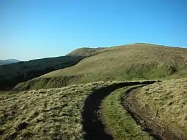
Mullaghmore (from Irish an Mullach Mór 'the big summit')[1] is a mountain in County Londonderry, Northern Ireland. It is part of the Sperrins and the 359th highest mountain in Ireland[2] The summit is dominated by a large telecommunication tower. The mountain is located 5 miles north of the village of Draperstown, and 6 mile south of Dungiven.[3] It is also locally known as, "The Birren" hence the road name passing over the mountain, "Birren Road"[4]
| Mullaghmore | |
|---|---|
| an Mullach Mór | |
 | |
| Highest point | |
| Elevation | 550 m (1,800 ft) |
| Prominence | 235 m (771 ft) |
| Listing | Marilyn |
| Geography | |
| Location | County Londonderry, Northern Ireland |
| Parent range | Sperrin Mountains |
| OSI/OSNI grid | C739008 |
| Topo map | OSNI Discoverer Series 8 (1:50000) |
References
- Placenames Database of Ireland
- "MountainViews". MountainViews website. Retrieved 9 February 2010.
- Mullaghmore, Draperstown, Google Maps. "Mulaghmore". Google Maps. Retrieved 29 March 2015.
- "NiCarFinder Tour Of Ulster promotional page".
Mountains and hills of Ulster | ||
|---|---|---|
| Antrim Hills | 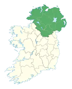 | |
| Antrim Plateau | ||
| Belfast Hills | ||
| Croaghgorms | ||
| Derryveagh | ||
| Inishowen | ||
| Mournes | ||
| Sperrins | ||
| Southwest Donegal | ||
| Others | ||
This article is issued from Wikipedia. The text is licensed under Creative Commons - Attribution - Sharealike. Additional terms may apply for the media files.