National Register of Historic Places listings in Charles City County, Virginia
This is a list of the National Register of Historic Places listings in Charles City County, Virginia.
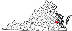
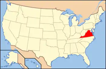
Location of Charles City County in Virginia
This is intended to be a complete list of the properties and districts on the National Register of Historic Places in Charles City County, Virginia, United States. The locations of National Register properties and districts for which the latitude and longitude coordinates are included below, may be seen in a Google map.[1]
There are 29 properties and districts listed on the National Register in the county, including 4 National Historic Landmarks. Another property was once listed but has been removed.
- This National Park Service list is complete through NPS recent listings posted January 29, 2021.[2]
Current listings
| [3] | Name on the Register[4] | Image | Date listed[5] | Location | City or town | Description |
|---|---|---|---|---|---|---|
| 1 | Belle Air | 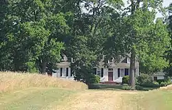 Belle Air |
July 18, 1974 (#74002232) |
North of State Route 5 37°20′55″N 77°03′53″W |
Charles City | |
| 2 | Berkeley | 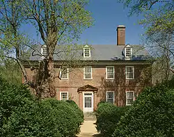 Berkeley |
November 11, 1971 (#71001040) |
Harrison Landing Rd., 8 miles (13 km) west of Charles City 37°19′02″N 77°10′50″W |
Charles City | |
| 3 | Lott Cary Birth Site | 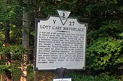 Lott Cary Birth Site |
July 30, 1980 (#80004883) |
Northwest of Charles City on Lott Cary Rd. 37°23′04″N 77°04′52″W |
Charles City | |
| 4 | Charles City County Courthouse | .jpg.webp) Charles City County Courthouse |
November 12, 1969 (#69000335) |
State Route 5 37°20′31″N 77°04′21″W |
Charles City | |
| 5 | Dancing Point | .jpg.webp) Dancing Point |
April 8, 2016 (#16000166) |
James River off Sandy Point Rd., southeast of Charles City[6] 37°14′05″N 76°55′06″W |
Charles City | |
| 6 | Dogham, Doggams | 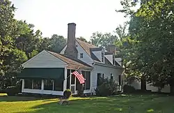 Dogham, Doggams |
September 24, 1999 (#99001200) |
1601 Dogham Ln. 37°21′39″N 77°14′11″W |
Charles City | |
| 7 | Edgewood | 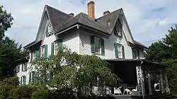 Edgewood |
February 10, 1983 (#83003265) |
West of Charles City on State Route 5 37°19′50″N 77°11′12″W |
Charles City | |
| 8 | Eppes Island |  Eppes Island |
November 12, 1969 (#69000337) |
James River[7] 37°19′48″N 77°15′00″W |
Hopewell | |
| 9 | Evelynton | 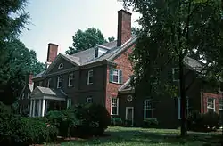 Evelynton |
August 17, 1989 (#89000486) |
State Route 5 east of Barnetts Rd. 37°19′46″N 77°09′13″W |
Charles City | |
| 10 | Fort Pocahontas | 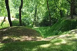 Fort Pocahontas |
July 27, 1999 (#99000848) |
Sturgeon Point Rd. 37°18′17″N 76°59′48″W |
Charles City | |
| 11 | Glebe of Westover Parish | 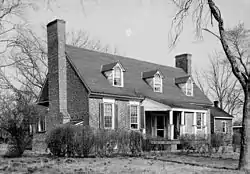 Glebe of Westover Parish |
June 5, 1975 (#75002108) |
Southwest of Ruthville off The Glebe Ln. 37°21′43″N 77°03′10″W |
Ruthville | |
| 12 | Greenway | .jpg.webp) Greenway |
November 12, 1969 (#69000336) |
On State Route 5 37°20′29″N 77°04′54″W |
Charles City | |
| 13 | Hardens | 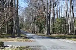 Hardens |
February 10, 1983 (#83003266) |
West of Lamptie Hill on State Routes 5/156 37°22′08″N 77°14′26″W |
Lamptie Hill | |
| 14 | Aaron Hilton Site | February 21, 1997 (#97000148) |
Address Restricted |
Charles City | ||
| 15 | Kittiewan | 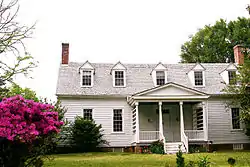 Kittiewan |
December 28, 1979 (#79003316) |
2.5 miles southeast of New Hope 37°18′20″N 77°02′54″W |
New Hope | |
| 16 | Margots |  Margots |
August 17, 1973 (#73002203) |
Northeast of Tettington off Eagles Nest Rd. 37°18′52″N 76°53′25″W |
Tettington | |
| 17 | Mount Stirling | 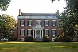 Mount Stirling |
February 4, 1993 (#93000005) |
Eastern side of State Route 155, 3,200 feet (980 m) north-northeast of its junction with Sturgeon Point Rd. 37°25′23″N 77°02′16″W |
Providence Forge | |
| 18 | Nance-Major House and Store | 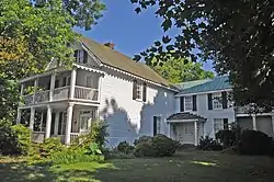 Nance-Major House and Store |
August 16, 2006 (#06000707) |
10811 Courthouse Rd. 37°20′31″N 77°04′23″W |
Charles City | |
| 19 | North Bend | 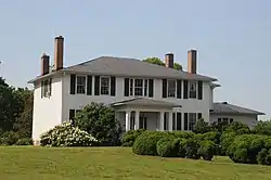 North Bend |
August 21, 1989 (#89001107) |
Weyanoke Rd. 37°18′43″N 77°03′20″W |
Weyanoke | |
| 20 | Piney Grove | 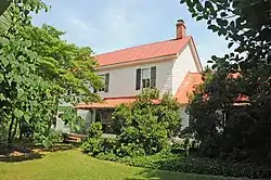 Piney Grove |
November 26, 1985 (#85003052) |
The Glebe Ln. 37°22′23″N 76°58′40″W |
Holdcroft | |
| 21 | Poplar Springs |  Poplar Springs |
August 30, 1994 (#94001028) |
17300 The Glebe Ln. 37°22′32″N 76°58′12″W |
Charles City | |
| 22 | Shirley | 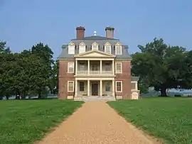 Shirley |
October 1, 1969 (#69000328) |
5 miles north of Hopewell off Westbury Farm Rd. 37°20′31″N 77°15′40″W |
Hopewell | |
| 23 | John Tyler House | 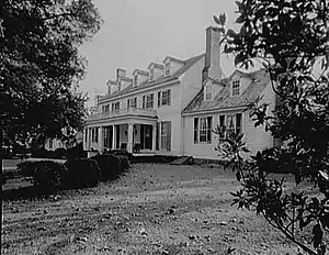 John Tyler House |
October 15, 1966 (#66000922) |
4 miles (6.4 km) east of Charles City on State Route 5 37°20′03″N 77°01′14″W |
Charles City | |
| 24 | Upper Shirley | 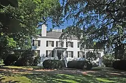 Upper Shirley |
October 29, 1982 (#82001884) |
West of Charles City on Westbury Farm Rd. 37°20′51″N 77°15′22″W |
Charles City | |
| 25 | Upper Weyanoke | 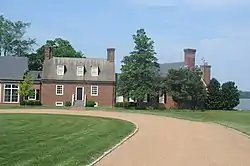 Upper Weyanoke |
December 9, 1980 (#80004441) |
South of Charles City on Weyanoke Rd. 37°17′43″N 77°04′30″W |
Charles City | |
| 26 | Westover | 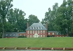 Westover |
October 15, 1966 (#66000923) |
7 miles (11 km) west of Charles City on State Route 5 37°18′40″N 77°08′58″W |
Charles City | |
| 27 | Westover Church | 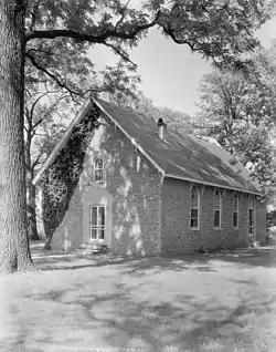 Westover Church |
December 5, 1972 (#72001502) |
5 miles (8.0 km) west of Charles City off State Route 5 37°19′53″N 77°09′32″W |
Charles City | |
| 28 | Weyanoke | 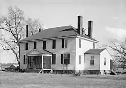 Weyanoke |
March 10, 1980 (#80004406) |
Weyanoke Rd. off State Route 5 37°17′26″N 77°03′54″W |
Charles City | |
| 29 | Woodburn | 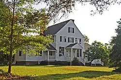 Woodburn |
December 12, 1978 (#78003183) |
Northwest of Charles City on Adkins Rd. 37°21′23″N 77°06′38″W |
Charles City |
Former listing
| [3] | Name on the Register | Image | Date listed | Date removed | Location | City or town | Summary |
|---|---|---|---|---|---|---|---|
| 1 | The Rowe | March 28, 1980 (#80004442) | June 4, 2008 | 3 miles southwest of Rustic 37°15′17″N 76°57′43″W |
Rustic |
See also
| Wikimedia Commons has media related to National Register of Historic Places in Charles City County, Virginia. |
References
- The latitude and longitude information provided in this table was derived originally from the National Register Information System, which has been found to be fairly accurate for about 99% of listings. Some locations in this table may have been corrected to current GPS standards.
- "National Register of Historic Places: Weekly List Actions". National Park Service, United States Department of the Interior. Retrieved on January 29, 2021.
- Numbers represent an alphabetical ordering by significant words. Various colorings, defined here, differentiate National Historic Landmarks and historic districts from other NRHP buildings, structures, sites or objects.
- "National Register Information System". National Register of Historic Places. National Park Service. April 24, 2008.
- The eight-digit number below each date is the number assigned to each location in the National Register Information System database, which can be viewed by clicking the number.
- Green, Bryan Clark, and Matthew R. Laird. National Register of Historic Places Inventory/Nomination: Dancing Point. National Park Service, 2015-09-10, 56.
- Virginia Historic Landmarks Commission Staff. National Register of Historic Places Inventory/Nomination: Eppes Island. National Park Service, 1969-05-01, 5.
Municipalities and communities of Charles City County, Virginia, United States | ||
|---|---|---|
| CDP | Map of Virginia highlighting Charles City County | |
| Unincorporated communities | ||
| ||
This article is issued from Wikipedia. The text is licensed under Creative Commons - Attribution - Sharealike. Additional terms may apply for the media files.