National Register of Historic Places listings in Powhatan County, Virginia
This is a list of the National Register of Historic Places listings in Powhatan County, Virginia.
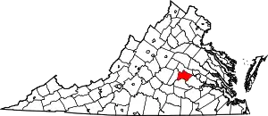
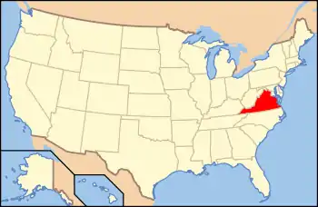
Location of Powhatan County in Virginia
This is intended to be a complete list of the properties and districts on the National Register of Historic Places in Powhatan County, Virginia, United States. The locations of National Register properties and districts for which the latitude and longitude coordinates are included below, may be seen in an online map.[1]
There are 20 properties and districts listed on the National Register in the county.
- This National Park Service list is complete through NPS recent listings posted February 5, 2021.[2]
Current listings
| [3] | Name on the Register[4] | Image | Date listed[5] | Location | City or town | Description |
|---|---|---|---|---|---|---|
| 1 | Beaumont |  Beaumont |
April 2, 1987 (#87000571) |
State Route 313 37°40′05″N 77°54′46″W |
Michaux | |
| 2 | Belmead |  Belmead |
November 12, 1969 (#69000270) |
Northwest of the junction of Belmead Rd. and St. Emma Dr. 37°37′15″N 77°59′32″W |
Powhatan | |
| 3 | Belnemus | .jpg.webp) Belnemus |
April 20, 1979 (#79003069) |
West of Powhatan off U.S. Route 60 37°34′04″N 77°59′44″W |
Powhatan | |
| 4 | Blenheim | 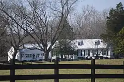 Blenheim |
December 11, 1986 (#86003475) |
6177 Blenheim Rd. 37°30′50″N 78°05′03″W |
Ballsville | |
| 5 | Elmington | 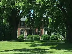 Elmington |
January 20, 2005 (#04001538) |
3277 Maidens Rd. 37°36′25″N 77°55′48″W |
Powhatan | |
| 6 | Emmanuel Episcopal Church | 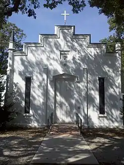 Emmanuel Episcopal Church |
December 27, 1990 (#90001924) |
Emmanuel Church Rd., south of U.S. Route 60 37°33′05″N 77°56′34″W |
Powhatan | |
| 7 | Fighting Creek Plantation | 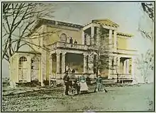 Fighting Creek Plantation |
December 3, 2013 (#13000890) |
1811 Mill Quarter Rd. 37°31′00″N 77°55′55″W |
Powhatan | |
| 8 | Fine Creek Mills Historic District | 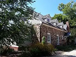 Fine Creek Mills Historic District |
January 16, 2004 (#03001440) |
2425-2434 Robert E. Lee Rd. 37°35′59″N 77°49′04″W |
Fine Creek Mills | |
| 9 | French's Tavern | 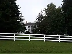 French's Tavern |
April 21, 1989 (#89000293) |
6100 State Route 13 37°29′24″N 78°04′48″W |
Ballsville | |
| 10 | Huguenot Memorial Chapel and Monument | 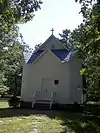 Huguenot Memorial Chapel and Monument |
March 23, 1988 (#88000214) |
Huguenot Trail 37°33′53″N 77°42′33″W |
Manakin | |
| 11 | Keswick | %252C_State_Route_711_vicinity%252C_Huguenot_vicinity_(Powhatan_County%252C_Virginia).jpg.webp) Keswick |
December 19, 1974 (#74002144) |
Northeast of Powhatan off Huguenot Trail 37°33′25″N 77°39′59″W |
Powhatan | |
| 12 | Mosby Tavern | 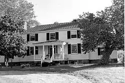 Mosby Tavern |
April 11, 2003 (#03000214) |
2625 Old Tavern Rd. 37°33′55″N 78°02′13″W |
Powhatan | |
| 13 | Norwood | .jpg.webp) Norwood |
May 19, 1980 (#80004212) |
Northeast of Powhatan off Huguenot Trail 37°35′04″N 77°44′35″W |
Powhatan | |
| 14 | Paxton |  Paxton |
December 28, 1990 (#90001987) |
3032 Genito Rd. 37°27′47″N 77°51′33″W |
Powhatan | |
| 15 | Powhatan Courthouse Historic District | 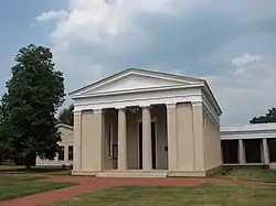 Powhatan Courthouse Historic District |
February 16, 1970 (#70000821) |
Junction of State Routes 13 and 300 37°32′30″N 77°55′06″W |
Powhatan | |
| 16 | Provost | 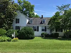 Provost |
December 22, 1999 (#99001603) |
4801 Cartersville Rd. 37°36′19″N 77°59′01″W |
Powhatan | |
| 17 | Red Lane Tavern | 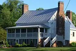 Red Lane Tavern |
January 24, 2002 (#01001516) |
3009 Lower Hill Rd. 37°31′47″N 77°51′28″W |
Powhatan | |
| 18 | Rosemont | 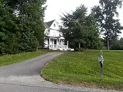 Rosemont |
May 29, 2008 (#08000482) |
4747 Cosby Rd. 37°36′20″N 77°58′55″W |
Powhatan | |
| 19 | St. Luke's Episcopal Church | _-_20121114162043.jpg.webp) St. Luke's Episcopal Church |
March 29, 1989 (#89000193) |
2245 Huguenot Trail 37°35′39″N 77°48′01″W |
Fine Creek Mills | |
| 20 | Somerset | 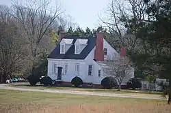 Somerset |
September 6, 2006 (#06000804) |
2310 Ballsville Rd. 37°32′50″N 78°05′20″W |
Powhatan |
See also
| Wikimedia Commons has media related to National Register of Historic Places in Powhatan County, Virginia. |
References
- The latitude and longitude information provided in this table was derived originally from the National Register Information System, which has been found to be fairly accurate for about 99% of listings. Some locations in this table may have been corrected to current GPS standards.
- "National Register of Historic Places: Weekly List Actions". National Park Service, United States Department of the Interior. Retrieved on February 5, 2021.
- Numbers represent an alphabetical ordering by significant words. Various colorings, defined here, differentiate National Historic Landmarks and historic districts from other NRHP buildings, structures, sites or objects.
- "National Register Information System". National Register of Historic Places. National Park Service. April 24, 2008.
- The eight-digit number below each date is the number assigned to each location in the National Register Information System database, which can be viewed by clicking the number.
Municipalities and communities of Powhatan County, Virginia, United States | ||
|---|---|---|
| CDP | Map of Virginia highlighting Powhatan County | |
| Other unincorporated communities | ||
| ||
This article is issued from Wikipedia. The text is licensed under Creative Commons - Attribution - Sharealike. Additional terms may apply for the media files.