National Register of Historic Places listings in Mecklenburg County, Virginia
This is a list of the National Register of Historic Places listings in Mecklenburg County, Virginia.
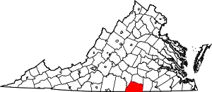
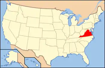
Location of Mecklenburg County in Virginia
This is intended to be a complete list of the properties and districts on the National Register of Historic Places in Mecklenburg County, Virginia, United States. The locations of National Register properties and districts for which the latitude and longitude coordinates are included below, may be seen in an online map.[1]
There are 27 properties and districts listed on the National Register in the county, including 1 National Historic Landmark. Another property was once listed but has been removed.
- This National Park Service list is complete through NPS recent listings posted January 29, 2021.[2]
Current listings
| [3] | Name on the Register[4] | Image | Date listed[5] | Location | City or town | Description |
|---|---|---|---|---|---|---|
| 1 | Boyd's Tavern | 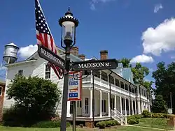 Boyd's Tavern |
September 29, 1976 (#76002113) |
Washington St. 36°40′04″N 78°23′18″W |
Boydton | |
| 2 | Boydton Historic District | 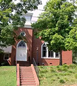 Boydton Historic District |
May 16, 2002 (#02000511) |
Roughly the Boydton corporate limits except for the section including and northwest of U.S. Route 58 36°40′00″N 78°23′20″W |
Boydton | |
| 3 | Buffalo Springs Historical Archeological District | 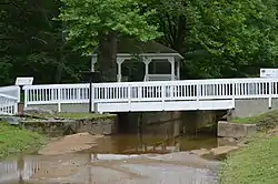 Buffalo Springs Historical Archeological District |
June 12, 1998 (#98000603) |
Buffalo Springs Rd., north of U.S. Route 58[6] 36°38′54″N 78°39′45″W |
Buffalo Junction | |
| 4 | Cedar Grove | 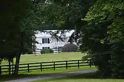 Cedar Grove |
August 16, 2010 (#10000560) |
138 Lewis Mill Rd. 36°33′46″N 78°34′53″W |
Clarksville | |
| 5 | Chase City High School | 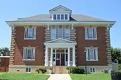 Chase City High School |
May 11, 2000 (#00000482) |
132 Endly St. 36°47′53″N 78°27′43″W |
Chase City | |
| 6 | Chase City Warehouse and Commercial Historic District | December 11, 2020 (#100005923) |
North Main, East 5th, West 4th, East 2nd, and East Sycamore Sts. 36°48′04″N 78°27′34″W |
Chase City | ||
| 7 | Clarksville Historic District |  Clarksville Historic District |
June 6, 2002 (#02000625) |
Roughly along Virginia Ave., from Rose Hill Ave., Ferry St., East St., and 2nd St. 36°37′26″N 78°33′29″W |
Clarksville | |
| 8 | Colonial Theatre | 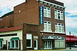 Colonial Theatre |
May 19, 2003 (#03000448) |
220 S. Mecklenburg Ave. 36°43′29″N 78°07′49″W |
South Hill | |
| 9 | Elm Hill | 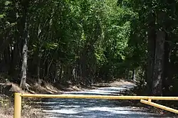 Elm Hill |
July 27, 1979 (#79003053) |
Southeast of Baskerville off State Route 4 36°36′40″N 78°17′36″W |
Baskerville | |
| 10 | Elm Hill Archaeological Site |  Elm Hill Archaeological Site |
March 14, 1985 (#85000569) |
Northern side of the Roanoke River, 1 mile (1.6 km) below the Robert H. Kerr Dam[7] 36°36′41″N 78°16′09″W |
Castle Heights | |
| 11 | Eureka | 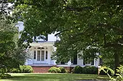 Eureka |
September 17, 1980 (#80004200) |
Southeast of Baskerville 36°37′59″N 78°14′07″W |
Baskerville | |
| 12 | John Groom Elementary School |  John Groom Elementary School |
February 13, 2018 (#100002138) |
1050 Plank Rd. 36°43′35″N 78°08′44″W |
South Hill | |
| 13 | La Crosse Hotel |  La Crosse Hotel |
September 12, 2008 (#08000876) |
201 Central Ave. 36°41′44″N 78°05′36″W |
La Crosse | |
| 14 | Long Grass | 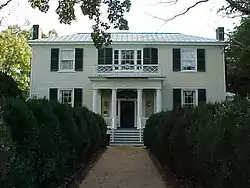 Long Grass |
July 21, 1995 (#95000894) |
Epps Fork Rd. 36°33′10″N 78°20′39″W |
Eppes Fork | |
| 15 | Mecklenburg County Courthouse |  Mecklenburg County Courthouse |
July 17, 1975 (#75002025) |
Southwestern corner of the junction of U.S. Route 58 and State Route 92 36°40′01″N 78°23′19″W |
Boydton | |
| 16 | MacCallum More and Hudgins House Historic District | 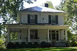 MacCallum More and Hudgins House Historic District |
September 10, 2010 (#09001051) |
603 Hudgins St. and 439 Walker St. 36°48′08″N 78°27′22″W |
Chase City | |
| 17 | On the Hill | 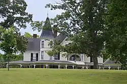 On the Hill |
February 5, 2014 (#13001164) |
982 Jefferson St. 36°39′56″N 78°23′37″W |
Boydton | |
| 18 | Prestwould | 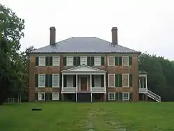 Prestwould |
October 1, 1969 (#69000260) |
North of Clarksville 36°38′59″N 78°33′51″W |
Clarksville | Designated a National Historic Landmark July 31, 2003 |
| 19 | Red Fox Farm | 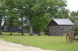 Red Fox Farm |
June 10, 1993 (#93000508) |
Eastern side of Skipwith Rd., 0.7 miles (1.1 km) south of its junction with Hanford Rd. 36°42′51″N 78°29′45″W |
Skipwith | |
| 20 | Clark Royster House | 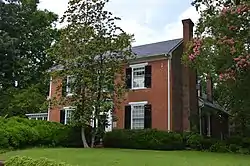 Clark Royster House |
December 16, 1996 (#96001455) |
300 Rose Hill Ave. 36°37′39″N 78°33′28″W |
Clarksville | |
| 21 | Rudd Branch Ridge-Complexes Nos. 1 and 2 | May 8, 2003 (#03000396) |
Address Restricted |
Boydton | ||
| 22 | Shadow Lawn |  Shadow Lawn |
October 19, 1982 (#82001824) |
27 N. Main St. 36°47′50″N 78°27′29″W |
Chase City | |
| 23 | South Hill Commercial Historic District |  South Hill Commercial Historic District |
November 24, 2017 (#100001853) |
Mecklenburg Ave. and Franklin and W. Danville Sts. 36°43′32″N 78°07′46″W |
South Hill | |
| 24 | Sunnyside | 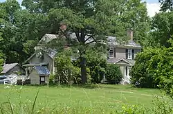 Sunnyside |
December 6, 1996 (#96001452) |
104 Shiney Rock Rd. 36°36′49″N 78°34′09″W |
Clarksville | |
| 25 | Patrick Robert Sydnor Log Cabin | 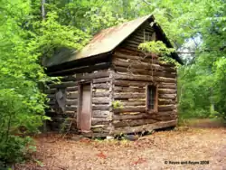 Patrick Robert Sydnor Log Cabin |
August 30, 2007 (#07000896) |
Junction of Wilbourne and Morgan Farm Rds.[8] 36°39′40″N 78°32′55″W |
Clarksville | |
| 26 | O.H.P. Tanner House |  O.H.P. Tanner House |
August 26, 2011 (#11000606) |
3199 Old St. Tammany Rd. 36°36′58″N 78°08′08″W |
La Crosse | |
| 27 | Judge Henry Wood, Jr., House | 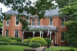 Judge Henry Wood, Jr., House |
September 24, 1999 (#99001201) |
105 6th St. 36°37′30″N 78°33′34″W |
Clarksville |
Former listing
| [3] | Name on the Register | Image | Date listed | Date removed | Location | City or town | Summary |
|---|---|---|---|---|---|---|---|
| 1 | Moss Tobacco Factory | May 21, 1979 (#79003054) | March 19, 2001 | Main and 7th Streets |
Clarksville | Demolished February 1980 |
See also
| Wikimedia Commons has media related to National Register of Historic Places in Mecklenburg County, Virginia. |
References
- The latitude and longitude information provided in this table was derived originally from the National Register Information System, which has been found to be fairly accurate for about 99% of listings. Some locations in this table may have been corrected to current GPS standards.
- "National Register of Historic Places: Weekly List Actions". National Park Service, United States Department of the Interior. Retrieved on January 29, 2021.
- Numbers represent an alphabetical ordering by significant words. Various colorings, defined here, differentiate National Historic Landmarks and historic districts from other NRHP buildings, structures, sites or objects.
- "National Register Information System". National Register of Historic Places. National Park Service. April 24, 2008.
- The eight-digit number below each date is the number assigned to each location in the National Register Information System database, which can be viewed by clicking the number.
- "Buffalo Springs — Interpretive Trail", United States Army Corps of Engineers via hmdb.org, n.d. Accessed 2017-01-02.
- MacCord, Howard A. "The Elm Hill Site, Mecklenburg County, Virginia". Quarterly Bulletin, Archaeological Society of Virginia 23.2 (1968): 63-83: 66.
- Reyes, Angelita D. National Register of Historic Places Inventory/Nomination: Patrick Robert Sydnor Log Cabin. National Park Service, n.d., 32.
Municipalities and communities of Mecklenburg County, Virginia, United States | ||
|---|---|---|
| Towns | Map of Virginia highlighting Mecklenburg County | |
| CDPs | ||
| Unincorporated communities | ||
| Footnotes | ‡This populated place also has portions in an adjacent county or counties | |
| ||
This article is issued from Wikipedia. The text is licensed under Creative Commons - Attribution - Sharealike. Additional terms may apply for the media files.