National Register of Historic Places listings in Stafford County, Virginia
This is a list of the National Register of Historic Places listings in Stafford County, Virginia.
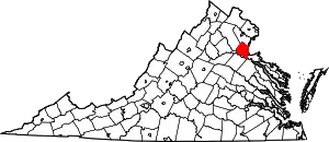
Location of Stafford County in Virginia
This is intended to be a complete list of the properties and districts on the National Register of Historic Places in Stafford County, Virginia, United States. The locations of National Register properties and districts for which the latitude and longitude coordinates are included below, may be seen in an online map.[1]
There are 21 properties and districts listed on the National Register in the county, including 3 National Historic Landmarks.
- This National Park Service list is complete through NPS recent listings posted January 29, 2021.[2]
Current listings
| [3] | Name on the Register[4] | Image | Date listed[5] | Location | City or town | Description |
|---|---|---|---|---|---|---|
| 1 | Accokeek Furnace Archeological Site (44ST53) | May 15, 1984 (#84003598) |
Address Restricted |
Stafford | ||
| 2 | Aquia Church | 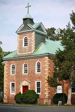 Aquia Church |
November 12, 1969 (#69000282) |
North of the junction of U.S. Route 1 and Garrisonville Rd. 38°27′53″N 77°24′11″W |
Garrisonville | |
| 3 | Belmont | 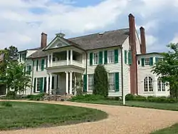 Belmont |
October 15, 1966 (#66000848) |
Off U.S. Route 1 38°19′26″N 77°28′23″W |
Falmouth | Also known as Gari Melchers Home |
| 4 | Bethlehem Primitive Baptist Church Cemetery |  Bethlehem Primitive Baptist Church Cemetery |
June 21, 2018 (#100002206) |
135 Chapel Green Rd. 38°17′37″N 77°21′25″W |
Fredericksburg | |
| 5 | Carlton | 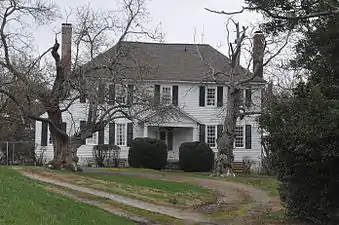 Carlton |
October 3, 1973 (#73002064) |
501 Melchers Dr. 38°19′32″N 77°28′14″W |
Falmouth | |
| 6 | Clearview | Clearview |
February 24, 1975 (#75002039) |
Off Telegraph Rd. near U.S. Route 1 and Butler Rd. 38°19′25″N 77°27′49″W |
Falmouth | |
| 7 | Conway House | 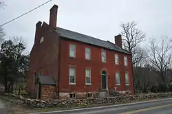 Conway House |
March 8, 2004 (#04000162) |
305 King St. 38°19′19″N 77°28′07″W |
Falmouth | |
| 8 | Falmouth Historic District | 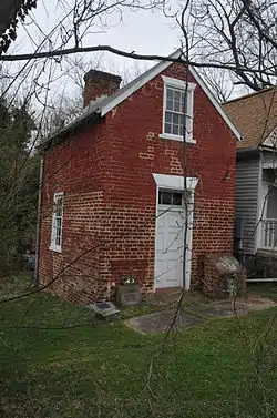 Falmouth Historic District |
February 26, 1970 (#70000825) |
Junction of U.S. Routes 1 and 17 38°19′28″N 77°28′00″W |
Falmouth | |
| 9 | Ferry Farm Site | 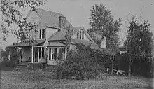 Ferry Farm Site |
May 5, 1972 (#72001417) |
East of Fredericksburg at 712 Kings Highway 38°17′36″N 77°26′55″W |
Fredericksburg | Same as George Washington Boyhood Home Site |
| 10 | Hartwood Manor | 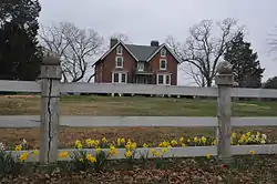 Hartwood Manor |
February 1, 2006 (#05001618) |
335 Hartwood Rd. 38°25′15″N 77°34′26″W |
Hartwood | |
| 11 | Hartwood Presbyterian Church | 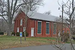 Hartwood Presbyterian Church |
November 13, 1989 (#89001929) |
Junction of Hartwood and Hartwood Church Rds. 38°24′07″N 77°34′01″W |
Hartwood | |
| 12 | Hunter's Ironworks |  Hunter's Ironworks |
January 18, 1974 (#74002147) |
West of Falmouth off U.S. Route 17 38°19′27″N 77°29′14″W |
Falmouth | |
| 13 | Quantico Marine Corps Base Historic District | 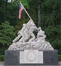 Quantico Marine Corps Base Historic District |
March 26, 2001 (#01000260) |
Marine Corps Base Quantico 38°30′08″N 77°18′21″W |
Quantico | Extends into Prince William County |
| 14 | Potomac Creek Site | 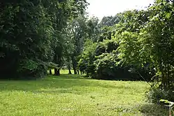 Potomac Creek Site |
December 3, 1969 (#69000281) |
Indian Point Rd.[6] 38°21′06″N 77°17′53″W |
Brooke | |
| 15 | Public Quarry at Government Island |  Public Quarry at Government Island |
May 30, 2007 (#03000457) |
Address Restricted 38°26′54″N 77°23′00″W |
Stafford | |
| 16 | Redoubt No. 2 |  Redoubt No. 2 |
February 14, 2006 (#06000051) |
Old Fort Lane 38°23′36″N 77°21′21″W |
Stafford | |
| 17 | Stafford Training School | 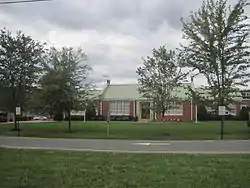 Stafford Training School |
February 5, 2013 (#12001272) |
1739 U.S. Route 1 38°24′16″N 77°25′12″W |
Stafford | |
| 18 | Tennessee Camp | November 12, 2008 (#08001059) |
Civil War and Hill trails[7] 38°29′45″N 77°19′52″W |
Marine Corps Base Quantico | ||
| 19 | Union Church and Cemetery | %252C_Carter_Street%252C_Falmouth_(Stafford_County%252C_Virginia).jpg.webp) Union Church and Cemetery |
September 10, 2008 (#08000896) |
Carter St. and Butler Rd. 38°19′23″N 77°27′56″W |
Falmouth | |
| 20 | George Washington Boyhood Home Site |  George Washington Boyhood Home Site |
February 16, 2000 (#00000259) |
237 King's Highway 38°17′38″N 77°26′53″W |
Fredericksburg | |
| 21 | White Oak Church | .jpg.webp) White Oak Church |
January 3, 1991 (#90002112) |
8 Caisson Rd. 38°18′01″N 77°22′32″W |
Falmouth |
See also
| Wikimedia Commons has media related to National Register of Historic Places in Stafford County, Virginia. |
References
- The latitude and longitude information provided in this table was derived originally from the National Register Information System, which has been found to be fairly accurate for about 99% of listings. Some locations in this table may have been corrected to current GPS standards.
- "National Register of Historic Places: Weekly List Actions". National Park Service, United States Department of the Interior. Retrieved on January 29, 2021.
- Numbers represent an alphabetical ordering by significant words. Various colorings, defined here, differentiate National Historic Landmarks and historic districts from other NRHP buildings, structures, sites or objects.
- "National Register Information System". National Register of Historic Places. National Park Service. April 24, 2008.
- The eight-digit number below each date is the number assigned to each location in the National Register Information System database, which can be viewed by clicking the number.
- Stewart, T. Dale. Archeological exploration of Patawomeke : the Indian town site (44St2) ancestral to the one (44St1) visited in 1608 by Captain John Smith. Smithsonian contributions to anthropology 36. Washington: Smithsonian 1992, ix.
- Haynes, John H. National Register of Historic Places Inventory/Nomination: Tennessee Camp. National Park Service, 2005-07-22, 14.
Municipalities and communities of Stafford County, Virginia, United States | ||
|---|---|---|
| CDPs | Map of Virginia highlighting Stafford County | |
| Unincorporated communities |
| |
| Footnotes | ‡This populated place also has portions in an adjacent county or counties | |
| ||
This article is issued from Wikipedia. The text is licensed under Creative Commons - Attribution - Sharealike. Additional terms may apply for the media files.