National Register of Historic Places listings in Page County, Virginia
This is a list of the National Register of Historic Places listings in Page County, Virginia.
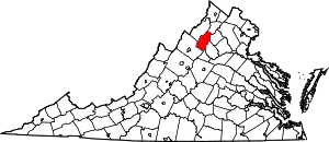
Location of Page County in Virginia
This is intended to be a complete list of the properties and districts on the National Register of Historic Places in Page County, Virginia, United States. The locations of National Register properties and districts for which the latitude and longitude coordinates are included below, may be seen in an online map.[1]
There are 31 properties and districts listed on the National Register in the county, including 1 National Historic Landmark. Another property was once listed but has been removed.
- This National Park Service list is complete through NPS recent listings posted January 29, 2021.[2]
Current listings
| [3] | Name on the Register[4] | Image | Date listed[5] | Location | City or town | Description |
|---|---|---|---|---|---|---|
| 1 | Almond | 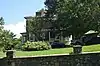 Almond |
August 12, 2020 (#100005444) |
2620 N. U.S. Route 340 38°42′04″N 78°26′33″W |
Luray | |
| 2 | Aventine Hall | 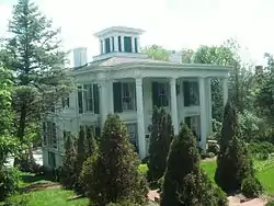 Aventine Hall |
February 26, 1970 (#70000820) |
143 S. Court St. 38°39′44″N 78°27′52″W |
Luray | |
| 3 | John Beaver House | 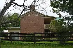 John Beaver House |
June 22, 1979 (#79003065) |
North of Stanley on Longs Rd. 38°37′48″N 78°33′45″W |
Salem | |
| 4 | Catherine Furnace | 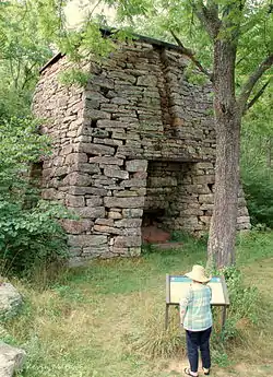 Catherine Furnace |
January 21, 1974 (#74002141) |
2 miles west of Newport in the George Washington National Forest 38°33′28″N 78°38′08″W |
Newport | |
| 5 | Fort Egypt | .jpg.webp) Fort Egypt |
June 18, 1979 (#79003064) |
Northwest of Hamburg off Egypt Bend Rd. 38°39′45″N 78°31′46″W |
Hamburg | |
| 6 | Fort Philip Long | 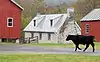 Fort Philip Long |
April 11, 1973 (#73002048) |
Off Leaksville Rd. on the Shenandoah River 38°36′21″N 78°34′04″W |
Stanley | |
| 7 | Graves Chapel and Cemetery | 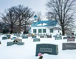 Graves Chapel and Cemetery |
May 29, 2008 (#08000481) |
457 Chapel Rd. 38°34′36″N 78°29′16″W |
Stanley | |
| 8 | Heiston-Strickler House | 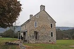 Heiston-Strickler House |
November 16, 1978 (#78003037) |
Northwest of Luray off Bixlers Ferry Rd. 38°42′01″N 78°29′48″W |
Luray | |
| 9 | Jeremey's Run Site | 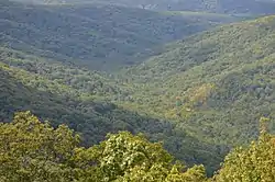 Jeremey's Run Site |
December 13, 1985 (#85003175) |
Address Restricted |
Luray | |
| 10 | Kanawha | 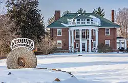 Kanawha |
August 5, 1999 (#99000968) |
4 Jamison Rd. 38°39′42″N 78°27′35″W |
Luray | |
| 11 | Locust Grove | 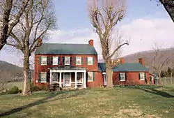 Locust Grove |
December 8, 2015 (#15000879) |
6601 Ida Rd. 38°34′28″N 78°27′33″W |
Stanley | |
| 12 | Luray Downtown Historic District | 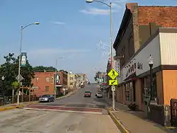 Luray Downtown Historic District |
May 22, 2003 (#03000438) |
Roughly E. Main St., W. Main St., S. Court St., and S. Broad St. 38°39′56″N 78°27′44″W |
Luray | |
| 13 | Luray Norfolk and Western Passenger Station | 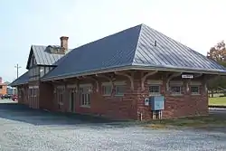 Luray Norfolk and Western Passenger Station |
January 27, 2000 (#99001718) |
Junction of Campbell St. with the Norfolk Southern Railway 38°39′50″N 78°27′36″W |
Luray | |
| 14 | Massanutton Heights | 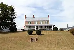 Massanutton Heights |
July 30, 1976 (#76002117) |
West of Luray on U.S. Route 211 38°38′08″N 78°34′10″W |
Luray | |
| 15 | Mauck's Meetinghouse | 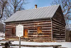 Mauck's Meetinghouse |
June 18, 1976 (#76002116) |
Off U.S. Route 211 38°39′30″N 78°30′47″W |
Hamburg | |
| 16 | Milford Battlefield |  Milford Battlefield |
August 11, 2004 (#04000854) |
U.S. Route 340 and Overall Rd. 38°48′19″N 78°20′47″W |
Overall | Extends into Warren County |
| 17 | Mount Calvary Lutheran Church | 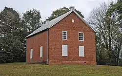 Mount Calvary Lutheran Church |
June 3, 2008 (#98001068) |
279 Somers Rd.[6] 38°37′48″N 78°25′23″W |
Luray | |
| 18 | Page County Bridge No. 1990 |  Page County Bridge No. 1990 |
May 15, 2008 (#08000423) |
U.S. Route 340 38°48′22″N 78°20′56″W |
Overall | Extends into Warren County |
| 19 | Page County Courthouse | 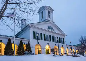 Page County Courthouse |
June 25, 1973 (#73002047) |
116 S. Court St. 38°39′52″N 78°27′54″W |
Luray | |
| 20 | Abram and Sallie Printz Farm | 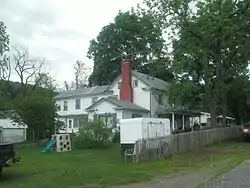 Abram and Sallie Printz Farm |
August 12, 1999 (#99001006) |
597 Rosedale Ln. 38°37′26″N 78°24′18″W |
Luray | |
| 21 | Redwell-Isabella Furnace Historic District | 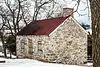 Redwell-Isabella Furnace Historic District |
July 27, 2005 (#05000762) |
Between Yagers Rd. and Hawksbill Creek on the northern side of Luray 38°40′50″N 78°27′30″W |
Luray | |
| 22 | Ruffner House |  Ruffner House |
January 24, 2002 (#01001515) |
440 Ruffner House Ln. 38°40′10″N 78°27′18″W |
Luray | |
| 23 | Shenandoah Historic District | 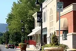 Shenandoah Historic District |
May 27, 2004 (#04000554) |
Parts of 1st, 2nd, 3rd, 4th, 5th, 6th, 7th, 8th, Denver, Long, and H Sts., and Central, Maryland, Pennsylvania, and Virginia Aves. 38°29′16″N 78°37′26″W |
Shenandoah | |
| 24 | Shenandoah Land and Improvement Company Office | 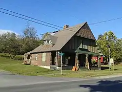 Shenandoah Land and Improvement Company Office |
July 14, 1978 (#78003038) |
201 Maryland Ave. 38°29′03″N 78°37′22″W |
Shenandoah | |
| 25 | Skyline Drive Historic District | 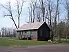 Skyline Drive Historic District |
April 28, 1997 (#97000375) |
Shenandoah National Park, from the northern entrance station at Front Royal to the southern entrance station at Rockfish Gap; also within Shenandoah National Park, the areas known as Headquarters, Big Meadows, Dickey Ridge, Simmons Gap, and Piney River; also within Shenandoah National Park, the Skyland, Lewis Mountain, and Big Meadows 38°32′50″N 78°24′54″W |
Luray | Second and third sets of boundaries represent boundary increases of September 19, 1997 and December 5, 2003; designated a National Historic Landmark on October 6, 2008 |
| 26 | Isaac Spitler House | 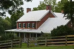 Isaac Spitler House |
May 23, 1997 (#97000486) |
2948 Oak Forest Ln. 38°37′43″N 78°30′16″W |
Luray | |
| 27 | Stover House | 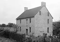 Stover House |
May 22, 1978 (#78003189) |
North of Luray off Kiblee Hill Rd. 38°43′32″N 78°27′27″W |
Luray | |
| 28 | Strickley-Louderback House |  Strickley-Louderback House |
November 22, 2000 (#00001441) |
1001 Old Farm Rd. 38°32′04″N 78°34′52″W |
Shenandoah | |
| 29 | Wall Brook Farm | 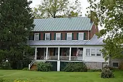 Wall Brook Farm |
November 22, 2002 (#02001375) |
967 Longs Rd. 38°37′56″N 78°32′49″W |
Luray | |
| 30 | Welfley-Shuler House | 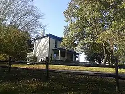 Welfley-Shuler House |
December 22, 1999 (#99001604) |
449 Shipyard Rd. 38°30′03″N 78°38′05″W |
Shenandoah | |
| 31 | The White House | 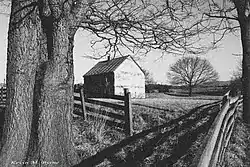 The White House |
December 24, 2013 (#13000992) |
1917 Kauffmans Mill Rd. 38°38′52″N 78°32′04″W |
Luray |
Former listing
| [3] | Name on the Register | Image | Date listed | Date removed | Location | City or town | Summary |
|---|---|---|---|---|---|---|---|
| 1 | Fort Rodes | 1978 (#78003190) | March 19, 2001 | NW of Luray off VA 615 |
Luray | Destroyed by fire in 1990 |
See also
| Wikimedia Commons has media related to National Register of Historic Places in Page County, Virginia. |
References
- The latitude and longitude information provided in this table was derived originally from the National Register Information System, which has been found to be fairly accurate for about 99% of listings. Some locations in this table may have been corrected to current GPS standards.
- "National Register of Historic Places: Weekly List Actions". National Park Service, United States Department of the Interior. Retrieved on January 29, 2021.
- Numbers represent an alphabetical ordering by significant words. Various colorings, defined here, differentiate National Historic Landmarks and historic districts from other NRHP buildings, structures, sites or objects.
- "National Register Information System". National Register of Historic Places. National Park Service. April 24, 2008.
- The eight-digit number below each date is the number assigned to each location in the National Register Information System database, which can be viewed by clicking the number.
- "National Register of Historic Places Registration Form: Mount Calvary Lutheran Church" (PDF). Virginia Department of Historic Resources. June 3, 2008. Retrieved February 27, 2009.
Municipalities and communities of Page County, Virginia, United States | ||
|---|---|---|
| Towns | Map of Virginia highlighting Page County | |
| Unincorporated communities |
| |
| ||
This article is issued from Wikipedia. The text is licensed under Creative Commons - Attribution - Sharealike. Additional terms may apply for the media files.